Ettleton Cemetery
Burial Ground (Medieval), Church (Medieval), Cross(S) (Medieval)
Site Name Ettleton Cemetery
Classification Burial Ground (Medieval), Church (Medieval), Cross(S) (Medieval)
Alternative Name(s) Ettleton Church; Ethleton Churchyard
Canmore ID 67873
Site Number NY48NE 4
NGR NY 47226 86314
Datum OSGB36 - NGR
Permalink http://canmore.org.uk/site/67873
- Council Scottish Borders, The
- Parish Castleton
- Former Region Borders
- Former District Roxburgh
- Former County Roxburghshire
NY48NE 4 47226 86314
(NY 4726 8631) Ettleton Church (NR) (Site of)
OS 6" map (1957)
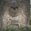
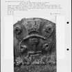
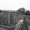
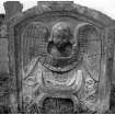
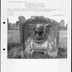
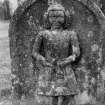
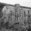
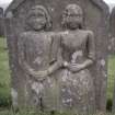
Nothing now remains of Ettleton Church. The churchyard, however, which is still occasionally used, contains a number of (scheduled) early tombstones, cross-shafts etc which have been gathered together and enclosed by a railing. The RCAHMS describe nine of them; those which they date are ascribed to the 13th century.
RCAHMS 1956, visited 1945
There is now no trace of Ettleton Church. The nine cross fragments and several other stones are in a railed enclosure in Ettleton cemetery at NY 4722 8631.
Visited by OS (TRG) 22 June 1979.
Field Visit (10 July 1931 - 29 May 1945)
Ettleton Churchyard, NY 472 863.
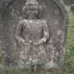
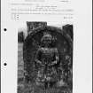
Of this church, which stood about a mile SSW. of Newcastleton, nothing now survives. Its churchyard, however, which is still occasionally used, contains a number of fragments of early tombstones, etc., which have been gathered together and enclosed by a railing for protection. These comprise: (I) Two portions of a tapered cross-shaft, the upper one showing the intersection of the shaft with the cross-arms. Both portions are enriched on each edge with a cable ornament, and when placed together have a total length of 5 ft. 6 ½ in. (2) Part of a recumbent slab with chamfered edges, having a present length of 4 ft. 6 in. and a width of 1 ft. 2 in. It bears an incised cross, the head of which is a cross moline, while near the foot of the shaft there is a cross-bar, with a pair of shears alongside. (3) The upper part of another slab, 1 ft. 4 in. long and originally 1 ft. 3 in. wide. It bears a cross-head formed by four impinging penannular rings, a well-known type of late 13th or early 14th-century date. (4) The lower part of a slab, 1 ft. 5 in. in width and 1 ft. 10 in. in length, bearing a cross-shaft terminating in a cross moline with a sword blade on the dexter side. (5) The middle part of a slab, 2 ft. I in. in length and I ft.si in. wide, exhibiting a cross-shaft between a book and a chalice. (6) The upper part of a slab, 3 ft. long and I ft. 41 in. wide, with chamfered edges, bearing a floriated cross-head below which appears the hilt of a sword with depressed quillons. (7) The upper portion, 4 ft. in length, of a tapering slab bearing a cross-head of four oval lobes. (8) A 13th century finial cross-head. (9) A 13th-century base from an angle-shaft. The enclosure also contains fourteen smaller fragments of tombstones as well as the head of a small Romanesque window.
RCAHMS 1956, visited 10 July 1931 and 29 May 1945
OS map: N xl ("Ettleton Church, site of ").
Field Visit (18 April 1996)
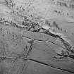
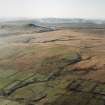
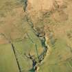
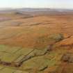
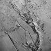
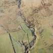
The site of Ettleton Church is marked by an L-shaped terrace at roughly the location shown on the 1st edition of the OS 6-inch map (Roxburghshire 1862-3, sheet xlv). The terrace extends for about 11m from ESE to WNW by 4.8m transversely, merging with the hillside on the N and W.
The cross fragments, grave slabs and other worked stones are in an iron-railed enclosure inside the cemetery (NY 4722 8631).
Visited by RCAHMS (DCC) 18 April 1996
Sbc Note
No trace. Marked on Pont's map as Ettilstoun K.
Information from Scottish Borders Council Historic Environment Record
(n.d.)


