Ewes Doors
Watch Tower (Roman)
Site Name Ewes Doors
Classification Watch Tower (Roman)
Alternative Name(s) Eweslees Burn; Eweslees
Canmore ID 67760
Site Number NY39NE 4
NGR NY 37252 98609
Datum OSGB36 - NGR
Permalink http://canmore.org.uk/site/67760
- Council Dumfries And Galloway
- Parish Ewes
- Former Region Dumfries And Galloway
- Former District Annandale And Eskdale
- Former County Dumfries-shire
Field Visit (31 July 1962)
At NY 3725 9860 there is a circular mound, with a maximum height on its western side of 1.6m, on top of a natural knoll commanding a good view down the valley of Ewelees Burn. Around it can be traced a shallow ditch and on the NW there is the suggestion of an outer upcast bank. The fairly flat top of the mound is 8.0m in diameter, while the overall diameter of the mound is 18.0m.
There is no sign of any structure, and no evidence of the date or purpose of the feature except that when viewed from the steep hillside above and immediately to the SW, it has all the appearances of a tumulus; no stones can be seen at or around the site.
Surveyed at 1:2500.
Visited by OS (RDL) 31 July 1962
Subsequently added to OS 6" map (1964) Mound (NR)
Field Visit (October 1980)
In the pass known as Ewes Doors, at the head of the Eweslees Burn, there is a possible barrow measuring 14.3m in diameter and 1.1m in height within a ditch 1.1m broad and 0.3m deep.
RCAHMS 1981, visited October 1980.
Field Visit (17 December 1996)
NY 3725 9860 NY39NE 4
This earthwork comprises a roughly circular enclosure which measures about 14.5m in diameter and is defined by a ditch and counterscarp bank; the ditch is 2.4m broad and 0.6m deep while the bank is 2.1m thick and 0.4m high. Within the enclosure there is a low mound (measuring 11.2m in diameter) which supports a penannular bank fronted by a berm; this bank measures 2.5m in thickness and is 0.7m and 0.3m high, measured externally and internally, respectively. Within the bank there is a slightly dished interior measuring 5m in diameter. An entrance-gap pierces the N side, where the remnants of a causeway and a gap in the conterscarp bank suggest a link with the possible Roman road (NY39NE 29) that passes within 25m on the monument.
The characteristics of this earthwork are consistent with its identification as a possible Roman watch tower.
Visited by RCAHMS (SPH, ATW), 17 December 1996.
Listed as watch-tower (probable).
RCAHMS 1997.
Measured Survey (29 June 2005)
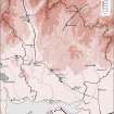
A detailed GPS survey was carried out at Ewes Doors in 2005 in order to create a terrain model of the site.
Field Visit (8 December 2015 - 9 December 2015)
This Roman watchtower is situated on the crest of a natural knoll, near the foot of Pikethaw Hill and about 30m S of the old road (NY39NE 29) that runs through Ewes Doors, a narrow pass linking the valley of the Eweslees Water to the SE and that of the Wrangway Burn to the NW. Circular on plan, the grass-grown earthwork comprises a conical mound 17.5m in diameter and 0.6m high, enclosed by a ditch 1.15m wide and 0.15m deep and a counterscarp bank up to 4m thick, 0.4m high -the whole measuring 25.5m in diameter overall. The summit of the mound measures 11m in diameter over a circular bank 2.7m thick and 0.15m high. It is broken by an entrance on the NNW leading out onto a causeway across the ditch. In the interior, which is 5m across, there are two shallow depressions on the NE and SE respectively, each measuring 0.7m in diameter and possibly marking the positions of two out of perhaps four corner-posts that once provided the framework for a 4m square timber tower.
The site is overlooked by steeply rising ground on the SW, down which a narrow path descends before fading 12m from the knoll. It is also overseen by rising ground on the N side of the pass. The road, itself, measures about 2m wide as it approaches the gate marking the summit from the E; but W of this point it runs along a terrace up to 5m broad, before dropping down to the haugh E of the Wrangway Burn. A later hollow way takes a short cut to this lower ground by descending the N facing scarp immediately W of the gate.
The outlook SE from the earthworks extends down Eweslees Hope to the barns of Eweslees Farm with Castlewink and the high hills behind rising in the background, while to the N it reaches to the summit of Merrypath Rig and to the confluence of the streams forming Limiecleuch Burn. The tower is isolated and not one of a series, but it allowed the military to keep watch over traffic as it passed along the road through this difficult hilly country. It guarded the pass and could promise practical help to convoys of waggons or pack animals labouring on the steeper ascents. Its sentries are likely to have been drawn from an unknown fort, or fortlet, no more than perhaps half-a-day's march - about 10 Roman miles (14km) away. The best parallels are of Flavian date and this would be in keeping with the establishment of the fort at Broomholm (NY38SE 7) about 20km S. However, the origin and early history of the road passing through Ewes Doors is hardly known and it might equally be attributed to an Antonine date.
Visited by RCAHMS (ATW and GG), 9 December 2015.
Measured Survey (8 December 2015 - 9 December 2015)
HES surveyed Ewes Doors Roman watch tower between 8-9 December 2015 with plane-table and self-reducing alidade at a scale of 1:250. GNSS was used to record survey control. The resultant plan and section were redrawn in vector graphics software.


