
Pricing Change
New pricing for orders of material from this site will come into place shortly. Charges for supply of digital images, digitisation on demand, prints and licensing will be altered.
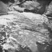
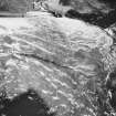
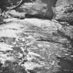
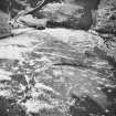
Gibb's Hill


Cultivation Remains (Medieval) - (Post Medieval), Enclosed Settlement (Prehistoric), Farmstead (Medieval) - (Post Medieval), Unenclosed Settlement (Prehistoric)
Site Name Gibb's Hill
Classification Cultivation Remains (Medieval) - (Post Medieval), Enclosed Settlement (Prehistoric), Farmstead (Medieval) - (Post Medieval), Unenclosed Settlement (Prehistoric)
Canmore ID 67732
Site Number NY38SW 28
NGR NY 3106 8405
Datum OSGB36 - NGR
Permalink http://canmore.org.uk/site/67732


- Council Dumfries And Galloway
- Parish Langholm
- Former Region Dumfries And Galloway
- Former District Annandale And Eskdale
- Former County Dumfries-shire
Field Visit (March 1981)
Gibb's Hill NY 310 840 NY38SW
On the steep E-facing slope of Gibb's Hill 800m SSW of Arresgill there are two platform-buildings measuring respectively 8.8m by 2.5m and about 4.8m by 2.2m internally.
RCAHMS 1981, visited March 1981
Note (1997)
NY 3106 8405 NY38SW 28
Listed as farmstead.
RCAHMS 1997.

