Gibb's Hill
Palisaded Settlement (Bronze Age) - (Iron Age), Roundhouse(S) (Later Prehistoric), Unenclosed Settlement (Bronze Age) - (Iron Age)
Site Name Gibb's Hill
Classification Palisaded Settlement (Bronze Age) - (Iron Age), Roundhouse(S) (Later Prehistoric), Unenclosed Settlement (Bronze Age) - (Iron Age)
Alternative Name(s) Logan Water
Canmore ID 67716
Site Number NY38SW 13
NGR NY 30867 84172
Datum OSGB36 - NGR
Permalink http://canmore.org.uk/site/67716
- Council Dumfries And Galloway
- Parish Langholm
- Former Region Dumfries And Galloway
- Former District Annandale And Eskdale
- Former County Dumfries-shire
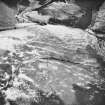
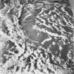
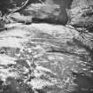
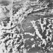
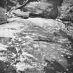
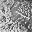
The remains of a complex multi-phase Iron Age settlement has been recorded on Gibb's Hill. A palimpsest of intercutting palisade trenches (a narrow trench which held a fence of vertical timbers) and the remains of timber round-houses represent at least six periods of construction and occupation. The relationships between the features allows a relative chronological relationship to be established, although the site has not been dated by scientific means.
Information from RCAHMS (SC) 16 August 2007
Well-preserved remains of multi-phase later prehistoric settlement site together with pre-improvement buildings, located on east facing slopes of Logan Water valley in rough pasture. Later prehistoric settlement lies at higher elevation, main views are to east and south along Logan valley, more restricted views from preimprovement features due to local topography. Other related sites in vicinity. Craig wind farm visible to north-east
information from Héléna Gray, (CFA Archaeology Ltd), August 2015
OASIS ID: cfaarcha1-278420
Field Visit (March 1981)
Gibb's Hill NY 308 841 NY38SW
On the summit of Gibb's Hill there is a palisaded settlement of at least three constructional phases which succeeded an unenclosed homestead. The homestead is situated immediately W of the summit and comprises at least two timber house-sites, one of which is of ring-ditch type with a baffle wall at its entrance. Subsequently an area measuring 60m by 53m on the top of the hill was enclosed by a single palisade accompanied on the N and W by a low bank and external ditch. This was superseded by a double palisade enclosing an area measuring 57m by 42m, and finally a second double palisade was constructed to enclose an area measuring 45m by 31 m. Both double palisades have entrances with hairpin terminals on the SE. Associated with the palisaded enclosures there are at least seven timber house-sites, three of which probably belong to the final phase of occupation. Immediately to the SSW there are intermittent traces of slight rigs (up to 1.4m broad and 0.2m high) over an area of 0.5ha.
RCAHMS 1981, visited March 1981
Field Visit (17 February 1993)
(Location re-cited as NY 3086 8418). The well preserved remains of a multi-period settlement of timber round-houses, comprising both unenclosed and palisaded phases, are situated on the summit of Gibb's Hill, a SE-facing spur on the W side of the valley of the Logan Water. The palisaded settlement has been of at least five phases, the two earliest of which are the least well preserved. The larger of the earlier phases is represented by a single palisade trench on the SW and by two low scarps on the NE, and measures about 60m from N to S by 50m transversely. Of the other, only an arc of palisade trench on its NW side is visible where short fragments of it cross the interior of what was to become the latest enclosure. The two early phases were succeeded by a pair of palisade trenches, set from 1.5m to 3m apart, enclosing an roughly oval area measuring about 56m by 44m. This in turn was succeeded by a smaller enclosure, measuring 45.5m by 31m within a pair of palisade trenches set 1m to 2m apart. The final phase of enclosure saw the reduction in size of this enclosure to about 45.5m by 29m, by re-siting the inner palisade trench along the line of the inner of the palisades of the preceding twin-palisaded enclosure. In its latest guise, the enclosure appears to have consisted of a single palisade. All three later enclosures had entrances on the SE, and it is likely that the entrance of the larger of these enclosures re-used the entrance of the preceding phases.
On the NW, there is a bank and ditch which follows the natural edge of the summit and cuts off access from higher ground on that side. This earthwork may well be contemporary with the first-phase palisaded enclosure or, though it is less likely, any of the subsequent phases of enclosure.
In addition to the palisade trenches, the summit of the hill is liberally covered with the remains of timber round-houses. In places, clear relative chronological relationships can be demonstrated not only between the various phases of palisade trenches and the round-houses, but between the different phases of round-houses. On the W, a round-house, one of four which lie just off the summit, can be seen to cut into the ditch of an earlier phase earthwork, piercing its low counterscarp bank in the process.
Such is the nature of relative dating by association, however, that structures can only be shown to be earlier or later than one another, and it is very difficult to prove contemporaneity between structures that are not physically linked. This, and the fragmentary nature of most of the structures on the summit of the hill, makes anything more than a crude analysis of the history of the site impossible.
Visited by RCAHMS (JRS), 17 February 1993.
Measured Survey (16 February 1993 - 3 March 1993)
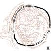
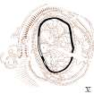
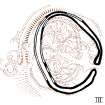
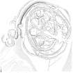
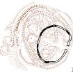
RCAHMS surveyed the palisaded settlement at Gibb’s Hill with plane-table and self-reducing alidade between 16-19 February and 1-3 March 1993 at a scale of 1:250. The plan was redrawn in ink and published at a scale of 1:500 (RCAHMS 1997, Figs. 116, 161). Six plans of the palisades phasing were also published at a scale of 1:1000 (RCAHMS 1997, Fig.118 I-VI).
Field Visit (3 March 1993)
On Gibb's Hill detailed field survey has revealed a palimpsest of intercutting palisade trenches representing at least five separate perimeters, and possibly six. The sequence of construction is revealed by the banks of upcast that accompany each palisade trench, for these either infill, or are cut by, intersecting trenches. The earliest palisade on Gibb's Hill probably enclosed a relatively small area (0.8ha) centred towards the SE side of the site, but its course can only be followed with difficulty. This was succeeded by a larger enclosure, which is marked by a single palisade trench on the NE and the SW; on the SE the line of the trench has evidently been incorporated into the larger of the double palisades (III) that succeeded it, while on the NW, where a shallow saddle provides the easiest line of approach to the hill, the line of the palisade is taken up by a low rampart with an external ditch. The well-formed terminal of this rampart on the W appears to mark one side of an entrance through the palisade, and it is likely that they represent two complementary elements in one defensive scheme. The large double-palisaded enclosure (III) that was subsequently constructed lies eccentrically across this earlier enclosure, and its entrance is on the SE, where the palisades return around the low medial bank to form hairpin terminals. In its turn, the large double-palisade was superseded by a smaller double-palisaded perimeter (IV) enclosing 0.11ha. Its entrance, again with hairpin terminals, is also on the SE, but set further back up the slope. While the general sequence between the two double palisades is reasonably well established, the configuration of the palisade trenches on the SW is immensely complicated. Detailed examination on the ground suggests that both the inner and outer palisade trenches of the later double may have been re-cut at different periods, thus representing two subsequent periods of enclosure on the site. Given that the row of three round-houses along the W side of the settlement overlies the line of the inner of these two palisade trenches, it is likely that the outer represents the latest period of enclosure on the hill-top (VI). Numerous traces of round-houses are visible within the settlement, but it is almost impossible to disentangle their sequence of construction. The three described above, each comprising a circular platform measuring between 9m and 10m in diameter within a concentric external bank are evidently the latest, but they are set very close together, and even these may be the result of successive construction. The unenclosed round-houses in the saddle to the west appear to overlie the ditch of the phase II defences, but there is no evidence to show at what point in the subsequent sequence of structures they were constructed.
Visited by RCAHMS (SPH), 3 March 1993
Listed as palisaded settlements and timber round-houses.
RCAHMS 1997.
Note (1997)
NY 3086 8418 NY38SW 13
Listed as palisaded settlements and timber round-houses.
RCAHMS 1997.
Note (3 July 2014 - 16 August 2016)
A complex palisaded enclosure displaying evidence of up to six phases of construction is situated on the summit of Gibb's Hill, a spur of Rashy Knowes from which it is separated on the NW by a shallow saddle. Several of these perimeters are relatively slight stockades, comprising no more than a single line of palisading, but three can be picked out from the palimpsest of intercutting palisade trenches and timber round-houses that evidently represent more substantial enclosures with some intent to provide a measure of defence. The earliest of these was a sub-oval enclosure of some 0.25ha, measuring about 60m from N to S by 53m transversely within for most of its circuit by a single palisade trench, but which has been reinforced in the NW sector facing onto the saddle by a low rampart with an external ditch; while the rampart is little more than 0.5m in height internally, externally it forms a more formidable barrier dropping up to 2m into the bottom of the shallow ditch. There was probably an entrance on the WSW, adjacent to the well-formed terminal of the rampart, and there may have been a second on the ESE, which was the position of the entrance in the subsequent phases, two of which were provided with pairs of concentric palisade trenches forming enclosures on slightly different axes. The earlier of these is an enclosure of 0.18ha, measuring 57m from NW to SE by 42m transversely within trenches between 1.5m and 3m apart, while the later is of 0.12ha and measures 45m from NNW to SSE by 31m transversely within close-set trenches about 2m apart. The entrances of both are on the same ESE axis, with a worn hollow running up between the hairpin terminals into the interior. The better preserved of the round houses, which have floors levelled into the slope and traces of a ring-grooves and external banks, are probably the latest and are set in a contiguous row on the W, but there are fragments of grooves and shallow ring-ditches throughout the rest of the interior, and there are also three in the saddle on the W, one of which appears to cut through the counterscarp of the ditch accompanying the rampart.
Information from An Atlas of Hillforts of Great Britain and Ireland – 16 August 2016. Atlas of Hillforts SC1127
Project (29 May 2014)
An archaeological evaluation was undertaken by CFA Archaeology Ltd, a desk based assessment and walk over survey (May 29th 2014) was conducted
The historic environment record within the Site Boundary is relatively limited, although there is some potential for the proposed development site to contain previously unknown heritage assets from at least the later prehistoric period onwards, given the historic landscape character of the wider area. Taking this into account, the archaeological potential of the proposed development site is considered to be low.
A summary assessment, on a site by site basis, of the predicted effects on the settings of assets within a 10km radius where the blade tip ZTV indicates that there would be theoretical views of one or more turbines
information from Héléna Gray, (CFA Archaeology Ltd), August 2015
OASIS ID: cfaarcha1-278420


