Lochmaben, Old Castle
Motte (Medieval)
Site Name Lochmaben, Old Castle
Classification Motte (Medieval)
Alternative Name(s) Lochmaben, Castle Hill; Lochmaben, Brus Motte; Lochmaben Motte
Canmore ID 66314
Site Number NY08SE 7
NGR NY 0820 8220
Datum OSGB36 - NGR
Permalink http://canmore.org.uk/site/66314
- Council Dumfries And Galloway
- Parish Lochmaben
- Former Region Dumfries And Galloway
- Former District Annandale And Eskdale
- Former County Dumfries-shire
NY08SE 7.00 0820 8220
NY08SE 7.01 NY 081 822 Trial Excavation
(NY 0820 8220) Castle Hill (NAT)
Motte (NR)
OS 6" map (1969)
For successor (royal) castle (NY 0883 8115), see NY08SE 8.
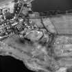
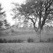
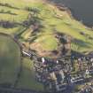
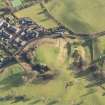
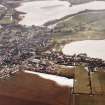
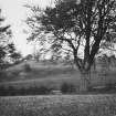
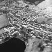
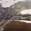
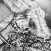
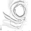
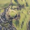
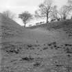
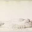
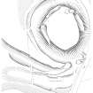
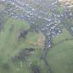
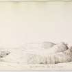
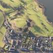
This motte is formed by isolating the end of a ridge by making a deep, wide cutting around it. The oval summit measures 245 ft by 195 ft; the steeply scarped sides vary in height from 18ft in the S to 24 ft in the E. The surrounding ditch is 20 ft to 25 ft wide and 18 ft deep. To the NNW on the scarp is a bastion-like mound composed to some extent of rubble and mortar. The ditch has been partly destroyed on the S and E by a roadway.
RCAHMS 1920, visited 1912; R C Reid 1954; R Fraser 1930
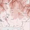
NY 082 822 A topographic and archaeological survey was undertaken of the Scheduled area around and including Lochmaben Castle (NY08SE 7).
The fieldwork involved an initial walkover survey followed by the surveying of a closed loop traverse. The survey included the recording of all archaeological features together with topographic information. All trees and vegetation areas across the site were surveyed and trees with a girth (bole) diameter above 15cm were individually located and bole size recorded. Areas containing bushes, shrubs and brambles were also delimited and recorded in outline. (GUARD 1001)
Sponsor: HS
J Arthur and J S Duncan 2002
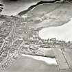
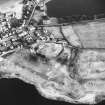
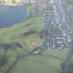
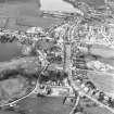
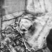
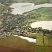
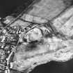
NY 082 820 to NY 082 818 Oval enclosure, 150m by up to 70m, identified adjoining the SSE side of the Old Motte of Lochmaben (NY08SE 7), coaxial to the longer axis of the motte and containing Gallows Hill. Houses and gardens overlie where it would join. The enclosure is contained by a bank, ditch and counterscarp bank, now only recognisable on the NE and SW, otherwise reduced to a scarp and terrace, and obscured by golf course earthworks on the NW. It clearly functioned as a very large bailey, and might therefore be Edward I's palisade or cloisture outside the peel constructed in 1299, although this has normally been identified with the site occupied by the later castle (NY08SE 8).
The ditch on the NE, around the base of Gallows Hill, can be traced for 120m, 8-12m wide, and the remains of the counterscarp bank, up to 20m thick, along the escarpment overlooking Castle Loch. Beyond a D-shaped mound, 40 x 30m, which projects from the slope, the defences continue as a scarp and terrace along the slope crest. The southern end, in the next field, E of Castlehill Farm, has been almost obliterated by ploughing, but the course is resumed in the SW corner of the Gallows Hill field at NY 081 818, where the bank, ditch and counterscarp are extant for 70m, before merging with the farm road.
T C Welsh 2004
Publication Account (1980)
Lochmaben was a castle which belonged to the Bruces of Annandale and later to the Earls of Douglas until their forfeiture in 1440. Thereafter it was crown property and was allowed to decay irretrievably. An amount of confusion exists as to the particular site in question: the later stone built castle however, may be taken to be later than 1300.
The initial Norman fortif1cation was built in the early twelfth century as a residence for the Bruce family who were granted Annandale by David I, 1124-1153. The site of this structure was undoubtedly the Castle Hill motte which today serves as the fourteenth tee at the municipal golf course. It is known that Edward I shortly after his victory at Falkirk in 1298 caused to be built 'an enclosure outside the castrum, made strong by a pallisade' (RCAM, 1920, 151), but it is unclear where that structure was built. Some local scholars are of the opinion that Edward built his pele on the iron age site at the south end of Castle Loch, thus abandoning the Norman motte (Reid, 1952-53, 60-1) yet others (Wilson, 1973 9; Anon, n.d.,8) believe that the Edwardian pele was built at the motte.
The fortunes of Lochmaben castle - whatever its site - seesawed back and forth between warring English and Scottish factions. In 1385 Scottish forces under the conmand of Archibald Douglas, Lord of Galloway, after a nine day siege razed the castle to the ground (Reid, 1952-53, 73), thus ending years of English domination. The castle came into full possession of the Douglases until their forfeiture in 1440, when it reverted to the crown. It remained crown property and after the Union of the Crowns in 1603 it was allowed to decay.
Information from ‘Historic Lochmaben: The Archaeological Implications of Development’ (1980).
Measured Survey (29 March 1994 - 1 April 1994)
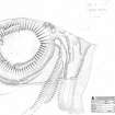
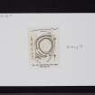
RCAHMS surveyed the motte at Lochmaben (Old Castle) between 29 March – 1 April 1994 with plane-table and self-reducing alidade at a scale of 1:500. The plan was redrawn in ink at two different scales. One published at a scale of 1:1000 (RCAHMS 1997, Fig. 201) and the other at 1:2500 alongside comparative plans of mottes and medieval earthwork monuments (RCAHMS 1997, Fig. 202).
Field Visit (11 July 1995)
NY 0820 8220 NY08SE 7
The Dumfries Museum accession numbers for medieval pottery from this site are DUMFM: 1956.90 and 1967.593.3.
Dumfries Museum visited by RCAHMS (JRS), 11 July 1995.
Listed as motte-and-bailey and medieval pottery.
RCAHMS 1997.


