Lincluden College
Church (15th Century), Nunnery (12th Century)
Site Name Lincluden College
Classification Church (15th Century), Nunnery (12th Century)
Alternative Name(s) Lincluden Abbey; Lincluden, Convent
Canmore ID 65571
Site Number NX97NE 4
NGR NX 96640 77911
Datum OSGB36 - NGR
Permalink http://canmore.org.uk/site/65571
First 100 images shown. See the Collections panel (below) for a link to all digital images.
- Council Dumfries And Galloway
- Parish Terregles (Dumfries-shire)
- Former Region Dumfries And Galloway
- Former District Nithsdale
- Former County Dumfries-shire
NX97NE 4 96640 77911.
(NX 9664 7792) Remains of Lincluden College (NR) on site of Nunnery (NR) (Benedictine - founded 1164)
OS 1:10000 map (1978)
Spottiswoode, as well as manuscript and other lists, ascribe the foundation of a Benedictine nunnery here to Uchtred, son of Fergus, Lord of Galloway (d. 1174); others assign it to the reign of Malcolm IV (1153 65). It was suppressed in 1389 and replaced by a college of secular canons.
I B Cowan and D E Easson 1976
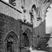
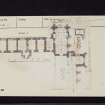
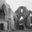
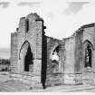
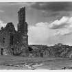
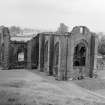
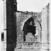
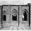
The DoE state that the nunnery was founded in 1164. The existing remains are those of the collegiate church and the provost's house. The church, of which the chancel and S aisle survive, dates from the early 15th century; it contains the tomb of Margaret, daughter of Robert III. The provost's house is of 16th century date.
RCAHMS 1914, visited 1911; S Piggott and W D Simpson 1970
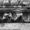
Excavations in 1882 at the NW angle of the nave disclosed foundations of a W range of buildings, probably domestic, and indications of a staircase, possibly leading from the church to a dormitory above. Thus there appears to have been a cloister garth or courtyard, measuring some 70 ft by 56 ft, with the church on the S side and a range of buildings on the E, W, and possibly the N, though no foundations were found in the latter direction. At the same time, fragmentary portions of semi-circular piers belonging to the N arcade of the nave were discovered; they are thought to have been part of the original convent. A 15th century frieze and medieval pottery from here are in Dumfries Museum.
J Barbour 1887; D MacGibbon and T Ross 1896; A E Truckell 1964; 1975
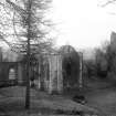
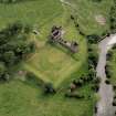
The remains of Lincluden College are well-preserved. The large rectangular earthwork on the E has been completely renovated by the D o E and now has a modern appearance. Within it, lawns have been laid out in ornamental terracing.
Visited by OS (JLD) 7 December 1960.
NX 966 779 Archaeological monitoring was carried out in April 2000 during excavation of the settings for two metal gate posts. The area was shown to have been landscaped at some period, the topsoil lying directly on the natural clay without the presence of an intervening subsoil.
Sponsor: Historic Scotland
D Stewart 2000
EXTERNAL REFERENCE:
National Library of Scotland
Uncatalogued MSS of General Hutton and numbered 55, Vol.1, a plan given by Capt. Grese, 1790; and a sketch of Lincluden College on the East border of the County, and near Dumfries.
Aerial Photography (1971)
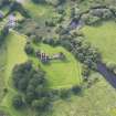
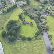
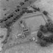
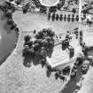
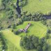
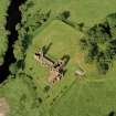
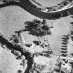
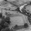
Oblique aerial photographs of Lincluden College taken by Mr John Dewar in 1971.
Aerial Photography (1972)
Oblique aerial photographs of Lincluden College taken by Mr John Dewar in 1972.
Publication Account (1986)
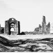
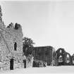
This precious gem of medieval architectural and social history stands close to the confluence of the Cluden Water and the River Nith. There are two distinct elements: the choir, south transept and fragment of the nave of an elegant collegiate church, and, extending northwards from the church sacristy, a rubble-built domestic and service range. On the east, the layout includes a restored formal knot garden and, immediately to the south, a tree-shrouded and terraced motte, which has obviously been part of the horticultural scheme.
How long the early castle mound remained in use for serious defensive purposes is not known, for a Benedectine nunnery was founded here, evidently by Uchtred (d. 1174), son of Fergus, Lord of Galloway. The nunnery was said to have been endowed to support up to ten nuns, but at the date of its suppression in 1389 it housed only four. In his papal petition to abolish the nunnery and erect in its place a collegiate church, Archibald, 3rd Earl of Douglas, claimed that the nuns lived 'disgracefully'; they 'do not trouble to repair the beautiful buildings, ... which are disfigured and ruinous through their sloth and neglect, but deck with fUle clothing and ornaments their daughters born on their immoralities whom they rear in common with them in the same monastery'.
His allegations were seemingly sustained, and authority was granted for the establishment of a college of secular priests whose main job would be to celebrate masses for the souls of the founder and his family. The staff of the college comprised a provost and eight prebendaries (priests), later increased to twelve, together with 24 bedesmen to serve the annexed poors' hospital at Holywood.
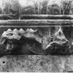
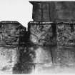
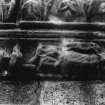
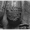
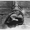
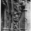
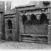
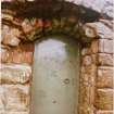
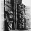
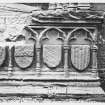
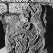
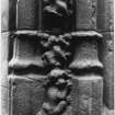
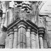
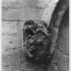
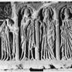
It is Douglas wealth which is now so sumptuously displayed in the surviving architecture and sculpture, but the claustral layout of the nunnery guided the planning of the collegiate establishment Authorship of the architecture may be attributed to John Morow, a Parisian-born master-mason whose work at Melrose Abbey was accompanied by an inscribed panel listing other Scottish commissions, including work in 'Nyddysdayl' (Nithsdale). The forms of the stone mouldings and window tracery show close affinities with Melrose, and would have coincided with the acquisition of French tastes and interests by the founders son, Archibald, 4th Earl of Douglas and Duke of Touraine, who was killed at Verneuil in 1424. It is the effigy and tomb of his widow, Princess Margaret, eldest daughter of King Robert III, which takes pride of place on the north side of the choir, and her status is denoted by the magnificence of the tomb surround. Similar craftmanship is also shown in the surround of the adjacent sacristy door, and of the sedilia and piscina in the opposite wall. There is indeed a wealth of testimony to the stone-carvers art: note especially the ubiquitous heraldry, the angelmusicians at the bases of the vaulting-ribs, and the enriched cornice of the stone choir screen, itself a rare survival. A relief-sculptured panel portraying the Apostles was originally set on the parapet or rood loft above this screen and is now preserved in one on the vaults of the domestic range.
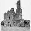
The southern half of the domestic block, originally three-storeyed and known as the Provost's Lodging, was probably built in the first half of the 15th century. The projecting stair-tower and the northern half of the range, which included a four-storeyed tower, is believed to have been the work of Provost William Stewart (1529-36). This range continued in use as a residence into the second half of the 17th century.
Information from ‘Exploring Scotland’s Heritage: Dumfries and Galloway’, (1986).
Watching Brief (3 April 2000)
A brief excavation with archaeological monitoring was carried out on 3rd April 2000 at Lincluden Collegiate Church, Dumfriesshire. The purpose of the excavation was to create the settings for two metal gate posts set within the length of an already existing perimeter fence.
The site of the gate post excavations consisted of a small flat platform area on the E side of the hill which dominates the area just to the E of the Collegiate Church. The gate was to be positioned along the N-S aligned section of the existing metal perimeter fence at a point approximately 11m N of the SE corner of the fence.
The new gate posts required two identical holes measuring 1m E-W by 350mm N-S with a depth of 800mm. One hole was 10.6m from the SE corner of the fence line and the other at 12.2m, a separation of 1.6m.
Both holes were hand dug by MCU to the required depth without hitting masonry. The horizons exposed in the excavations consisted of 300mm of medium brown topsoil lying directly on 500mm of pink silty clay. There were no visible features or finds in either of the holes.
The area of the post excavations seems to have been landscaped at some period which may explain the way the topsoil lies directly on the natural clay without the presence of an intervening subsoil.
Project (May 2022 - July 2022)
NX 96640 77911 A geophysical survey was undertaken at Lincluden Collegiate Church in May and July 2022. This survey forms part of a programme of research to increase the understanding of the Church and the wider landscape.
Gradiometry, resistance, and ground penetrating radar (GPR) survey were undertaken over open areas surrounding the church. GPR transects were attempted across the Motte in the SE of the site. Unfortunately, the area was too overgrown with trees, brambles, and other vegetation for survey to be undertaken.
The area of the postulated W and N ranges is generally quiet in all data sets. However, a well-defined area of elevated resistance has been detected which may be associated with the cloister. Some additional weak trends in the resistance and gradiometer data may be associated with possible remnants of former ranges but they are very ephemeral and not indicative of structural remains and the lack of associated magnetic response suggests that, if ranges did exist in this area, they have been almost entirely robbed.
In the SW of the site both the resistance and the GPR surveys have detected a concentration of rectilinear anomalies that suggest potential structural remains. These are aligned SW/NE and respect, and appear to be associated with, a low bank thought to cover substantial wall footings, although the origin of the bank is unknown. In the GPR data, a linear anomaly on the same alignment extends northeastward into the knot garden at the same depth. The response suggests a possible track or boundary, which terminates at the original break of slope in the NE of the knot garden.
A variety of responses has been detected within the knot garden by the resistance and GPR surveys. Many of these appear to be associated with the original topographic change in the NE of the site before the area was built up and extended to form the ground the knot garden sits on. In the S of the knot garden a curving response has been noted which could, tentatively, be associated with the Motte, which lies immediately to the S.
Archive: Rose Geophysical Consultants Funder: Historic Environment Scotland
Susan Ovenden – Rose Geophysical Consultants
(Source: DES Volume 23)
Ground Penetrating Radar (May 2022 - July 2022)
NX 96640 77911
Ground penetrating radar survey.
Archive: Rose Geophysical Consultants Funder: Historic Environment Scotland
Susan Ovenden – Rose Geophysical Consultants
(Source: DES Volume 23)
Earth Resistance Survey (May 2022 - July 2022)
NX 96640 77911
Resistance survey.
Archive: Rose Geophysical Consultants Funder: Historic Environment Scotland
Susan Ovenden – Rose Geophysical Consultants
(Source: DES Volume 23)
Magnetometry (May 2022 - July 2022)
NX 96640 77911
Magnetometry survey.
Archive: Rose Geophysical Consultants Funder: Historic Environment Scotland
Susan Ovenden – Rose Geophysical Consultants
(Source: DES Volume 23)


