Kilbruar
Cairnfield (Prehistoric), Hut Circle (Prehistoric)
Site Name Kilbruar
Classification Cairnfield (Prehistoric), Hut Circle (Prehistoric)
Alternative Name(s) Scottarie Burn
Canmore ID 6507
Site Number NC80NW 5
NGR NC 8218 0982
Datum OSGB36 - NGR
Permalink http://canmore.org.uk/site/6507
- Council Highland
- Parish Clyne
- Former Region Highland
- Former District Sutherland
- Former County Sutherland
NC80NW 5 8218 0982.
(NC 8218 0982) Hut circle (NR)
OS 6"map, (1969)
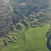
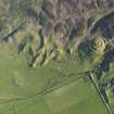
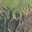
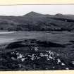
About 100 yards SW of the site of the broch at Kilbrare (NC80NW 4) is a small circular enclosure of about 17ft internal diameter. The entrance is from the SE and is about 2ft wide. The bank or wall which is about 5ft thick is on its inner face lined with large contiguous boulders from 1ft to 1 1/2ft high and 1 1/2ft to 2ft across. One or two mounds lie near.
RCAHMS 1911, visited 1909.
A small clearly-defined hut circle, 5.1m in internal diameter, as described above.
The mounds in the area are field clearance heaps of a minor contemporary field system.
Visited by OS (W D J) 26 April 1964 and (J B) 27 October 1975.
Field Visit (19 August 1909)
37. Scottarie Burn. [NC80NW 5] About 100 yards SW. of the site of the broch at Kilbrare, on the Scottarie Burn, is a small circular enclosure of about 17' interior diameter. The entrance is from the SE. and is about 2' wide. The bank or wall, which is about 5' thick, is on its inner face lined with large contiguous boulders from 1' to 1½' high and 1½' to 2' across. One or two small mounds lie near.
On the hillside, to the SW. of the shepherd's house at Kilbrare, is a group of small mounds, some of which have been opened.
Below the upper end of the group is a hut circle of simple oval form, the outline of which, however, is rather indefinite.
About ½ m. up the glen of the Scottarie Burn, on its W. side, is a stone-built hut circle of 34' interior diameter [NC80NW 7]. The entrance is from the E. through a passage 9' long and 3' wide. The wall, now
broken down, is about 5' 6" in thickness, widening towards the
entrance.
Some 150 yards higher up the glen are the ruins of an oblong
structure [NC80NW 8], with walls entirely of stone, in the construction of which very large boulders have been used. The entrance is from the SE.
The total length of the interior is 46', and the greatest width 18'.
The wall is 7' thick, expanding to 10' on either side of the entrance, which is 4' wide. At the back of the interior are the ruins of a circular building measuring 15' x 14' over all, but as the space occupied by it is entirely covered by the ruins, the thickness of its wall and position and details of the entrance are not ascertainable (fig. 6).
About 170 yards up the glen is a group of a score or so of mounds [NC80NW 6], well defined, measuring from 10' to 26' in diameter.
OS 6-inch map: Sutherland Sheet xcvii. (unnoted).
RCAHMS 1911, visited (AOC) 19th August 1909.


