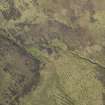
|
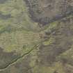
Photographs and Off-line Digital Images |
B 49471 |
RCAHMS Aerial Photography |
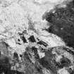
Oblique aerial view. |
1991 |
Item Level |
|
|
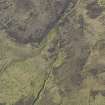
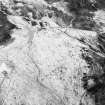
Photographs and Off-line Digital Images |
B 49472 |
RCAHMS Aerial Photography |
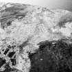
Oblique aerial view. |
1991 |
Item Level |
|
|
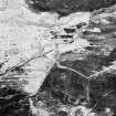
Photographs and Off-line Digital Images |
B 49473 |
RCAHMS Aerial Photography |
Oblique aerial view. |
1991 |
Item Level |
|
|
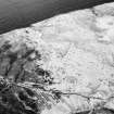
Photographs and Off-line Digital Images |
B 49474 |
RCAHMS Aerial Photography |
Oblique aerial view. |
1991 |
Item Level |
|
|
Photographs and Off-line Digital Images |
B 49475 |
RCAHMS Aerial Photography |
Oblique aerial view. |
1991 |
Item Level |
|
 |
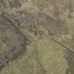
On-line Digital Images |
DP 080174 |
RCAHMS Aerial Photography Digital |
Oblique aerial view of the remains of the buildings, field boundaries and rig and furrow at Wester Badanloch, taken from the WSW. |
29/5/2009 |
Item Level |
|
 |
On-line Digital Images |
DP 080175 |
RCAHMS Aerial Photography Digital |
Oblique aerial view of the remains of the buildings, field boundaries and rig and furrow at Wester Badanloch, taken from the WSW. |
29/5/2009 |
Item Level |
|
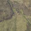 |
On-line Digital Images |
DP 080176 |
RCAHMS Aerial Photography Digital |
Oblique aerial view of the remains of the buildings, field boundaries and rig and furrow at Wester Badanloch, taken from the SW. |
29/5/2009 |
Item Level |
|
 |
On-line Digital Images |
DP 080177 |
RCAHMS Aerial Photography Digital |
Oblique aerial view of the remains of the buildings, field boundaries and rig and furrow at Wester Badanloch, taken from the S. |
29/5/2009 |
Item Level |
|
 |
On-line Digital Images |
DP 080178 |
RCAHMS Aerial Photography Digital |
Oblique aerial view of the remains of the buildings, field boundaries and rig and furrow at Wester Badanloch, taken from the ESE. |
29/5/2009 |
Item Level |
|
 |
On-line Digital Images |
SC 1693159 |
RCAHMS Aerial Photography |
Oblique aerial view. |
1991 |
Item Level |
|
 |
On-line Digital Images |
SC 1693160 |
RCAHMS Aerial Photography |
Oblique aerial view. |
1991 |
Item Level |
|
 |
On-line Digital Images |
SC 1693161 |
RCAHMS Aerial Photography |
Oblique aerial view. |
1991 |
Item Level |
|
 |
On-line Digital Images |
SC 1693162 |
RCAHMS Aerial Photography |
Oblique aerial view. |
1991 |
Item Level |
|
 |
On-line Digital Images |
SC 1693163 |
RCAHMS Aerial Photography |
Oblique aerial view. |
1991 |
Item Level |
|
 |
On-line Digital Images |
SC 2348912 |
Records of the Ordnance Survey, Southampton, Hampshire, England |
Wester Badanloch, NC73SE 14, Ordnance Survey index card, page number 1, Recto |
c. 1958 |
Item Level |
|
|
All Other |
551 166/1/1 |
Records of the Ordnance Survey, Southampton, Hampshire, England |
Archaeological site card index ('495' cards) |
1947 |
Sub-Group Level |
|


