Mull Of Galloway
Cairn (Prehistoric)
Site Name Mull Of Galloway
Classification Cairn (Prehistoric)
Canmore ID 61039
Site Number NX13SE 1
NGR NX 15686 30444
NGR Description Centre
Datum OSGB36 - NGR
Permalink http://canmore.org.uk/site/61039
- Council Dumfries And Galloway
- Parish Kirkmaiden
- Former Region Dumfries And Galloway
- Former District Wigtown
- Former County Wigtownshire
NX13SE 1 1568 3044.
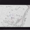
(NX 1569 3045) Cairn (NR)
OS 6" map (1957)
This cairn consists of a circular turf-covered mound 50' in diameter, standing to a height of 3' on the S side and 6' on the N. The top has been flattened to take a flag-pole.
RCAHMS TS 25 September 1953
A flat-topped, turf-covered mound of earth-and-stone standing to a maximum height of 1.7m and surmounted by a flag staff.
Resurveyed at 1:2500.
Visited by OS (RD) 7 February 1971
This cairn is situated on a low knoll 40m N of the Lighthouse on the tip of the Mull of Galloway. It measures 16.5m from NNW to SSE by 15m transversely and ranges from 2.2m in height in the NNW to 1.4m on the SSE. The top of the cairn has been flattened to take a flagstaff, and a storage tank has been dug into the edge of the cairn on the ENE.
RCAHMS 1985, visited (SH) June 1984
NX 156 304 A watching brief was carried out during the hand excavation of a water pipe track close to the Mull of Galloway cairn. The 30cm wide track revealed sections of two shallow grooves in the underlying natural boulder clay outcrop on which the cairn lies. The grooves appeared to be roughly parallel and aligned in a direction from the centre of the cairn. A broken flint flake was recovered from one of the grooves but it could not be securely identified as a product of deliberate human action.
Although only a limited section of the grooves was excavated, making identification difficult, it is possible that the grooves may be ard marks. The presence of features E of the cairn should be considered in the assessment for any future work at this site.
Sponsor: Solway Heritage.
R Toolis 2000
Field Visit (25 September 1953)
This site was included within the RCAHMS Marginal Land Survey (1950-1962), an unpublished rescue project. Site descriptions, organised by county, are available to view online - see the searchable PDF in 'Digital Items'. These vary from short notes, to lengthy and full descriptions. Contemporary plane-table surveys and inked drawings, where available, can be viewed online in most cases - see 'Digital Images'. The original typecripts, notebooks and drawings can also be viewed in the RCAHMS search room.
Information from RCAHMS (GFG) 19 July 2013.
Reference (1957)
This site is noted in the ‘List of monuments discovered during the survey of marginal land (1951-5)’ (RCAHMS 1957, xiv-xviii).
Information from RCAHMS (GFG), 24 October 2012.
Note (10 December 2021)
The location, classification and period of this site have been reviewed and changed from CAIRN (PERIOD UNASSIGNED).


