|
Photographs and Off-line Digital Images |
C 46589 |
RCAHMS Aerial Photography |
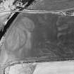
Ballantrae Bridge, oblique aerial view, taken from the SW, centred on the cropmarks of field boundaries and areas with pits. A souterrain and a round house are visible in the top right-hand corner of the photograph, and Ballantrae Bridge is shown in the top left-hand corner. |
29/6/1995 |
Item Level |
|
|
Photographs and Off-line Digital Images |
C 98259 CS |
RCAHMS Aerial Photography |
Ballantrae Bridge; Garleffin, oblique aerial view, taken from the SW, showing the cropmarks of a four poster stone-circle, ring-ditches, a barrow, pits, enclosures, two possible souterrains, a round house, field boundaries and linear cropmarks. Ballantrae Bridge is visible in the top left-hand corner of the photograph. |
29/6/1995 |
Item Level |
|
|
Photographs and Off-line Digital Images |
C 98256 CS |
RCAHMS Aerial Photography |
Ballantrae Bridge, oblique aerial view, taken from the NW, showing the cropmarks of a possible souterrain, a roundhouse, fieldboundaries, linear cropmarks and areas with pits. Ballantrae Bridge is visible in the top left-hand corner of the photograph. |
29/6/1995 |
Item Level |
|
|
Manuscripts |
MS 749/5565 |
Papers of Professor John R Hume, economic and industrial historian, Glasgow, Scotland |
John R Hume Industrial/CBA cards
Filed under Ayrshire, Ballantrae parish. Prints attached (see NMRS MS/749 entry for Collection description). |
14/8/1970 |
Item Level |
|
 |
On-line Digital Images |
SC 766432 |
Papers of Professor John R Hume, economic and industrial historian, Glasgow, Scotland |
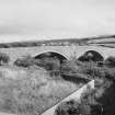
View from NW showing two large and one small arches |
14/8/1970 |
Item Level |
|
 |
On-line Digital Images |
SC 766445 |
Papers of Professor John R Hume, economic and industrial historian, Glasgow, Scotland |
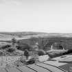
View from NNE showing two large arches |
14/8/1970 |
Item Level |
|
|
Photographs and Off-line Digital Images |
AY 2512 |
Records of A Brown and Company, photographers, Lanark, South Lanarkshire, Scotland
|
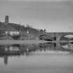
View of Ballantrae village showing the bridge, toll house and war memorial and the remains of Ardstinchar Castle. |
c. 1930 |
Item Level |
|
|
Photographs and Off-line Digital Images |
G 85862 PO |
|
General view. |
|
Item Level |
|
 |
On-line Digital Images |
DP 051931 |
RCAHMS Aerial Photography Digital |
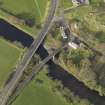
Oblique aerial view centred on the bridges with the remains of the castle adjacent, taken from the SE. |
1/11/2008 |
Item Level |
|
 |
On-line Digital Images |
DP 051934 |
RCAHMS Aerial Photography Digital |
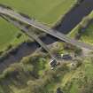
Oblique aerial view centred on the bridges with the remains of the castle adjacent, taken from the NE. |
1/11/2008 |
Item Level |
|
 |
On-line Digital Images |
SC 1520877 |
Records of A Brown and Company, photographers, Lanark, South Lanarkshire, Scotland
|
View of Ballantrae village showing the bridge, toll house and war memorial and the remains of Ardstinchar Castle. |
c. 1930 |
Item Level |
|
 |
On-line Digital Images |
SC 1754712 |
RCAHMS Aerial Photography |
Ballantrae Bridge, oblique aerial view, taken from the SW, centred on the cropmarks of field boundaries and areas with pits. A souterrain and a round house are visible in the top right-hand corner of the photograph, and Ballantrae Bridge is shown in the top left-hand corner. |
29/6/1995 |
Item Level |
|
 |
On-line Digital Images |
SC 1814752 |
Scottish Development Department |
Ballantrae Bridge, Ballantrae, South Ayrshire |
|
Item Level |
|
 |
On-line Digital Images |
SC 1814753 |
Scottish Development Department |
Ballantrae Bridge, Ballantrae, South Ayrshire |
|
Item Level |
|
 |
On-line Digital Images |
SC 2459587 |
Records of the Ordnance Survey, Southampton, Hampshire, England |
Ballantrae Bridge, NX08SE 25, Ordnance Survey index card, Recto |
c. 1958 |
Item Level |
|
|
All Other |
551 166/1/1 |
Records of the Ordnance Survey, Southampton, Hampshire, England |
Archaeological site card index ('495' cards) |
1947 |
Sub-Group Level |
|


