Pricing Change
New pricing for orders of material from this site will come into place shortly. Charges for supply of digital images, digitisation on demand, prints and licensing will be altered.
Upcoming Maintenance
Please be advised that this website will undergo scheduled maintenance on the following dates:
Thursday, 9 January: 11:00 AM - 3:00 PM
Thursday, 23 January: 11:00 AM - 3:00 PM
Thursday, 30 January: 11:00 AM - 3:00 PM
During these times, some functionality such as image purchasing may be temporarily unavailable. We apologise for any inconvenience this may cause.
Ballantrae Bridge
Road Bridge (Period Unassigned)
Site Name Ballantrae Bridge
Classification Road Bridge (Period Unassigned)
Alternative Name(s) Ballantrae, Old Bridge; River Stinchar
Canmore ID 60952
Site Number NX08SE 25
NGR NX 08669 82301
Datum OSGB36 - NGR
Permalink http://canmore.org.uk/site/60952
- Council South Ayrshire
- Parish Ballantrae (Kyle And Carrick)
- Former Region Strathclyde
- Former District Kyle And Carrick
- Former County Ayrshire
NX08SE 25 08669 82301
Location formerly cited as NX 0866 8229 and NX 08669 82291.
Ballantrae Bridge [NAT]
OS (GIS) AIB, June 2006.
For associated Toll Cottage (NX 08646 82340), see NX08SE 60.
For (successor) New Bridge (adjacent to W), see NX08SE 68.
EXTERNAL REFERENCE:
Scottish Record Office
GD 135/139. John Hamilton to 5th Eart of Stair; Bargany 28 August 1776 - "On the severe and expensive operation" this summer of building new bridge at Ballantrae "the foundation of the pillars, which nobody ever expected to be difficult has cost a great sum & has taken the whole season from the beginning of May to accomplish" etc.
GD 135/Box 48. Letter from John Hamilton asking the Earl of Stair to send him the subscription of 10 guineas. 1774
(Undated) information in NMRS.
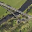
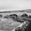
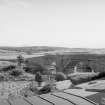
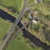
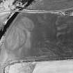
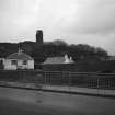
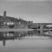
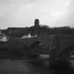
(Location cited as NX 087 823). Ballantrae Bridge, built 1770. A two-span bridge, with arch rings of dressed stone and rubble spandrels and wing walls. The arches are segmental, and there are triangular cutwaters extending upwards to form refuges. In the south abutment is a small segmental arch at a higher level, probably for a mill lade. At the north end is a single-storey cottage, probably a tollhouse [NX08SE 60].
J R Hume 1976.
Ballantrae Bridge, now by-passed, is for pedestrians only. Stone built in 1770, it has two main arches with ashlar voussoirs, a central pier and buttress.
Visited by OS (JRL), 4 March 1977.
This bridge carries the former line of the A77 (T) public road across the River Strinchar a short distance above its mouth, and to the S of Ballantrae village (NX08SE 21). The (present and successor) New Bridge (NX08SE 68) is situated adjacent and downstream (to the W).
The location assigned to this record denotes the apparent midpoint of the structure. The available map evidence indicates that it extends from NX c. 08664 82325 to NX c. 08674 82280.
Information from RCAHMS (RJCM), 26 June 2006.
Photographic Survey (1900 - 1930)
Photographs by A Brown & Co of sites across Scotland c1900-1930


