Pricing Change
New pricing for orders of material from this site will come into place shortly. Charges for supply of digital images, digitisation on demand, prints and licensing will be altered.
Eyemouth Harbour
Harbour (Post Medieval)
Site Name Eyemouth Harbour
Classification Harbour (Post Medieval)
Alternative Name(s) Harbour Road; Eye Water; Marine Parade
Canmore ID 60269
Site Number NT96SW 76
NGR NT 94660 64319
Datum OSGB36 - NGR
Permalink http://canmore.org.uk/site/60269
- Council Scottish Borders, The
- Parish Eyemouth
- Former Region Borders
- Former District Berwickshire
- Former County Berwickshire
NT96SW 76.00 9460 6460 to 9454 6411
NT96SW 76.01 NT 9459 6459 to NT 9463 6445 West Pier [also known as South Pier]
NT96SW 76.02 NT 9460 6462 to NT 9463 6456 East Pier [also known as North Pier]
NT96SW 76.03 NT 9468 6456 Lifeboat Station
NT96SW 76.04 NT 94673 64312 to NT 94530 64093 New Quay
NT96SW 76.05 NT 9468 6430 Footbridge
NT96SW 76.06 Cancelled: see NT96SW 380.00.
NT96SW 76.07 NT 94649 64411 Harbour Offices
NT96SW 76.08 NT 9452 6411 Sluice
NT96SW 76.09 NT c. 947 642 Fish preparation sheds
NT96SW 76.10 NT 9463 6442 Stores
NT96SW 76.11 Cancelled: see NT96SW 380.02.
NT96SW 76.12 NT c. 94554 64558 West Pier ('South Breakwater'), Beacon
NT96SW 76.12 NT c. 94593 64655 East Pier ('North Breakwater'), Beacon
See also:
NT96SW 380.00 Centred NT 94519 64036 Eyemouth Boatyard (Eyemouth Boat Building Co)
NT96SW 380.01 NT 94524 64023 Eyemouth Boatyard, Office
NT96SW 380.02 NT 94489 64009 Eyemouth Boatyard, Offices (Brown's Bank)
NT96SW 380.03 NT 94531 64062 and NT 94545 64052 Eyemouth Boatyard, Slipways
NT96SW 380.04 NT 94477 64067 Eyemouth Boatyard, Storehouse (Harbour Road)
NT96SW 380.05 NT 94479 64032 Footbridge
For (associated defensive) King's Mount (NT 94320 64851), see NT96SW 1.
For warehouses at NT 9461 6440, see NT96SW 134.
For Harbour Road premises of Royal National Mission to Deep Sea Fishermen (NT96SW 138), see NT96SW 138.
For gear stire at NT c. 945 642, see NT96SW 140.
For (new) fish market (NT 94723 64548), see NT96SW 449.
For general account of the Eyemouth fishing disaster (1881), see D McIver 1906.
Harbour [NAT] (centred NT 9462 6423)
OS 1:10,000 map, 1985.
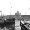
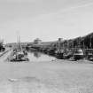
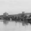
(Location cited as NT 945 645). Eyemouth, Berwickshire. This harbour has been formed in the mouth of the Eye Water, a straight tidal reach opening into a bay which has itself been partially protected, except from the N and NE, by projecting rocky horns. The W side of the harbour, on the left bank of the estuary, consists of a quay with houses behind it, but the E side is flanked by a pier, between which and the right bank a channel has been left for the river. Craft in the harbour are thus unaffected by the stream, which may, however, be let in through a sluice (NT96SW 76.08) if necessary, to clear out sand and mud. Owing to the natural shelter that the river-mouth provides, shipping may well have resorted to the place at any period in the past, and Eyemouth's old standing as a port is attested by the mention of anchorage dues collected as early as 1288, but neither this record, nor one of 1597, when the town was made a burgh of barony (NT96NW 108) with a free port, nor its inclusion, in 1602, in a list of 'portis and harboreis quhair his Hienes hes na customeris', necessarily proves the existence of harbour-works at any of these dates. In 1703, however, Adair writes of 'some little Keys up along the Shoar', ie. presumably somewhere on the left bank, and adds that 'they are about to build a strong Peir of Stone out from the Shoar on the East side'. In 1748, however, the place was still only a small harbour, good for fishing boats, and the plan for a stone pier does not seem to have put into practice until 1768, when on the advice of John Smeaton, the existing N pier (NT96SW 76.02) was built on the right bank, the contractor being Cramond of Dunbar. Meanwhile a pier had been built on the left bank, shortly before 1750, although whether extending or replacing Adair's 'little Keys' does not appear; in 1847 the face of this work was giving way and was noted as due for repair. The wall or quay that protected the harbour from spates in the river-channel was pulled down and rebuilt, and a sluice was formed at its head in 1843. The quarrying required for the construction of Smeaton's pier led to some enlargement of the harbour, and a maximum depth of 20ft [6.1m] was obtained.
The harbour has been improved so thoroughly in the interests of the herring fishery, and most recently in 1965, that few remains of earlier construction survive. The S face of the N pier [NT96SW 76.02], however, overlooking the lifeboat slip [NT96SW 76.03], exemplifies two points in Smeaton's report, ie. the stone used is a conglomerate obtainable at the NW end of the bay, and the foundations are set on a ledge quarried from rocks conveniently sited by nature. Some of the blocks are very large, two of the largest measuring 6ft 6ins [2m] by 3ft 9ins [1.1m] and 7ft [2.1m] by 2ft 9ins [0.8m] respectively. The outer (N) face of this pier made of similar material, but here the blocks are set diagonally. The parapet is 5ft 6ins [1.7m] high, and its base is defined by a string-course. The rest of the pier is concrete, and so is the pier [NT96SW 76.01] on the W side of the entrance; the S face of this latter shows some conglomerate blocks, but they are smaller than those on the E and need not be contemporary.
A Graham 1971.
(Location cited as NT 947 642). Eyemouth Harbour, formed 1768 by John Smeaton, engineer, and rebuilt several times, most substantially in 1885-7 by engineers Thomas Meik and Son. The harbour is basically the quayed mouth of the Eye [Water], protected by two piers. At the inner end, there are sluices to allow scouring of the basin to take place. The 1887 works are concrete, but earlier masonry can be seen in various places.
J R Hume 1976.
Construction (1747)
Old Pier constructed by William Crow.
Photographic Survey (June 1961)
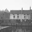
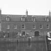
Photographic survey of buildings in Eyemouth, Berwickshire, by the Scottish National Buildings Record in June 1961.
Publication Account (1985)
The simplest kind of harbour was a quay lining a river mouth or inlet. Such was Leith in its earlier days, and Cramond. Eyemouth, a harbour since the 12th century, follows this same pattern with the subsequent addition of two projecting piers. In the mid 18th century, Eyemouth was "simply a sea tavern conveniently placed on an otherwise hostile shore to offer succour in the age of sail to vessels foiled by adverse winds".
Change, however, was imminent-triggered by John Smeaton, one of Scotland's engineering giants who had worked on canals and road bridges. The harbour was first built in 1768-70, Smeaton's breakwater being designed to enable ships to lie there even with a rare north or north-east wind-to which it was exposed. Between 1770 and 1841 the harbour was further improved, and it was rebuilt most substantially in 1885-87.Sluices at the inner end allowed the basin to be scoured.
White fisheries had developed around 1750, herring fisheries expanded in the 19th century and so did a coastal trade in corn. As trade increased, more wharves were built; also impressive stone warehouses and granaries, some of them four storeys high (NT 946643). And a rather different trade, in dead bodies, caused a watch-tower to be built in the churchyard! The village too, grew-huddles of houses clustered in the streets at the head of the bay, backing on to the quays; across the river, the prosperous Gunsgreen House.
On the western promontory of the bay are the remains of a series of fortifications from prehistoric times to the 20th century, occasioned by the good sheltered anchorage. An English fort, said to have been erected by the Protector Somerset, dates to 1547; French defences date to 1557 after the removal of the 60-strong English garrison in 1550. The French withdrew
in 1559.
Information from 'Exploring Scotland's Heritage: Lothian and Borders', (1985).
Project (2007)
This project was undertaken to input site information listed in 'Civil engineering heritage: Scotland - Lowlands and Borders' by R Paxton and J Shipway, 2007.
Publication Account (2007)
Early records show proposals for a harbour at the entrance to the Eye Water at Eyemouth as early as 1660. Silting was a problem and in 1747 what is now known as the Old Pier was constructed by William Crow to channel the river.
This effected an improvement but the harbour was badly damaged by the sea in 1767 and further damaged by a severe flood in 1794. John Smeaton made recommendations for the building of a North Pier, which was begun in 1769 and completed in 1773 to his design as shown. This gave a measure of protection for the harbour entrance. Inclined masonry courses, which Smeaton considered better for resisting wave action than the customary horizontal ones, were used in constructing the pier, some of which can still be seen.
In 1882, after the fishing fleet disaster of 1881, new plans were prepared which were carried out in 1885–87. The harbour was extended to 9.5 acres and deepened by 2 ft. The middle pier was constructed and rock cutting on the Gunsgreen side improved the river course. In 1892–93 the harbour was deepened by a further 3 ft.Eyemouth was nearest to the most abundant of the white fishing grounds and over the years the harbour became known as ‘The Hope of the Town’. In the 20th century further improvements were carried out and in 1995 the harbour was still being improved and developed.
R Paxton and J Shipway 2007
Reproduced from 'Civil Engineering heritage: Scotland - Lowlands and Borders' with kind permission of Thomas Telford Publishers.
Sbc Note (15 April 2016)
Visibility: Standing structure or monument.
Information from Scottish Borders Council


