
Pricing Change
New pricing for orders of material from this site will come into place shortly. Charges for supply of digital images, digitisation on demand, prints and licensing will be altered.
Dremergid


Burnt Mound (Prehistoric)
Site Name Dremergid
Classification Burnt Mound (Prehistoric)
Canmore ID 5874
Site Number NC70NW 36
NGR NC 7394 0642
Datum OSGB36 - NGR
Permalink http://canmore.org.uk/site/5874


- Council Highland
- Parish Rogart
- Former Region Highland
- Former District Sutherland
- Former County Sutherland
Field Visit (9 April 1981)
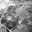
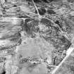
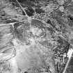
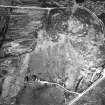
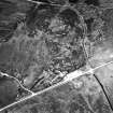
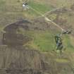
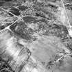
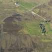
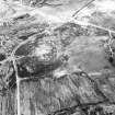
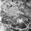
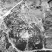
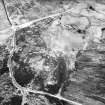
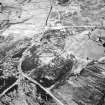
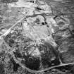
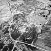
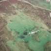
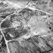
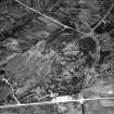
At NC 7394 0642, on the margin of damp ground and adjacent to hut circles and field system (NC70NW 18) is a U-shaped burnt mound 9.5m across the open end by 6.5m transversely and 1.0m high. Erosion of the peat-cover reveals friable and reddened fragments of stone.
Surveyed at 1:10,000.
Visited by OS (J M) 9 April 1981.
Field Visit (7 March 1995)
NC70NW 36 7394 0642.
This C-shaped burnt mound lies at the edge of a field-system (NC 70NW 18), and measures 11m from ESE to WNW by 6.8m transversely and 1m in height, opening out on the SSE. The W side merges with the drier ground and may have been ploughed across. Rabbit burrows reveal black soil, cracked stone and fragments of charcoal.
(ROG95 1)
Visited by RCAHMS (DCC) 7 March 1995

