Pricing Change
New pricing for orders of material from this site will come into place shortly. Charges for supply of digital images, digitisation on demand, prints and licensing will be altered.
Upcoming Maintenance
Please be advised that this website will undergo scheduled maintenance on the following dates:
Thursday, 9 January: 11:00 AM - 3:00 PM
Thursday, 23 January: 11:00 AM - 3:00 PM
Thursday, 30 January: 11:00 AM - 3:00 PM
During these times, some functionality such as image purchasing may be temporarily unavailable. We apologise for any inconvenience this may cause.
Dremergid
Burnt Mound (Prehistoric)
Site Name Dremergid
Classification Burnt Mound (Prehistoric)
Canmore ID 5873
Site Number NC70NW 35
NGR NC 7389 0656
Datum OSGB36 - NGR
Permalink http://canmore.org.uk/site/5873
- Council Highland
- Parish Rogart
- Former Region Highland
- Former District Sutherland
- Former County Sutherland
Field Visit (9 April 1981)
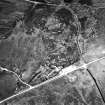
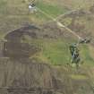
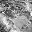
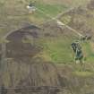
At NC 7388 0655, on the edge of damp ground by a settlement of hut circles (NC70NW 18), is a kidney-shaped burnt mound, 9.5 by 6.5m across and 0.8m high. Probing through the heather and peat-cover reveals friable and reddened fragments of stone.
Surveyed at 1:10 000.
Visited by OS (J M) 9 April 1981.
Field Visit (7 March 1995)
NC70NW 35 7389 0656
This C-shaped burnt mound is situated beside a boggy sump within a field-system (NC 70NW 18), and measures 9.5m from WSW to ESE by 6.1m transversely and 0.7m in height, opening out to the SSE. An edge-set boulder on the S side of the hollow in the mound may have formed part of a trough. Lifting a sod revealed densely packed cracked stone set in a matrix of black soil.
(ROG95 2)
Visited by RCAHMS (DCC) 7 March 1995


