|
Photographs and Off-line Digital Images |
C 92140 PO/CN |
John Dent |
|
1992 |
Item Level |
|
|
Photographs and Off-line Digital Images |
C 92137 PO/CN |
John Dent |
Oblique aerial view |
1992 |
Item Level |
|
|
Photographs and Off-line Digital Images |
C 92141 PO/CN |
John Dent |
|
1992 |
Item Level |
|
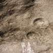 |
On-line Digital Images |
SC 1939003 |
John Dent |
Oblique aerial view |
1992 |
Item Level |
|
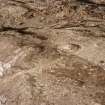 |
On-line Digital Images |
SC 1939004 |
John Dent |
|
1992 |
Item Level |
|
 |
On-line Digital Images |
SC 1939005 |
John Dent |
|
1992 |
Item Level |
|
|
Digital Files (Non-image) |
TM 000541 |
Records of the Royal Commission on the Ancient and Historical Monuments of Scotland (RCAHMS), Edinbu |
Zip file containing all survey linework data recorded during the RCAHMS Afforestable Land Survey of Kale Water 1999 |
1999 |
Item Level |
|
 |
On-line Digital Images |
SC 2454173 |
Records of the Ordnance Survey, Southampton, Hampshire, England |
Blackhall Hill, NT71SE 17, Ordnance Survey index card, Recto |
c. 1958 |
Item Level |
|
 |
On-line Digital Images |
SC 2454174 |
Records of the Ordnance Survey, Southampton, Hampshire, England |
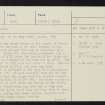
Blackhall Hill, NT71SE 17, Ordnance Survey index card, page number 1, Recto |
c. 1958 |
Item Level |
|
 |
On-line Digital Images |
SC 2454175 |
Records of the Ordnance Survey, Southampton, Hampshire, England |
Blackhall Hill, NT71SE 17, Ordnance Survey index card, page number 2, Verso |
c. 1958 |
Item Level |
|
|
All Other |
551 166/1/1 |
Records of the Ordnance Survey, Southampton, Hampshire, England |
Archaeological site card index ('495' cards) |
1947 |
Sub-Group Level |
|


