Woden Law
Fort (Prehistoric), Linear Earthwork(S) (Prehistoric)
Site Name Woden Law
Classification Fort (Prehistoric), Linear Earthwork(S) (Prehistoric)
Alternative Name(s) Woden Law, 'siege Works'
Canmore ID 58068
Site Number NT71SE 15
NGR NT 76777 12547
Datum OSGB36 - NGR
Permalink http://canmore.org.uk/site/58068
First 100 images shown. See the Collections panel (below) for a link to all digital images.
- Council Scottish Borders, The
- Parish Hownam
- Former Region Borders
- Former District Roxburgh
- Former County Roxburghshire
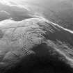
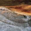
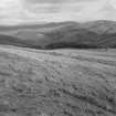
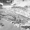
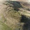
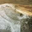
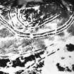
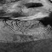
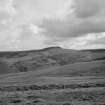
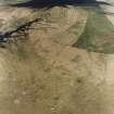
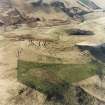
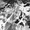
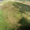
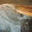
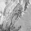
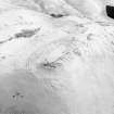
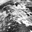
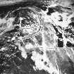
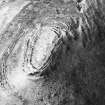
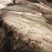
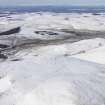
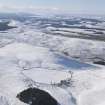
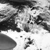
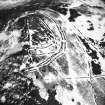
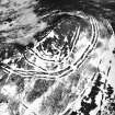
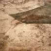
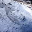
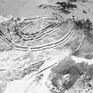
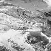
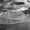
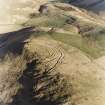
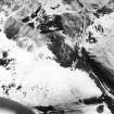
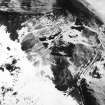
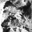
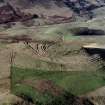
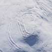
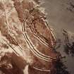
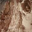
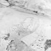
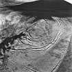
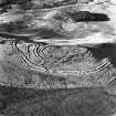
The ramparts that enclose the summit of Woden Law belong to at least three phases of construction, and the innermost rampart surrounds the remains of a number of timber round-houses. Linear earthworks on the lower slopes of the hill probably formed parts of Iron Age field-systems, which were in use sometime during the occupation of the fort. Further evidence for prehistoric farming on the flank of the hill is provided by extensive swathes of cord rig (narrow cultivation ridges), some of which overlie the banks of the field-system.
Information from RCAHMS (SC) 25 July 2007
Ritchie, A and Ritchie, G 1998
NT71SE 15 768 125.
(Centred NT 7677 1251) Fort (NR)
Roman Training Siegeworks (R)
OS 6" map, (1962).
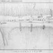
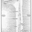
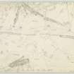
On top of Woden Law there is a notable group of remains comprising (i) a native fort with multiple ramparts (I - III, see RCAHMS 1956 plan, fig.197); (ii) earthworks T, W. X, Y and Z, identified as Roman siege- works, and in view of the small size of the fort and other reasons, considered to have been built and used for practice rather than actual siege operations; and (iii) a small enclosure, Q (described on NT71SE 48).
A section cut across the defences of the fort (noted as a settlement by Feachem) in 1950 revealed three structural periods. It was originally defended (barring a palisade) by a wall (I on plan) enclosing an oval area meauring about 400' N-S by 140'. This is analogous with the earliest stone defences at Hownam Rings (NT71NE 1) which were obsolete in the late 1st century AD. Ramparts IIA and IIB, with a medial rock-cut ditch, which were deliberately destroyed soon after their construction, also paralleled at Hownam Rings, were probably erected immediately before the Agricolan invasion of Scotland.
The fort was abandoned during the Roman occupation of Scotland, until, in the 3rd century AD or thereby, the place was re-fortified by wall III, the innermost structure on the hill; within it are slight traces of four probable huts. The fort is everywhere enclosed, except on the steep W slope and the steepest part of the N slope, by earthwork 'Z', consisting of two banks between three ditches. This, in turn, is enveloped by outer lines, made up of three independent works, sometimes double and sometimes single, of which 'Y' runs across the S, and 'W' and 'X' across the E face of the hill. 'Y' is over-ridden by 'X'. All these works are incomplete, and show signs of having been erected in short stretches, Sections were cut by the RCAHMS, who gave a full description.
Traverse 'T' comprises a ditch of lunate plan enfolding an almost circular mound, which closely resembles the well-known traverses in the N front of the S Roman siege-camp at Birrenswark.
RCAHMS 1956, visited 1952; R W Feachem 1965.
Fort, etc, as described above.
Visited by OS (WDJ) 13 September 1960.
Woden Law and its associated works are as described by RCAHMS except that the outer annex IID appears to be unfinished. This is evident from the generally ragged and insubstantial nature of the enclosing bank and ditch together with the fact that it stops short of the Roman siegeworks on the S.
Visited by OS (BS) 16 September 1976.
Field Visit (13 September 1960)
Fort, etc, as described by RCAHMS.
Visited by OS (WDJ) 13 September 1960.
Field Visit (16 September 1976)
Woden Law and its associated works are as described by RCAHMS except that the outer annex IID appears to be unfinished. This is evident from the generally ragged and insubstantial nature of the enclosing bank and ditch together with the fact that it stops short of the Roman siegeworks on the S.
Visited by OS (BS) 16 September 1976.
Publication Account (1985)
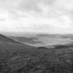
The climb of Wo den Law (423m) is well worthwhile. The line of the Roman Road is quite well preserved alongside the gully rising from Tow Ford, but is even more distinct further east, towards Hunthall Hill- a linear mound some 8.2m wide and 1.2m high. It is but a short stretch to the Border, to the signal station on Brownhart Law (NT 79009G) and to camps at Chew Green (NT 7808-7908). A major highway throughout the later medieval period, and equally in pre-Roman times, to the Romans it was their crucial link between York and the Firth of Forth, crucial to their conquest of Scotland. Though the road fell into disrepair after Agricola's withdrawal cAD 100, it was reconstructed during the Antonine reoccupation in the 2nd century and played an important part in the 3rd century Severan Campaign.
Equally vital was control of Wo den Law, strategically situated just north of the watershed. Originally it was a native British fort, built in three stages (see section 8) a settlement surrounded by a single, oval stone dyke, to which was then added a double rampart and intervening ditch. Both ramparts were demolished quite soon after completion, probably as a result of Roman road-building and occupation, and the site was only reoccupied by native peoples after the Romans left. Then the innermost rubble dyke on the top of the hill was built and faced with boulders.
The Romans, however, seem to have used Woden Law for siege practice (if the so-called siegeworks are not simply part of the native defences). They dug a remarkable earthwork of two banks between three ditches at 12m-30m from the fort's defences: in other words, mostly beyond the killing-range for hand-thrown missiles. Several flattened platforms on the outer bank seem to have provided sites for siegeengines, protected by the inner bank and ditch, whilst beyond the main siegework, three further independent lines of earthworks were built in the customary Roman manner of short, separate sections. These are all incomplete.
A further feature, the series of five cross-dykes spanning the easy ridge between Woden Law and Hunthall Hill, is pre-Roman however, and part of the native British defence system. Such cross-dykes are not uncommon in relation to hillforts in the Cheviotsi here they guard access from the main Cheviot ridge and emphasise the importance of the site and the route.
Information from 'Exploring Scotland's Heritage: Lothian and Borders', (1985).
Field Visit (16 November 1999)
NT71SE 15
Fort
Woden Law
NT 768 125
This site was recorded as part of the Kale Water Survey project and is largely as described previously on the date of visit.
The defences of the fort crowning the summit of Woden Law are previously depicted in the Roxburgh Inventory (RCAHMS, 1956, p. 169, no. 308). Within the interior, however, there are traces of numerous timber round-houses and stone-walled hut-circles disposed along the crest of the hill on the NW side of the fort; to the E and S of the ramparts lie extensive remains of cord rig cultivation.
At the SW end of the fort, is a ring-ditch house (NT 76751 12513) measuring 10.2m in diameter over a shallow ditch 1.2m in breadth. Immediately to the N lies a slightly smaller ring-ditch house (NT 76754 12527) which measures 8.5m in diameter over a shallow ditch 1.1m in breadth with a causeway on the S. About 10m to the E of these two houses, there is a circular platform (NT 76768 12521) 6m in diameter, which has been terraced into the slope on the NW up to a depth of 0.4m and possibly indicates the position of another round-house; what may be another platform lies immediately to the N of it. A little to the W of the centre of the interior there is a ring-groove house (NT 76764 12544) which measures 11.5m in diameter over a shallow groove up to 0.5m in breadth. A low internal bank can be traced within the N and S arcs of the groove and there is an entrance on the ESE. On the N, this house overlies a smaller ring-ditch house (NT 76766 12555), which measures 8m in diameter over a ditch up to 1.3m in breadth. A small stone-walled hut-circle (NT 76771 12566) lies immediately to the NNE and measures 4.7m in diameter within a low stony bank 1m in thickness. This hut-circle, which has its entrance on the S, overlies another possible ring-ditch house (NT 76776 12572) on the NE, which measures 7.2m in diameter over a shallow ditch up to 2m in breadth. Situated at the NE end of the interior there is another ring-groove house (NT 76792 12585) which measures 11.9m in diameter over a low bank with an outer groove between 0.5m and 1m in breadth; here there is also a low internal bank accompanying the groove and the entrance is on the ENE. The second stone-walled hut-circle (NT 76786 12598) abuts the inner rampart to the NNW of this ring-groove house; it measures 4m in diameter within a bank 2m in width and 0.3m in height and there is an entrance on the SW.
Abutting the outer edge of the outer earthworks (RCAHMS, 1956, p169 , fig 197 ‘Z’) and extending SW for about 400m lies a plot of cord rig covering an area of at least 2ha (see NT71SE 51, NT71SE 53).
(Kale99 129-36, 141)
Visited by RCAHMS (MFTR) 16 November 1999
Note (8 September 2015 - 19 October 2016)
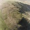
The summit of Woden law is crowned by a complex of earthworks, at the core of which is a large Iron Age fort. Oval on plan, it measures about 120m from NNE to SSW by 45m transversely (0.45ha) within a belt of up to four ramparts some 25m deep along the E flank and around the ends. This belt of defences, however, is composite, and the innermost rampart is clearly the latest, with entrances reusing earlier gaps on the NNE and SW, but blocking the earlier entrance in the middle of the ESE side. Its entrance in this side is a little further south, approached obliquely through gaps cut through the outer ramparts to expose the visitor's left side; RCAHMS investigators in 1952 identified by probing that the medial ditch of the outermost ramparts was continuous across this gap. Excavation by Ian Richmond and J K St Joseph in 1950 showed that the innermost rampart is stone-faced, about 2.7m in thickness, with a shallow quarry scoop to its rear, and overlay deposits in the quarry behind the rampart immediately in front. This latter, in accordance with the interpretation of Mrs C M Piggott's work at Hownam Rings (Atlas no.3401), was considered the perimeter of a free-standing enclosure, taking in a rather larger area of about 0.59ha, to which the two outer ramparts flanking a medial ditch had subsequently been added (RCAHMS 1956, 169-72, no.308; Richmond and St Joseph 1982, 278-9, fig 2). While these two outer ramparts may be an addition, perhaps reflected in the deflection of their lines at the entrance on the ESE, it is as well not to impose the supposed sequence found at Hownam Rings elsewhere, and the divergence of their circuit on the SSW at Woden Law could as easily indicate that this was a yet earlier enclosure. At each stage in the evolution of the defences, there were probably three entrances, the roadways through the three outer ramparts on the NNE and ESE approaching obliquely to expose the visitors left side. This is particularly noticeable at the ESE entrance, where the terminals of the inner of the earlier ramparts, the second rampart of the four visible on this side, are offset to either side of the gap. Likewise, one of the terminals of this rampart at the SSW entrance appears to turn inwards, though in this case to expose the visitor's right side. In addition to what may be a single stone-founded round-house adjacent to the innermost rampart on the W, there are traces of numerous large timber round-houses throughout the interior, though these do not appear on any plan.
The relationship of the complex of earthworks outside the fort to the defensive sequence is not understood. At the SSW end they include elements that have been described as annexes, occupying the space between the fort and an outer belt of banks and ditches that appears to invest the southern and eastern flanks of the defences. The inner of the supposed annexes forms an enclosure against the defences, but plainly overlies the outermost rampart and ditch of the fort, while the outer seals off the gap between the defences and the outer belt. In 1950, these latter, and further earthworks to the S and E, were postulated to be the remains of Roman siegeworks. On the E the main belt comprises three ditches with intermediate banks, but close examination shows that at the southern end it is made up of three separate banks and ditches, the inner of which blocks an entrance in the middle one. Sections by Richmond and St Joseph (1982) revealed evidence of turf-work in their construction and re-cutting of the ditches, but was unable to demonstrate their date. While Roman activity may have taken place here, these earthworks may have other explanations more directly associated with the use of the fort (Halliday 1982, 80-3).
Information from An Atlas of Hillforts of Great Britain and Ireland – 19 October 2016. Atlas of Hillforts SC3408
Aerial Photography (2019)
NT 753 136 Pennymuir Temporary Camps, NT 765 123 Woden Law fort, NT 769 118 Dere Street Roman road and earlier cross-ridge earthworks.
A preliminary photographic trial using a drone camera was carried out over the Roman camps which flank Dere Street (Canmore ID: 83741). Camps A, B and D responded well where the earthworks were unploughed, while an Infra-red filter revealed parts of the perimeter of Camp C where cultivation had removed all surface traces.
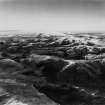
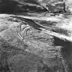
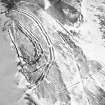
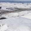
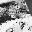
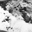
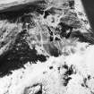
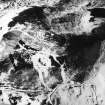
Woden Law fort (Canmore ID: 58068) was subjected to vertical photographic scan and 3D modelling; these picked out the ramparts very clearly, as well as some of the extensive cord-rig that covers the slopes immediately below the outermost ‘Roman’ earthworks on the east side.
The Roman road, Dere Street was photographed where it crosses a narrow neck of ground south-east of the fort between Whitehope Cleuch and Twisehope Cleuch; the scan revealed its embankment over five earlier cross-ridge dykes (Canmore ID: 58075, 58105) and tell-tale quarry pits where the road to the south is terraced into the hillside. Part of a nearby palisaded homestead (Canmore ID: 58109) was also included in the survey.
Archive: NRHE (intended); 3D modelling at https://sketchfab.com/3d-models/wodens-law-hill-fort-3b241068ffe0463dad356942d5801711;
Funder: Private individuals
Tony Hunt and John Dent
(Source: DES Vol 20)
Sbc Note
Visibility: This is an upstanding earthwork or monument.
Information from Scottish Borders Council


