Pricing Change
New pricing for orders of material from this site will come into place shortly. Charges for supply of digital images, digitisation on demand, prints and licensing will be altered.
Rosal
Burnt Mound (Prehistoric), Head Dyke (Post Medieval), Township (Period Unassigned)
Site Name Rosal
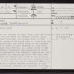
Classification Burnt Mound (Prehistoric), Head Dyke (Post Medieval), Township (Period Unassigned)
Alternative Name(s) Naver Forest; Strathnaver
Canmore ID 5682
Site Number NC64SE 12
NGR NC 6891 4163
NGR Description Centred NC 6891 4163
Datum OSGB36 - NGR
Permalink http://canmore.org.uk/site/5682
- Council Highland
- Parish Farr
- Former Region Highland
- Former District Sutherland
- Former County Sutherland
NC64SE 12 689 416
See also NC64SE 28 and NC64SE 63.
(NC 689 416) Rosal (NAT)
OS 6" map, (1961)
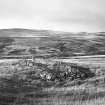
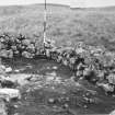
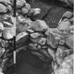
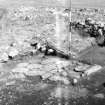
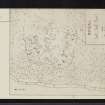
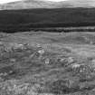
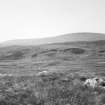
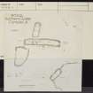
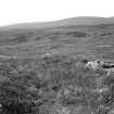
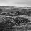
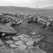
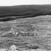
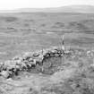
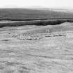
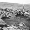
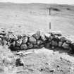
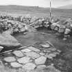
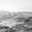
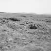
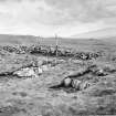
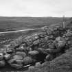
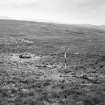
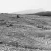
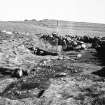
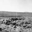
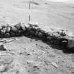
The remains of the township of Rosal whose lands are first on record in 1269 and which was cleared 1814-18, since when it remained relatively undisturbed until in 1962 excavation and survey by Fairhurst made it a type-site for clearance depopulation. The arable lands of the township extended over 60 acres and were enclosed by a dry-stone dyke, the plough rigs surviving as a green island in the rough moor. Seventy structures were recognised of which 15 to 18 were long-houses, the remainder being barns, outhouses, stackyards and corn-drying kilns. The barns were rectangular with one rounded end. A few of the buildings had bowed walls and rounded ends and it is suggested that these may be earlier than the others. Selective excavation was undertaken on a typical complex consisting of long-house, barn, stackyard, outhouse and corn-kiln. The long-house was built on a slope with first, a small room at the upper end, then the main living quarters around a central hearth and finally the long byre giving an overall length of 85ft, though other long-houses reached a length of 108ft. The walls consisted of dry-stone work up to a height of 2 or 3ft, presumably forming the base for a turf wall. The roof was supported on couples which rose from ground level. Efforts to locate Medieval house-sites proved fruitless presumably because the buildings were constructed without foundation trenches and were abandoned and the building stones re-used at relatively short intervals. Earlier occupation of the site is indicated by the Iron Age hut-circles and souterrain (NC64SE 28).
H Fairhurst 1969.
Rosal is as described by the previous authorities.
Visited by OS (J L D) 7 May 1960.
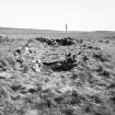
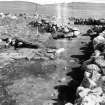
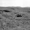
NC 6870 4178: Burnt Mound. This burnt mound is situated on the E side of a boggy gully within the ring-dyke of Rosal Township, some 60m ESE of the entrance to the Forestry Commission walk. It comprises two oval mounds set parallel to each other across the slope; merging with the natural slope to the SE and opening out to the NW. It measures 7.4m from NE to SW by 5.7m transversely and up to 0.6m in height. Exposures in both arms revealed cracked stone set in a matrix of black soil.
Visited by RCAHMS (DCC) 18 July 1991.
A township comprising nine unroofed buildings, one of which is T-shaped, one unroofed structure, which may be another building, and a ring dyke is depicted on the 1st edition of the OS 6-inch map (Sutherland 1878, sheet xliv). Thirty-nine unroofed buildings, what may be the remains of a two-compartment, long building, one enclosure and a ring dyke are shown on the current edition of the OS 1:10,000 map (1992).
Information from RCAHMS (SAH) 5 October 1995
Field Visit (7 May 1960)
Rosal is as described by the previous authorities.
Visited by OS (J L D) 7 May 1960.
Field Visit (18 July 1991)
NC 6870 4178: Burnt Mound. This burnt mound is situated on the E side of a boggy gully within the ring-dyke of Rosal Township, some 60m ESE of the entrance to the Forestry Commission walk. It comprises two oval mounds set parallel to each other across the slope; merging with the natural slope to the SE and opening out to the NW. It measures 7.4m from NE to SW by 5.7m transversely and up to 0.6m in height. Exposures in both arms revealed cracked stone set in a matrix of black soil.
Visited by RCAHMS (DCC) 18 July 1991.
Desk Based Assessment (5 October 1995)
A township comprising nine unroofed buildings, one of which is T-shaped, one unroofed structure, which may be another building, and a ring dyke is depicted on the 1st edition of the OS 6-inch map (Sutherland 1878, sheet xliv). Thirty-nine unroofed buildings, what may be the remains of a two-compartment, long building, one enclosure and a ring dyke are shown on the current edition of the OS 1:10,000 map (1992).
Information from RCAHMS (SAH) 5 October 1995
Publication Account (1995)
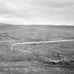
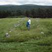
An example of the layout of an 18th-century farming township, from which the inhabitants were moved to coastal settlements in 1814-18. The site has been preserved by the Forestry Commission as a grassy island within the surrounding forest, and is laid out with wooden walkways over the wettest areas (gumboots still advisable) and explanatory noticeboards. The site was planned and a few buildings excavated in 1962.
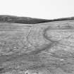
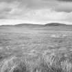
A few traces of prehistoric occupation were found, such as some hut circles (all outside the fenced area and now under trees) and a souterrain ssee chapter 10) near the centre, now filled in again though one or two of its lintels still show; there is a plan beside it. The remaining structures relate to the township and comprise the ruined stone walls of buildings,enclosure walls, clearance cairns and broad cultivation strips known as rigs in the ploughed 'infield'. The area now fenced is this infield of some 50 acres enclosed by a stone ring-dyke; the far larger area of common grazing outside this, where the all-important black cattle, sheep and goats were grazed in summer, is now under trees. Even within the enclosure wall only about two-thirds of the land had been ploughed. In Upper Strathnaver arable land was not continuous, and Rosal and the other contemporary settlements would have appeared as green patches in a wide expanse of brown moor.
The 1962 survey noted some twelve to fifteen exceptionally long buildings which were probably houses; this agrees well with a record of thirteen families living here in 1808. The buildings were scattered in clusters round the perimeter of the enclosure, the longhouses set on slopes with the byres at the downhill end ro assist drainage. The house excavated in 1962 had low stone walls less than 1m high, which would have been heightened in turf, and slots in the walls for the wooden crucks that supported the thatched roof. There was only one door at the junction of house and byre, and no partition between the two, a central hearth in the main room, and tne separate room with its own hearth divided off by a stone and mud partition. By the house was a separate barn with two opposed doors, a kail or stack yard, and another outbuilding. There were also several corn-drying kilns at Rosal, generally attached to barns; one has been moved and rebuilt at the carpark.
Strathnaver was cleared in 1814 and the inhabitants given new lots on the coast at Bettyhill and Farr, where they were expected to take up fishing. The agent Patrick Sellar was brought to trial on charges of brutality over their eviction, but acquitted on the evidence presented. Later accounts refer to wholesale burnings of houses in Strathnaver. The excavated buildings at Rosal were certainly not burnt; but it emerges that Rosal was part of a new sheep farm which Sellar leased himself, where he was able to leave the old ten ants of one half (including Rosal) in possession for an extra four years after 1814, so they were able to move out slowly to their new allotments.
Rosal with thirteen families was one of the largest settlements in Strathnaver, and only two were larger. Indeed of the 49 'settlements' listed in 1806 many were very small, eleven having only one or two families. It has been suggested that some of the small settlements were the result of people settling permanently on shieling grounds and starting to cultivate small patches. Such a population must have been particularly vullnerable in times of famine.
Information from ‘Exploring Scotland’s Heritage: The Highlands’, (1995).
Publication Account (2009)
The website text produced for Rosal webpages on the Forest Heritage Scotland website (www.forestheritagescotland.com).
Introduction: By fair means or foul
In a forestry clearing in upper Strathnaver lie the remains of Rosal township. Strathnaver was the scene of some of the most notorious events of the Highland Clearances.
In the early 19th century the Countess of Sutherland and her husband the Marquis of Stafford began a programme of 'improvements' to the Sutherland estates. This involved converting the great glens of the county into large sheep farms.
To achieve this they cleared out hundreds of small tenant farmers and resettled them in new villages on the coast. Here they were expected to learn new occupations such as fishing, cloth manufacture and brick-making. The tenants were rightly suspicious of their promised rosy new future, and were reluctant to move, but were given no choice.
In 1814 Patrick Sellar, an employee of the estate, obtained the lease of a sheep farm in Strathnaver, and began to clear the ground. He did so ruthlessly, sometimes burning houses to prevent tenants returning.
There were allegations that he caused the deaths of two old and sick tenants. In 1816 he was tried on charges of culpable homicide but was found not guilty, though history remembers his name as a symbol of a dark episode in Highland history.
People Story: Gloomy Memories
It is unknown whether they cleared Rosal in 1814. It may have survived until later less violent clearances in 1819.
Archaeological excavations of part of the township show no signs that the buildings burnt down. This may explain why a Donald MacLeod of Rosal was called to testify in support of Sellar at his trial.
Donald MacLeod may be the same person who later, in 1857, wrote letters for the Edinburgh Weekly Chronicle telling of his memories of life in Sutherland. He called them 'Gloomy Memories'.
Personal accounts, at the time, claim that Sellar did undertake at least one violent eviction at Rosal, although it appears not to have gone to court.
Sellar demanded the removal of several old women. The people of Rosal ignored this demand. John MacKay testified that the evictors came and set fire to the house with the women in it. Rescuers save the women but the house burnt down in half an hour.
'I have never seen such an object in my lifetime, and I hopes in God I shall never see such another'
John MacKay (year unknown), translated from Gaelic
Evidence Story: Excavations at Rosal: what do they tell us?
The excavation at Rosal is one of the few undertaken to investigate the remains of a rural township for this period of Scottish history.
In 1962, Horace Fairhurst of Glasgow University surveyed the remains of the township and identified over seventy buildings, including houses, barns, outhouses and corn-drying kilns.
Fairhurst then excavated a sample of these buildings, including a house of a type known today as a byre-dwelling.
The byre dwelling was a long rectangular building, 26 metres long in total, built on a slope.
There were two rooms for the family living there to use; the main room had a central fire where the family would gather. At the lower end of the building there was the byre where the animals would stay. Their closeness to the family would have provided extra heat for the house.
Historical records mention Rosal as early as 1269. The excavations, however, only found remains for houses dating to around the 18th century. It did not discover evidence of any medieval houses. This could be because they built the later houses on the site of the old houses and re-used the same building materials.
Measured Survey (February 2014 - March 2014)
NC 6890 4160 A programme of archaeological work consisting of a comprehensive site inspection and detailed measured survey were undertaken in February–March 2014 to provide a baseline record of the surviving structural features at Rosal township.
The survey works recorded the remains of 15 dwellings (of which 13 were longhouses), 23 ancillary structures (of which at least 6 were barns – indicated by their opposing entrances used for winnowing) 4 corn kilns, 3 pit-like features (sited on knolls), eleven enclosures and 2 stone (circle) settings, as well as numerous clearance cairns and sections of turf/stone banks and walling.
A supporting high resolution aerial laser scan survey (ALS or LiDAR) was also commissioned by FCS (and undertaken by Bluesky International). The low earthworks of the longhouses, barns, corn-drying kilns, enclosures and field systems are all captured within the extensive surface model. Approximately 1km² was flown at a very high resolution (averaging 16 points per metre) as a bespoke archaeological survey. The resulting
terrain model records the nature and extent of the associated rig and furrow field systems. The terrain model has been used to generate images for onsite interpretation.
Archive: RCAHMS. Report: Forestry Commission Scotland and Highland HER
Funder: Forestry Commission Scotland
Matt Ritchie, Rebecca Shaw, Ben Edwards and Andrew Wilson – Forestry Commission Scotland and Rebecca Shaw Archaeological Services
(Source: DES)


