Branxholme Castle
Barmkin (16th Century), Castle (16th Century)
Site Name Branxholme Castle
Classification Barmkin (16th Century), Castle (16th Century)
Alternative Name(s) Branxholm; Twentyfoot Tower
Canmore ID 54145
Site Number NT41SE 13
NGR NT 46443 11667
Datum OSGB36 - NGR
Permalink http://canmore.org.uk/site/54145
- Council Scottish Borders, The
- Parish Hawick
- Former Region Borders
- Former District Roxburgh
- Former County Roxburghshire
Architect: William Burn 1837 - Alterations and additions
Reference from Architecture Catalogue Slip: 'SNBR William Burn dated 1837 (from RIBA London): 3 sheets plans
2 sheets elevation & sections
1 sheet elevation
REFERENCE - Scottish Record Office
19th Century perspective elevation. RHP 9714/26
Construction (March 1571 - October 1576)
Reconstituted after demolition in 1570 with buildings on north and south side of a courtyard. The dates are recorded in an inscription above the doorway.
Modification (1790 - 1837)
Unspecified additions carried out over an unspecified period.
Photographic Survey (1956)
Photographic survey by the Scottish National Buildings Record in 1956.
Desk Based Assessment
NT41SE 13 4643 1164 and 4643 1167.
(NT 46443 11667) Branxholme Castle (NR) (Ruins)
(NT 46439 11687) Tentyfoot Tower (NR)
OS 6" map (1923)
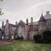
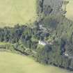
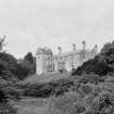
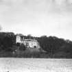
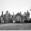
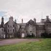
Branxholme Castle. In 1570 the Earl of Sussex razed "Braunsawe.....the Laird of Buckloughes house" (J Bain 1887), with the aid of gunpowder. The present structure, which stands on the high left bank of the River Teviot 3 miles SW. of Hawick, represents a restoration begun in the following year which, as one of the inscriptions given below records, took some five and a half years to complete. Whether any part of the older structure survived to be incorporated in the later one is now uncertain, for this in its turn has been rebuilt to a considerable extent and greatly enlarged by modern additions.
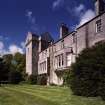
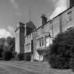
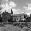
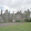
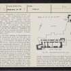
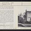
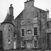
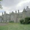
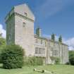
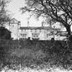
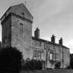
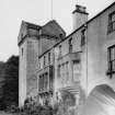
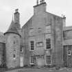
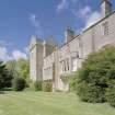
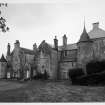
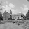
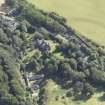
As it stood in 1544, Branxholme consisted of a tower and barmkin (R B Armstrong 1883); but as reconstituted after the demolition the buildings stood on the N and S sides of an open courtyard, the two other sides of which were simply screen-walls. The parallelogram thus enclosed measured about 60 ft. from N. to S. by 80 ft. from E. to W. Of this arrangement there survives, on the S, the main building - or "Hal" as it is described in the contemporary inscription - a long rectangular three-storeyed range. This is Z-shaped on plan, having two rectangular towers projecting from opposite corners.
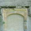
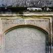
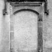
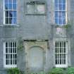
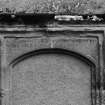
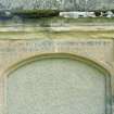
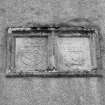
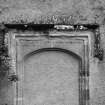
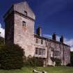
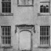
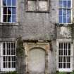
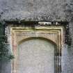
The SW tower, which is locally called "Nebsie", contains three storeys and an attic while the NE one, which is now obscured by additions and appears to have been considerably rebuilt, contains the main staircase. The stair, although not itself earlier than the 18th century, replaces an original one which occupied this same position. The whole N. side of the main building as well as the greater part of both ends is obscured by additions dating from 1790 and later; but the S side which faces the river and three walls of the SW tower are unencumbered, this tower being the part least affected externally by alteration. The masonry of the tower is of whin rubble covered with the old harling. On the lowest floor each of its outer walls contained a gun-loop, but only those to S and E can be traced today and both of them have been built up. The original windows of the upper floors have quirked edge-roll on their jambs and lintels, one having also a cavetto-shaped outer member. Of these, four have been built up while one has been enlarged by the lowering of the sill. Of the three modern windows that have been inserted, only two remain open. At the attic-floor level the superstructure of the tower is advanced on a corbel-course, in which double members alternate with single ones; while its capping shows indications of having once been ornamented with projecting spouts. Part at least of the superstructure has been renewed, if the whole has not been practically rebuilt. The windows in the S wall of the main portion are all of late date, the two oriels on the first floor being modern. This main building was originally entered from the courtyard on the N. Its entrance, together with two armorial panels which once surmounted it, has been taken down and re-erected for preservation in the N gable of an addition. This dooray is English in type, like the one at Hillslap Tower (RCAHMS 1956, No. 570), and resembles the latter in possessing a rectangular Tudor hood-mould. The spandrel space above the segmental head is occupied by an inscription:
IN UARLAD IN NOCHT
NATURE HES UROUCHT
. YAT SAL LEST AY /
THAIRFORE SERVE GOD ;
KEIP UEIL YE ROD,
THY FAME SAL NOCHT DEKAY /
SCHIR UALTER SCOT OF BRANXHOLME ; KNYCHT ; /
MARGRET DOUGLAS 1571
The ends of the lines are marked respectively by a trefoil, a thistle, a sexfoil, and a rose-slip. The dexter of the two armorial panels has an inscription running above and on each side of the shield:
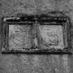
S(I)R W. SCOT UMQ(UHI)L(E) OF BRANX/HEIM KNYT SO(N)E OF S(I)R WILLIAM / SCOT OF KIRKURD KNYT BEGANE YE / VORK OF YIS HAL VPON YE 24 OF / MARCHE 1571 ZIER QUHA / DEPAIRTED AT GOD'S PLESOUR / YE 17 OF APRIL 1574. The continuation is cut upon the neighbouring panel: DAME MARGRET DOUGLAS / HIS SPOUS COM/PLEITTIT THE / FORSAID VORK (IN) OCTOBER 1576. The dexter shield has a bordure inscribed with the initials S V S for Sir Walter Scott and this motto AMO. It is charged: On a bend, a star and two crescents, in chief a stag's head erased and a rose, the last for difference. Similarly, the sinister shield also has a bordure inscribed D M D for Dame Margaret Douglas and is charged: A heart, on a chief three stars.
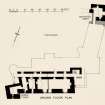
Internally, the main building of Branxholme has been entirely modernised above the first floor, the only feature of interest surviving upon the upper floors being a newel-staircase contained in the W. wall of the SW. tower. And even on the ground floor there has been considerable alteration. At this level a vaulted passage, from either end of which the vault has been removed, runs along the N. wall, its E. end opening to the main staircase and the other end being broken through to give access to an addition on the W. This passage forms the access to a series of vaulted apartments on the S., originally five in number. The easternmost of these ,into which the one adjoining has been thrown, was probably the kitchen, as it has an unusually heavy gable such as might have contained a large fireplace. Its two windows have both been opened out. What was originally the central compartment has also had its window enlarged. The fourth compartment shows the back of an original window, the front of which is modern. Its floor has been lowered for the installation of heating apparatus, while a doorway on the W., which opened into the westernmost division, has been built up. In the westernmost division the vault springs E. and W., in contrast to the other vaults which spring from N. to S. On the S. there is a built-up window, beside which a doorway in the E. wall opens into the vaulted undercroft of the SW. tower, now fitted up as a wine-cellar.
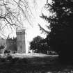
Nothing has survived of the screen-walls of the courtyard nor of its northern buildings other than the vaulted lower part of a rectangular tower, locally known as "Tentyfoot", which projected from the NE. corner of the courtyard. This rubble-built fragment stands to a height of only 15 ft. ; its W. side bears traces of the vaulted range that once extended W. from it, but otherwise the exterior is featureless. The tower is now entered either by a doorway in the E. wall or from a modern extension on the S., the opening in both cases being quite modern; originally, however, the sole access to its lowest storey was a hatchway, still traceable in the vault although now built up. The only original openings at this level are built-up gun-loops facing N., S., and W., the doorway on the E. occupying the position of a fourth gun-loop.
RCAHMS 1956, visited 1933
Tentyfoot Tower, This tower is part of the outer defences of Branxholme Castle (No. 242).
RCAHMS 1956, visited 1933
Information from Ordnance Survey Index Card.
Sbc Note
Visibility: This is an upstanding building.
Information from Scottish Borders Council.


