Pricing Change
New pricing for orders of material from this site will come into place shortly. Charges for supply of digital images, digitisation on demand, prints and licensing will be altered.
Musselburgh, New Bridge
Road Bridge (19th Century)
Site Name Musselburgh, New Bridge
Classification Road Bridge (19th Century)
Alternative Name(s) River Esk; Bridge Street; High Street; New Bridge, Musselburgh
Canmore ID 53921
Site Number NT37SW 81
NGR NT 34223 72642
Datum OSGB36 - NGR
Permalink http://canmore.org.uk/site/53921
- Council East Lothian
- Parish Inveresk (East Lothian)
- Former Region Lothian
- Former District East Lothian
- Former County Midlothian
NT37SW 81 34223 72642
For (predecessor) Old Bridge (NT 34076 72537), see NT37SW 5.00.
New Bridge [NAT]
OS 1:10,000 map, 1989.
New Bridge [NAT]
OS (GIS) AIB, April 2006.
NMRS REFERENCE
Architect: Sir John Rennie, 1806-7 (5 elliptic arches) (main road, Edinburgh to Berwick)
Newcutting (including Old Bridge), missing at time of upgrade, 30 September 2003
EXTERNAL REFERENCE
Scottish Records Office
RHP 8796 John Rennie 1803 - plans, elevations & sections (photocopy).
(Undated) information in NMRS.
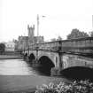
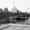
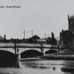
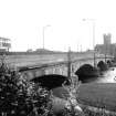
The New Bridge over the Esk was designed in 1806 by John Rennie, with five arches and niched piers over rounded cutwaters. It was greatly widened in 1924 by Blyth & Blyth, without altering its appearance from either side.
C McWilliam 1978.
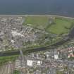
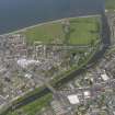
This bridge carries the former line of the A1(T) public road (now the A199) over the River Esk within the area of the town of Musselburgh (NT37SW 409), between Bridge Street (to the W) and High Street (to the E).
The location assigned to this record defines the centre of the structure, which apparently extends from NT c. 34195 72675 to NT c. 34248 72612.
Information from RCAHMS (RJCM), 26 April 2006.
Watching Brief (March 2003 - May 2004)
A watching brief was undertaken between March 2003 and May 2004 on water mains renewal in the archaeologically sensitive areas of Musselburgh, Fisherrow and Inveresk. All pipe track digging was monitored and all excavations were recorded. A number of archaeological deposits were recorded in section and sampled. These included medieval and post-medieval midden deposits and features in Musselburgh and Fisherrow, and a buried soil horizon and a ditch on Inveresk Brae that probably relate to the nearby vicus of Inveresk Roman fort. A fragment of Samian ware and pieces of hypocaust tile were recovered from the ditch. In addition, a number of stone-built culverts and a section of the town mill lade were recorded.
Report to be lodged with East Lothian SMR and the NMRS.
Sponsor: Scottish Water.
M Kimber 2004
Project (2007)
This project was undertaken to input site information listed in 'Civil engineering heritage: Scotland - Lowlands and Borders' by R Paxton and J Shipway, 2007.
Publication Account (2007)
This bridge over the Esk has five low-rise (one-tenth span) segmental arches with spans of 37 ft–46 ft and was
completed in 1808. It is built of freestone with an original width of 3412 ft before being widened in 1925 on the downstream side to 53 ft, carefully preserving the original facade stone-by-stone as can be seen in the view. A metal plaque on the north parapet of the bridge states that it ‘was built by John Rennie, Engineer, 1806. Repaired and widened 1924–25. Alexander Mitchell, Provost, Blyth & Blyth, Engineers, John Angus & Sons, Contractors’. The bridge was, and still is, notable for the low almost flat longitudinal profile of the road about 14 ft above the river, of which people exclaimed when they passed over it that they did not realise it was there! It is a fine example of a Rennie bridge.
R Paxton and J Shipway 2007
Reproduced from 'Civil Engineering heritage: Scotland - Lowlands and Borders' with kind permission of Thomas Telford Publishers.


