Crichton Castle
Castle (Medieval)
Site Name Crichton Castle
Classification Castle (Medieval)
Alternative Name(s) Crighton Castle
Canmore ID 53601
Site Number NT36SE 7
NGR NT 38000 61140
Datum OSGB36 - NGR
Permalink http://canmore.org.uk/site/53601

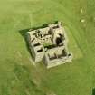


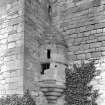


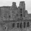





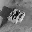

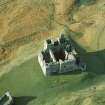
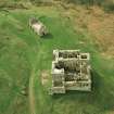
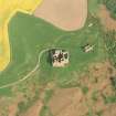

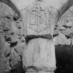
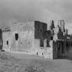


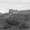


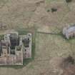

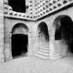

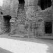


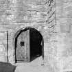

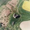
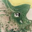
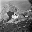


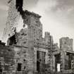


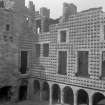
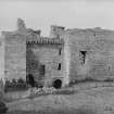
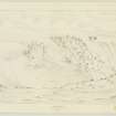
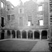

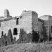


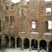


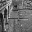

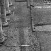
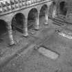
First 100 images shown. See the Collections panel (below) for a link to all digital images.
- Council Midlothian
- Parish Crichton
- Former Region Lothian
- Former District Midlothian
- Former County Midlothian
NT36SE 7.00 38000 61140
(NT 3800 6114) Crichton Castle (NR)
OS 6" map, (1966).
NT36SE 7.01 NT 38008 61088 'Chapel'; Stables
The Object Name Book of the Ordnance Survey describes the castle as 'A very splendid specimen of the ancient Norman Stronghold presenting in its architecture the style of three different ages. Its form is quadrangular and its walls massive and of considerable height perforated at numerous places by loopholes and small doors. The large square keep in the south east side is an erection of great strength, but the remainder of the structure in a very delapidated state.
It was once the property of the celebrated Crichton, Lord Chancellor of Scotland. It is now the property of Capt. B Callender of "Preston Gate".
Name Book 1853
Crichton Castle is fully described, planned and illustrated in the Ministry of Public Buildings and Works official guidebook.
W D Simpson 1957.
As described.
Visited by OS (BS) 24 October 1975.
The basement of the late 14th Century tower, the earliest extant building at Crichton, was excavated in advance of consolidation work. The mortared foundations of the tower were cut through the natural clay subsoil which probably formed the oringinal basement floor. Two post holes, each 0.40m in diameter by 0.3m deep, lay 2.25m apart, 1.3m away from the S wall, post-dating its construction. A series of drains were the only other features. W of the tower the area underneath the late 16th-century Italianate facade was cleared. The base of an E-W running mortared wall, 1.5m wide, underlay the 16th-century work, and may be the remains of the 14th century barmkin. The N range of cellars, perhaps 15th century, the supposdly 14th-century well, and the by then ruinous W wall of the early tower, had all been extensively re-faced during the 16th-century work. Traces of a kerb and bedding material for a 16th century courtyard were also noted.
Sponsor: HBM
J Cannell 1985
Excavation inside the basement of the castle's tower house, it's earliest extant building, revealed little of interest; whereas investigations in the area of the late 16th century Italianate facade on the north side of the courtyard revealed what are thought to be the foundations of the original north range, probabaly dating to the 15th century.
Sponsor: Historic Scotland
J Lewis 1997.
NT 380 611 Turf and topsoil were removed from an area around the S and E sides of Crichton Castle in January 2003. An area of rough metalling was found directly facing the main entrance, probably the remains of an earlier access path. Also found was an area covered in demolition debris, possibly evidence of levelling work or stone robbing.
Archive to be deposited in the NMRS.
Sponsor: HS
G Ewart 2003.
NT 380 611 A watching brief was undertaken in March 2005 during the excavation of two 1m2 trenches for the installation of lightning conductors; one at the foot of the E wall of the E tower and the other in the S return of the W tower. The trench near the E tower revealed sandstone rubble, with bedrock at a depth of 0.7m. The trench to the W uncovered similar rubble, also presumably demolition debris from the castle (NT36SE 7), but did not reach bedrock in its 1m depth.
Archive to be deposited in NMRS.
Sponsor: HS.
S Hogg 2005
NT 380 611 An archaeological watching brief was undertaken in May 2006 during the excavation of a posthole to secure the base of a handrail. Nothing of archaeological significance was discovered during the excavation of this posthole. According to Historic Scotland personnel, the area had probably been much disturbed during the installation of the cobbled surface c 20 years previously.
Archive and report to be deposited in NMRS. Report lodged with CECAS.
Sponsor: Historic Scotland.
S Hogg 2006.
NMRS REFERENCE:
Guardianship Monument
EXTERNAL REFERENCE:
National Library, MSS of General Hutton Vol 1 No 72 - plan of church 1817 & sketch dated 1781
National Library, Scots Magazine, Sept 1808 - engraving
(Undated) information in NMRS.
Field Visit (2 September 1920)
Crichton Castle.
This ruined structure (Figs. 69 and 70) occupies a commanding position at the head of the river Tyne 2 ¼ miles south-west of Pathhead and about 3 miles east of Gorebridge. The site is a mass of freestone of good quality, forming a terrace just below the 600 feet contour line and projecting from higher ground on the east-all part of the plateau which here overlooks the course of the Tyne. The site is steeply scarped on the west down to a marshy haugh bordering the river; on the north, where the ground beyond the site is level therewith, an old deeply cut watercourse and a ditch intervene and render approach difficult. On the west is a ditch with an outer rampart. The buildings of the castle proper, which completely enclose a courtyard, are set at the north-west angle of the site; 41 yards to the south of these is an outbuilding, the survivor of others which were apparently scattered about the south-eastern side of the plateau. The castle buildings, still standing for a height of 50 to 60 feet above the ground, form an imposing group. The various portions have been built at different periods, but the nucleus is a late 14th-century tower in the centre of the eastern side, which is the original house and a self-contained unit. Two wings were added in the 15th century and formed the south and west sides of a courtyard, of which the northern side may have been a screen wall or another wing afterwards removed or reconstructed. The present northern range dates from the period 1581-91.
[See RCAHMS 1929 pp.47-51 for a detailed architectural description].
HISTORICAL NOTE. On the Crichtons of that ilk see Introd., p. xxxviii. After the forfeiture of the third lord and of a temporary holder, the property was conferred on Patrick Hepburn, Lord Hailes, who was created Earl of Bothwell. With the forfeiture of the fourth earl, Queen Mary's husband, this link was broken till restored by James VI, who conferred the lands on Bothwell's nephew, Francis Stewart, created Earl of Bothwell and Admiral of all Scotland in 1581. He had returned from Italy in 1581 and married Margaret Douglas, a daughter of the Earl of Angus, before 1 July I592. He was responsible for the building of the arcaded north wing in the Italian manner, as his initials, surmounting an anchor to signify his office of Admiral (1), with those of his wife, appear twice in monogram on the piers. Francis Stewart was forfeited in 1591, but in the reign of Charles I his son Francis was restored to the property, which he encumbered with debt, so that in 1649 it was bought by Hepburn of Humbie, from whom the castle got the local appellation of ‘Humbie's Wa's’ (2). The name suggests that in Hepburn's time the place ceased to be occupied and was neglected. With this family it remained for the next thirty vears, after which it passed through the hands of various proprietors.
RCAHMS 1929, 2 September 1920.
(1) Cf. Rae Macdonald's Scottish Armorial Seals, where his seal (1589) shows an anchor below the shield; (2) Ruined Castles of Midlothian, John Dickson, p. 242.
Photographic Survey (1950)
Survey of Crichton Castle, Midlothian, by H Wyllie for the Scottish National Buildings Record c1950.
Photographic Survey (1953 - 1954)
Photographic survey of Crichton Castle in 1953-54, likely by the Ministry of Works.
Photographic Survey (April 1955)
Survey of Crichton Castle, Midlothian, by the Scottish National Buildings Record in 1955.
Photographic Survey (1964)
Photographic survey of Crichton Castle, Midlothian, by the Scottish Development Department in the Scottish National Buildings Record in 1964.
Aerial Photography (1981)
Aerial survey of Crichton Castle by RCAHMS in 1981.
Aerial Photography (1985)
Aerial survey of Crichton Castle by RCAHMS in 1985.
Publication Account (1985)
Crichton is one of two castles commanding the Middleton Gap and the route south to the Gala Water. Borthwick (NT 369597), on the Gore Water, is still inhabited and remains an outstandingly complete, large 15th century tower-house with two wings and the remains of a curtain wall; Crichton, on the Tyne, is an equally interesting example of a late 14th century tower, probably built by John de Crichton but subsequently extended and enveloped. The central, protruding section of the east wall is the east wall of the tower; the south and west courtyard sections were added in the 15th century; the present northern range dates from 1581-91.
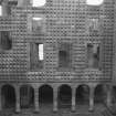
From without, Crichton is a stark and forbidding shell standing on a projecting terrace sharply above the still marshy river-side haugh. Internally, the original towerhouse, some 14m by 11m, had a high pointed barrel vault to the first-floor hall. There is a mezzanine floor; also a small prison (2m by 2.6m) entered through a tiny entrance but 0.6 m broad by 0.8m high and once secured by a strong, heavily-barred door. It is the facing wall of the later north range, however, that provides a most remarkable contrast to the bleak exterior. For this wall, with its large, rectangular, precisely-positioned windows, is ornamented in a way virtually unique in Scotland. Above an arcade of seven bays (and an extra 'return' bay on the West side), a distinctive diamond rustication covers the surface of the stone. Such embellishment reflects Continental Renaissance architecture, influenced more specifically here perhaps by Italian palaces of the period. It was commissioned by the 5th Earl of Both well (nephew of Mary, Queen of Scots' consort), who returned from Italy in 1581.
Bothwell also built the nearby stable, one of numerous ancillary buildings once standing on the plateau to the south. The actual stable was below, entered through a horseshoe-shaped arch decorated with a 'thong' patterning. Its vaulted roof set up stresses that later required external buttressing. Above was the hayloft, maybe heightened and made habitable, with crowstepped gables.
Crichton Village has an interesting church to St Mary and St Kentigern, restored in 1896 but parish church by decree in 1661 (NT 380616). Formerly collegiate (see section 6), it is cruciform, aisleless and unnelvaulted, with a barely evident nave. There are three iron headstones in the churchyard, the first dated 1841 to George Douglas of the Broughton foundry in Edinburgh.
Information from 'Exploring Scotland's Heritage: Lothian and Borders', (1985).
Excavation (1985)
The basement of the late 14th Century tower, the earliest extant building at Crichton, was excavated in advance of consolidation work. The mortared foundations of the tower were cut through the natural clay subsoil which probably formed the oringinal basement floor. Two post holes, each 0.40m in diameter by 0.3m deep, lay 2.25m apart, 1.3m away from the S wall, post-dating its construction. A series of drains were the only other features. W of the tower the area underneath the late 16th-century Italianate facade was cleared. The base of an E-W running mortared wall, 1.5m wide, underlay the 16th-century work, and may be the remains of the 14th century barmkin. The N range of cellars, perhaps 15th century, the supposdly 14th-century well, and the by then ruinous W wall of the early tower, had all been extensively re-faced during the 16th-century work. Traces of a kerb and bedding material for a 16th century courtyard were also noted.
Sponsor: HBM
J Cannell 1985
Photographic Survey (10 October 1986)
Photographic survey of Crichton Castle for a new guidebook 1986.
Photographic Survey (October 1986)
Photographic survey of Crichton Castle, Midlothian in 1986 for a new guidebook.
Photographic Survey (September 1986)
Photographic survey of Crichton Castle, Midlothian in 1986.
Aerial Photography (1994)
Aerial survey of Crichton Castle by RCAHMS in 1994
Aerial Photography (28 May 1997)
Aerial survey of Crichton Castle by RCAHMS in 1997.
Watching Brief (21 January 2003)
The work at Crichton Castle consisted of the archaeological monitoring of contractors during the removal of turf and top soil from a long strip of grassland along the E and S sides of the castle. The purpose of the excavations was to prepare the ground for a whin dust road and hard standing to create an access for service vehicles. The work would involve stripping away surface deposits from three areas: 22m of overgrown track to the E of the castle; a flat area near the SE corner of the castle, 20m in length; and a final 15m strip N from the flat area. Excavations totalled 57m in length, ranging in width from 2.50m to 7.00m with an expected depth of between 150 and 200mm. There were no previous records of archaeological material in these areas.
The present excavations which cover an area of approximately 180 sq m have only removed the turf and topsoil with the obvious result that existing features and structures may well still be blanketed by debris and levelling layers.
The presence of structures in the zone 20m from the E side of the castle has yet to be proven and will require deeper excavation than that carried out during the present works.
G Ewart 2003
Sponsor: Historic Scotland
Kirkdale Archaeology
Excavation (17 March 2005)
NT 380 611 A watching brief was undertaken in March 2005 during the excavation of two 1m2 trenches for the installation of lightning conductors; one at the foot of the E wall of the E tower and the other in the S return of the W tower. The trench near the E tower revealed sandstone rubble, with bedrock at a depth of 0.7m. The trench to the W uncovered similar rubble, also presumably demolition debris from the castle (NT36SE 7), but did not reach bedrock in its 1m depth.
S Hogg 2005
Sponsor: Historic Scotland
Kirkdale Archaeology
Watching Brief (May 2006)
NT 380 611 An archaeological watching brief was undertaken in May 2006 during the excavation of a posthole to secure the base of a handrail. Nothing of archaeological significance was discovered during the excavation of this posthole. According to Historic Scotland personnel, the area had probably been much disturbed during the installation of the cobbled surface c 20 years previously.
Archive and report to be deposited in NMRS. Report lodged with CECAS.
Sponsor: Historic Scotland.
S Hogg 2006
Fabric Recording (September 2007 - October 2007)
NT 3800 6114 This small carved stone collection contains some interesting fragments of a coffered ceiling. Other stones in the collection include sections from fireplaces in the castle, the base of a finial and a corbel. This inventory was undertaken between September and October 2007. This and other inventories of carved stones at Historic Scotland’s properties in care are held by Historic Scotland’s Collections Unit. For further
information please contact hs.collections@scotland.gsi.gov.uk.
Funder: Historic Scotland.
Standing Building Recording (25 November 2008 - 12 December 2008)
NT 3800 6114 To make additional use of temporary scaffolding erected in two places at Crichton Castle, a short period of standing building recording took place during November and December 2008. The scaffolding in the NW scale-and-platte stair opened up access not only to the stair itself but to a suite of rooms along the top of the W range. A second scaffold at first floor level in the Great Hall of the S Range provided access to a fireplace inserted into the S elevation of the Great Hall at second floor level.
Archive: RCAHMS (intended)
Funder: Historic Scotland
Information from Kirkdale Archaeoloy (G Ewart) 2008
OASIS ID: kirkdale1-249669
Watching Brief (17 January 2012)
NT 3804 6115 A watching brief was undertaken on 17 January 2012 during the excavation of two 0.4m deep test trenches, to assess the composition of the approach road, within the scheduled area of Crichton Castle ahead of proposed resurfacing works. There were no finds or features of archaeological significance, but archaeological deposits may exist below 0.4m.
Archive: RCAHMS (intended)
Funder: Historic Scotland
Paul Fox, Kirkdale Archaeology, 2012
(Source: DES)
OASIS Id: kirkdale1-310773
Watching Brief (27 November 2012)
NT 3803 6113 A watching brief was undertaken on 27 November 2012 during the excavation of six small trenches to allow the installation of a new gate through a fence to the E of the castle. The removal of an existing sign just SW of the gate was also monitored. There were no finds or features of archaeological significance.
Archive: RCAHMS (intended)
Funder: Historic Scotland
Information from Kirkdale Archaeology (P Fox) 2013
(Source: DES)
OASIS ID: kirkdale1-311425
Photographic Survey (February 2019)
NT 37992 61148 In February 2019 a photographic survey was carried out on the wall head of the western tower at Crichton Castle. Remedial works being carried on the wall head allowed access for the recording of two chimney openings and a U-shaped drainage feature, as well as the photogrammetric recording of the three sides of the wall head that were safe to access.
Archive: NRHE (intended). Reports lodged with Midlothian Council SMR
Funder: Historic Environment Scotland
Graeme Carruthers - CFA Archaeology Ltd
(Source: DES Vol 20)
OASIS Id: cfaarcha1-356714


