
Pricing Change
New pricing for orders of material from this site will come into place shortly. Charges for supply of digital images, digitisation on demand, prints and licensing will be altered.
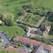
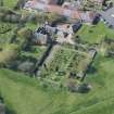
Edinburgh, Liberton Drive, Liberton House


Lairds House (17th Century)
Site Name Edinburgh, Liberton Drive, Liberton House
Classification Lairds House (17th Century)
Canmore ID 51750
Site Number NT26NE 9
NGR NT 26779 69317
Datum OSGB36 - NGR
Permalink http://canmore.org.uk/site/51750


- Council Edinburgh, City Of
- Parish Edinburgh (Edinburgh, City Of)
- Former Region Lothian
- Former District City Of Edinburgh
- Former County Midlothian
NT26NE 9.00 26779 69317
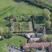
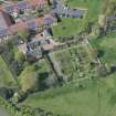
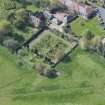
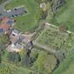
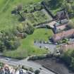
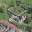
NT26NE 9.01 26824 69327 Walled Garden
(NT 2678 6931) Liberton House (NR) (restored)
OS 1:10000 map (1974)
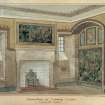
ARCHITECT:
Rowand Anderson & Paul and Partners. alterations 1936
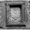
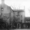
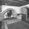
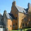
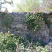
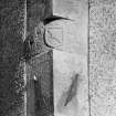
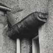
Liberton House, which forms the SE wing of a block of buildings, was built in the last quarter of the 17th century. It was restored not long before 1921 to reveal its character. The house is L-shaped on plan, and was originally two-storeyed, beneath a garret, with a 3-storeyed wing.
The outbuilding is probably slightly later that the house. One lintel is dated 1682.
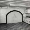
The house is inhabited and in good repair.
RCAHMS 1929, visited 1921; D MacGibbon and T Ross 1892
As described.
Visited by OS (SFS) 21 October 1975
NMRS REFERENCE:
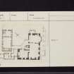
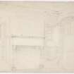
Liberton House (proposed restoration)
PLANS:
Dick Peddie & MacKay, Edinburgh restoration
Attic 2, Bin 6, Bag 2 n/s n/d
c 1950?
Printroom:
W Schomberg Scott Photograph Collection Acc no 1997/39
Side view - 2 prints
SCOTTISH RECORD OFFICE REFERENCE:
Plan of Houses, Byres etc at Liberton House
Not dated
GD 122/Box 27
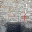
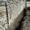
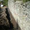
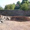
Standing Building Recording (4 May 2011 - 5 May 2011)
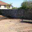
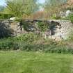
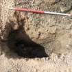
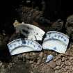
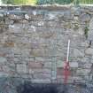
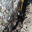
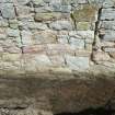
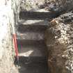
NT 2679 6934 A programme of monitoring and building recording was undertaken during May 2011 in advance of a small development within the grounds of Liberton House. The excavation of an 8m long foundation trench and two small test pits revealed that the entire footprint of the development consists of up to 1.5m of made ground. A significant quantity of 19th- to 20th-century ceramic fragments, bottles and brick were recovered from this deposit. The survey of the upstanding stone wall affected by the development revealed a number of minor features and possible evidence for two phases of development. The wall fabric included a significant amount of repair, including a brick and cement capping. The wall is thought to represent one elevation of a long rectangular building first depicted on the 1st Edition OS map of 1858.
Archive: RCAHMS
Funder: Kelly and Jonathan Foley
Headland Archaeology 2011 (D. Wilson) OASIS ID: headland1-100440

