Standing Building Recording


Date 4 May 2011 - 5 May 2011
Event ID 712016
Category Recording
Type Standing Building Recording
Permalink http://canmore.org.uk/event/712016
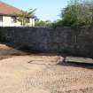
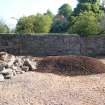
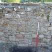
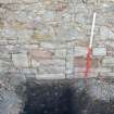
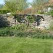
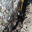
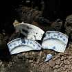
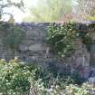
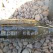
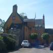
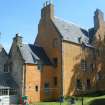
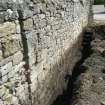
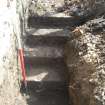
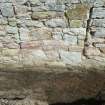
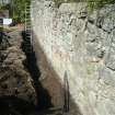
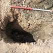
NT 2679 6934 A programme of monitoring and building recording was undertaken during May 2011 in advance of a small development within the grounds of Liberton House. The excavation of an 8m long foundation trench and two small test pits revealed that the entire footprint of the development consists of up to 1.5m of made ground. A significant quantity of 19th- to 20th-century ceramic fragments, bottles and brick were recovered from this deposit. The survey of the upstanding stone wall affected by the development revealed a number of minor features and possible evidence for two phases of development. The wall fabric included a significant amount of repair, including a brick and cement capping. The wall is thought to represent one elevation of a long rectangular building first depicted on the 1st Edition OS map of 1858.
Archive: RCAHMS
Funder: Kelly and Jonathan Foley
Headland Archaeology 2011 (D. Wilson) OASIS ID: headland1-100440