
Pricing Change
New pricing for orders of material from this site will come into place shortly. Charges for supply of digital images, digitisation on demand, prints and licensing will be altered.
Hopecarton


Farmstead (Medieval)
Site Name Hopecarton
Classification Farmstead (Medieval)
Canmore ID 49901
Site Number NT13SW 11
NGR NT 1296 3089
Datum OSGB36 - NGR
Permalink http://canmore.org.uk/site/49901


- Council Scottish Borders, The
- Parish Drumelzier
- Former Region Borders
- Former District Tweeddale
- Former County Peebles-shire
NT13SW 11 1296 3089.
(NT 1300 3092) Farmstead (NR)
OS 6" map, (1967).
These remains are generally as described (RCAHMS 1967). This is probably a medieval farmstead with later buildings.
Visited by OS (EGC) 28 May 1964 and (IA) 5 September 1972.
Field Visit (June 1956)
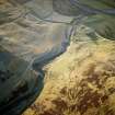
NT 129 309. Indeterminate Remains, Hopecarton.
A group of scooped courts and an adjacent enclosure are situated on a low knoll beside the Hopecarton Burn, 300 yds SE of Hopecarton cottage. The largest court (A on RCAHMS 1967 plan, fig.311), which mesures 70ft in length by 30ft in breadth, is bordered on the N by another (B) measuring 50ft by up to 20ft, and on the W by a third (C) measuring 40ft by 20ft. A shallow crescentic scarp (D), in front of which there are three earthfast boulders, lies in the angle between court A and a terrace (T). On the terrace there is an H-shaped foundation formed by low narrow grass grown banks. The enclosure (E) measures 50ft by 30ft within a wall which now appears partly as a low stony bank and partly as a mere scarp. A scarp runs E from the enclosure for a distance of 50ft before turning N to join a low bank which dies out on the hill-side 30ft N of the enclosure. Two stone walled buildings (F, G), now reduced to their foundations, to the S of the scooped courts. These buildings are probably later than the remains already described and may be of comparatively recent date.
RCAHMS 1967, visited June 1956.
Field Visit (1 December 1989)
NT13SW 11 1296 3089.
The remains of a farmstead which forms part of an extensive system of banks and cultivation ridges around the cottage at Hopecarton. The farmstead is probably that depicted on Roy's map (1747-55) as Hopecarton.
Visited by RCAHMS (SPH) 1 December 1989.
Sbc Note
Visibility: This is an upstanding earthwork or monument.
Information from Scottish Borders Council

