
The Ord


Burial Cairn (Prehistoric)(Possible)
Site Name The Ord
Classification Burial Cairn (Prehistoric)(Possible)
Canmore ID 4982
Site Number NC50NE 14
NGR NC 57264 05568
Datum OSGB36 - NGR
Permalink http://canmore.org.uk/site/4982


- Council Highland
- Parish Lairg
- Former Region Highland
- Former District Sutherland
- Former County Sutherland
NC50NE 14 5726 0555
(NC 5726 0555) Cairn (NR)
OS 1:10,000 map, (1970)
A circular, grass-covered stony mound or cairn (RCAHMS 1911) 9m in diameter and 0.9m high. A slight excavation has been made in the top but no cist nor chamber is exposed. Although this is probably a cairn, there is the possibility that it is simply a field clearance heap.
Visited by OS (W D J) 19 June 1963.
RCAHMS 1911.
This mound adjacent to an area of run-rig is similar in content to several field clearance heaps in the vicinity, but two factors suggest that it is a small round cairn. Firstly it is situated on a prominent false crest, and secondly it is bounded by about twelve stones up to 0.3m high, some contiguous, which contain the stony mound some 5.0m in diameter and 0.4m high. These stones do not describe a perfect arc as a cairn kerb, but some may be displaced.
Surveyed at 1:10,000.
Visited by OS (N K B) 21 July 1976.
Surveyed at 1/2500.
Visited by OS (J B) 15 March 1979.
Scheduled with NC50NE 13, NC50NE 16, NC50NE 17, NC50NE 19, NC50NE 22, NC50NE 38 -9, 46, 54-6 and 81-2 as The Ord, chambered cairns, cairns, settlements and field systems.
Information from Historic Scotland, scheduling document dated 14 February 2002.
Ground Survey (22 February 2010 - 18 March 2010)
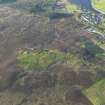
NC 575 050 A topographic survey of the scheduled area and a 100m buffer zone around the The Ord was carried out 22 February–18 March 2010. The area contains a high density of archaeological monuments, including Neolithic funerary monuments and remains of Bronze Age settlements and agriculture. Although the distribution of the major features was known, this survey added detail and increased the accuracy of information obtained in previous surveys. The survey also identified several previously unrecorded features. In total over 450 individual archaeological features were recorded including a burnt mound, c35 hut circles, 14 rectangular buildings and over 300 clearance cairns.
Archive: RCAHMS
Funder: The Forestry Commission Scotland

