Charlestown Harbour
Harbour (18th Century)
Site Name Charlestown Harbour
Classification Harbour (18th Century)
Alternative Name(s) East Harbour Road; Limekilns Harbour; River Forth
Canmore ID 49496
Site Number NT08SE 31
NGR NT 06604 83469
NGR Description Centred NT 06604 83469
Datum OSGB36 - NGR
Permalink http://canmore.org.uk/site/49496
- Council Fife
- Parish Dunfermline
- Former Region Fife
- Former District Dunfermline
- Former County Fife
NT08SE 31.00 centred 06604 83469
Harbour [NAT]
OS 1:10,000 map, 1975.
NT08SE 31.01 NT 06473 85503 Inner Basin
NT08SE 31.02 NT 06456 83417 Outer Basin
NT08SE 31.03 NT 06416 83442 to NT 06313 83467 NW pier
NT08SE 31.04 NT 06419 83363 to NT 06293 83398 SW pier
NT08SE 31.05 NT 06471 83471 to NT 06506 83484 to NT 06589 83468 NE pier
NT08SE 31.06 NT 06465 83351 to NT 06547 83326 S pier
NT08SE 31.07 NT 06730 83350 to NT c. 06648 83302 SE pier
NT08SE 31.08 NT 06412 83364 Beacon
Location formerly entered as NT 064 834.
For (adjacent and associated) Charlestown limekilns, see NT08SE 32.
Not to be confused with Limekilns Harbour (centred NT 0755 8330), for which see NT08SE 23.00.
(Location cited as NS 065 835). Charlestown, Fife: neither Roy's map of Scotland (1747-55) nor Ainslie's map of Fife (1775) marks a harbour at Charlestown, but the Statistical Account credits the 5th Earl of Elgin with having built one as part of his programme of industrial development. The date given in this source for the Earl's nine draw-kilns (NT08SE 32), which face what is now the inner basin of the greatly enlarged harbour is 1777 or 1778, but the kilns must have been standing as early as 1772, as they were visited by Pennant in that year and described by him as 'perhaps the greatest in the world'. Consequently, even if the kilns were new when Pennant saw them, the harbour's origin may be dated to the early 1770's.
The identity of the 5th Earl's works may also be inferred with confidence. The OS 6-inch map (surveyed in 1854) shows that, at that date, neither the SE portion of the existing outer harbour nor the block of made ground to the E of it had come into being, with the result that the pier that encloses the inner basin on the S fronted on the open Firth. Again, the NW portion of the outer harbour bears every appearance of 19th-century work, and should probably be dated to the years before 1844, when improvements are on record.
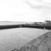
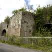
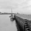
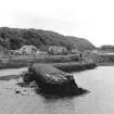
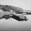
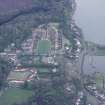
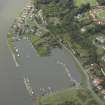
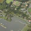
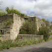
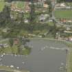
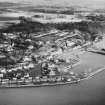
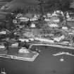
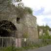
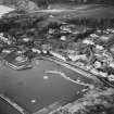
The main feature of interest is thus the pier enclosing the inner basin. It consists of two sections, of different build and alignment, and on plan resembles a sickle. The E portion, or so much of it as has escaped the encroaching made ground, is curved, is battered externally in steps, and measures 275ft [83.8m] in length by 12ft [3.7m] in width on the top; its general alignment is approximately from E to W but the part that originally formed the E end of the basin lies more nearly N and S. The W portion is straight, is less heavily battered, has a smooth outer face, and measures 132ft [40.2m] in length by 18ft [5.5m] in breadth on top. Apart from some patching in vertically set masonry, the slabs used in the curved portion seem longer and thinner than those in the straight stretch. The W end contains some very large blocks. The whole upper surface is provided with numerous mooring-rings, and that of the curved part has been partially paved with old chair-blocks from a demolished railway. The E end of the basin is neatly faced with coursed blocks, and is pierced by a large arched culvert, the stream from which must have served to scour out silt. The W end is of similar construction, but the N side, which must have constituted the wharf serving the Earl's kilns, has been obliterated by a railway embankment. The entrance, which opens between the pier-head and the land opposite, is 120ft [36.6m] wide. The enclosed area is 635ft [193.6m] long and from 100ft [30.5m] to 180ft [54.9m] wide. In 1844 the greatest depth of water at spring tides was 16.5ft [5m].
The peculiar plan of the pier, and the structural differences between its E and W portions, suggest that it may embody work of two periods. If so, the earliest harbour would have been a small U-shaped pocket open towards the W; its entrance, about 100ft [30.5m] wide would have partially sheltered by the land W of the basin.
A Graham 1971.
(Location cited as NT 064 833). Charlestown Harbour, 18th century and later. The inner basin was formed by the 5th Earl of Elgin c. 1770 and the outer basin added later, the NE pier dating from c. 1840 and the SE pier from the late 19th century. Built for coal and limestone shipment.
J R Hume 1976.
At the end of East Harbour Road, the harbour, its inner basin begun in 1777-8, the outer basin made in the 19th century.
J Gifford 1988.
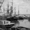
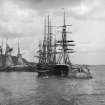
(General history of shipbreaking at Rosyth and Charlestown).
Table of operating statistics (p. 49); list of ships broken at Rosyth and Charlestown 1923-63 (pp. 61-100).
I Buxton 1992.
Site recorded by Maritime Fife during the Coastal Assessment Survey for Historic Scotland, Kincardine to Fife Ness, 1996
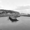
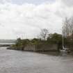
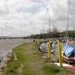
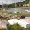
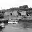
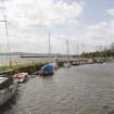
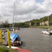
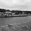
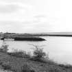
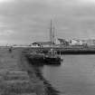
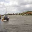
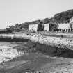
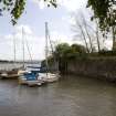
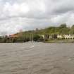
This harbour is silted-up, and dries at Low Water; the piers and other masonry structures are in a poor state of repair. It remains in limited use by recreational sailors, and also contains several derelict vessels.
The harbour is commonly known as 'Limekilns Harbour' causing confusion with NT08SE 23.00.
Information from RCAHMS (RJCM), 30 March 2006.
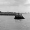
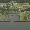
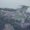
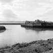
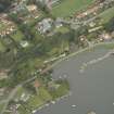
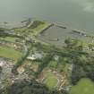
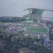
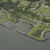
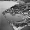
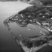
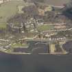
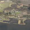
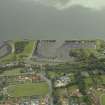
Sickle shaped inner pier with rounded end and truncated, squared off section to create an inner harbour. Two long, round-ended linear piers enclose the outer harbour. Eastern pier built up to create a further outer harbour in the later 19th century.
Charles, the 5th Earl of Elgin, created Charlestown as a model village from 1759 until his death in 1771, when it was continued by his successors. He exploited the abundance of raw materials around Charlestown which led to the establishment of a foundry, brick works, limekilns, the export of coal and coke, the development of the village to house the workers and the necessary transport for the materials which included wagonways and the harbour. The proximity of the limekilns to the harbour meant that the lime could be shovelled directly onto boats for exportation.
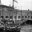
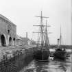
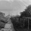
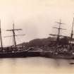
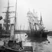
The harbour was also used for passenger steamers in the 19th century which ran from Granton to Stirling stopping at Charlestown amongst other ports. In 1863 the North British Railway Company bought the harbour and extended it to the E, there was a railway running along the Harbour Road and a station to the E at Saltpans. Although the harbour was extended to cope with the growing trade, towards the end of the century the use of the railway and competition from other ports such as Grangemouth led to a decline in the amount of commercial activity. However, shipbreaking began in the 1920s under the Alloa Shipbreaking Co. and ended in 1962. The harbour was also requisitioned by the Admiralty in WWII to berth crafts.
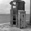
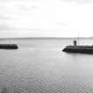
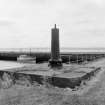
The harbour is now used for pleasure craft. The timber skeleton of a circa 1900 hexagonal harbour light stands at the end of the W pier but is not part of the Statutory List. (Historic Scotland).
Project (2007)
This project was undertaken to input site information listed in 'Civil engineering heritage: Scotland - Lowlands and Borders' by R Paxton and J Shipway, 2007.
Publication Account (2007)
From 1757 to 1761, as the Industrial and Agricultural Revolutions gathered momentum, the 5th Earl of Elgin developed lime production on his Broomhall Estate by quarrying limestone and building kilns, the village of Charlestown, and its harbour. Prior to this, limestone deposits had been exploited at nearby Limekilns but in a small way. The present pier there seems to be of third quarter18th century construction with roughly squared dry (unmortared) sandstone block facings quarried nearby.
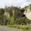
From 1774, with the opening of the original Elgin Wagonway, Charlestown was supplied with coal for lime making via Limekilns, the exporting port for coal from pits west of Dunfermline. In 1799 this wagonway was extended along the shore to Charlestown Harbour, being replaced by 1820 with a more direct line to the west with an inclined plane down to the harbour, including a substantial three-span arch bridge. The rails, at first of wood, were replaced by cast-iron in ca.1804 and malleable iron from ca.1820.
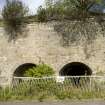
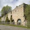
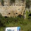
The imposing bank of draw kilns fronting the inner basin of the harbour were more or less continuously developed from 1759–90. The sickle-shaped in plan pier enclosing this basin is of similar construction to Limekilns Pier butwith some large blocks at the west end. Its top contains numerous mooring rings and is partly surfaced with old railway chair blocks. The inner basin entrance is 120 ft wide with an enclosed area 635 ft long by 100 ft to 180 ft wide, with a depth at Spring tides of 1612 ft in 1844.
From ca.1813–34, as the Estate was becoming one of the largest industrial operations of its kind in Scotland, the 7th Earl engaged Charles Landale, civil engineer, to superintend work. In addition to maintaining the harbours, Landale introduced numerous improvements for transporting materials in, or to and from, the quarries and mines, including the inclined plane to the harbour and the ingenious inclined planes at Pittencrieff and Colton near Dunfermline. His salary was £250 per annum, plus expenses and the use of a horse! The outer basin was added later, the north-west pier dating from ca.1840 and the south-east pier after 1853. In 1859 the harbour became the property of the North British Railway Company, who provided a passenger service to Charlestown in 1894. The harbour now contains about 10 ft of mud and is unused apart from small sailing boats.
R Paxton and J Shipway 2007
Reproduced from 'Civil Engineering heritage: Scotland - Lowlands and Borders' with kind permission from Thomas Telford Publishers.


