Langloch Knowe
Cultivation Remains (Period Unassigned), Fort(S) (Prehistoric), Roundhouse(S) (Prehistoric)
Site Name Langloch Knowe
Classification Cultivation Remains (Period Unassigned), Fort(S) (Prehistoric), Roundhouse(S) (Prehistoric)
Canmore ID 48747
Site Number NT03SW 16
NGR NT 0438 3294
Datum OSGB36 - NGR
Permalink http://canmore.org.uk/site/48747
- Council South Lanarkshire
- Parish Culter
- Former Region Strathclyde
- Former District Clydesdale
- Former County Lanarkshire
Measured Survey (12 August 1957)
RCAHMS surveyed this site by plane-table on 12 August 1957 as part of the Marginal Land Survey. The resultant plan and section were drawn up in ink in 1975 and published in the County Inventory of Lanarkshire (RCAHMS 1978, Fig. 60).
Field Visit (30 June 1959)
NT03SW 16 0438 3294.
(NT 0438 3294) Fort (NR)
OS 6" map, (1962).
This fort was in a similar condition when visited in 1959.
Visited by OS(JLD) 30 June 1959.
Field Visit (July 1975)
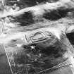
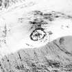
NT 043 329. The slight remains of a fort are situated on Langloch Knowe (312m OD). Stone-robbing and cultivation have severely reduced the defences but enough remains to distinguish two structural phases, the earlier represented by two ramparts (IA and IB on RCAHMS 1978 plan, fig.60) and the later by a single wall (II) which partly overlies rampart IA.
Where they are still visible, ramparts IA and IB now appear as mere scarps or crest lines, and although their original nature cannot be determined with certainty, it seems likely that they were composed of earth and rubble. The area they enclosed measures about 46m by 24m and the entrance probably lay somewhere on the NE.
The later wall (II), which is built largely on the line of rampart IA, encloses an oval area measuring 32m by 20m. It appears as a stony mound up to 3.0m thick and not more than 0.3m high; a few outer facing stones can be seen as indicated on the plan. The entrance, 5.0m wide, is on the NE. Within the interior there are faint indications, now too indefinite to plan, of ring-groove type houses, but it is uncertain to which of the two phases of occupation they belong.
RCAHMS 1978, visited July 1975.
This fort was in a similar condition when visited in 1959.
Visited by OS(JLD) 30 June 1959.
Note (29 July 2015 - 19 October 2016)
This small fortification occupies a steep-sided hillock at the foot of the main mass of Black Hill SE of Cow Castle. Oval on plan, its defences comprise two elements which are probably successive, namely a stone-wall enclosing most of the summit of the hillock, and two ramparts reduced to scarps on its NW, SW and SE flanks. The inner enclosure measures internally about 32m from NE to SW by 20m transversely (0.05ha), and though its wall is largely reduced to a grass-grown stony bank 3m in thickness, occasional outer facing-stones are visible around the E half of the circuit. A broad gap on the NE probably marks the position of the entrance, opening out onto a gentle slope where cultivation has removed all trace of the outer defences. These probably belong to an earlier phase of construction, and while it is not possible to demonstrate the relationship without excavation, it is likely that the inner enclosure follows the line of an earlier rampart around most of its circuit. Only on the SW, and possibly the N, does the earlier rampart emerge from beneath it, originally enclosing an oval area measuring about 46m from NE to SW by 24m transversely (0.09ha). The outer is largely reduced to a terrace encircling the foot of the hillock, but on the N it is clear that it formed the counterscarp rampart on the outer lip of a medial ditch between them. Traces of up to four timber round-houses were noted by RCAHMS investigators within the enclosure on the summit, and presumably relate to the second phase of occupation.
Information from An Atlas of Hillforts of Great Britain and Ireland – 19 October 2016. Atlas of Hillforts SC3234


