 |
On-line Digital Images |
SC 337202 |
RCAHMS Aerial Photography |
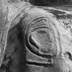
Scanned image of an oblique aerial view. |
1981 |
Item Level |
|
 |
On-line Digital Images |
SC 337251 |
Records of the Royal Commission on the Ancient and Historical Monuments of Scotland (RCAHMS), Edinbu |
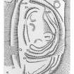
Publication plan of Cow Castle fort. Scanned image of photographic copy. |
1975 |
Item Level |
|
 |
On-line Digital Images |
SC 573022 |
RCAHMS Aerial Photography |
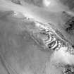
Scanned image of an oblique aerial view. |
1991 |
Item Level |
|
 |
On-line Digital Images |
SC 573024 |
RCAHMS Aerial Photography |
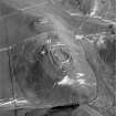
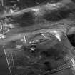
Scanned image of an oblique aerial view, taken from the WSW, centred on a fort and settlement site, with Nisbet settlement site and cultivation terraces to the top of the photograph. |
22/2/1996 |
Item Level |
|
 |
On-line Digital Images |
SC 624036 |
RCAHMS Aerial Photography |
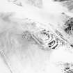
Cow Castle, oblique aerial view, taken from the NW, centred on a fort and settlement site, with Langloch Knowe fort and cultivation terraces to the top of the photograph. |
22/2/1996 |
Item Level |
|
 |
On-line Digital Images |
SC 1730394 |
RCAHMS Aerial Photography |
Oblique aerial view. |
1991 |
Item Level |
|
 |
On-line Digital Images |
SC 1730395 |
RCAHMS Aerial Photography |
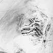
Oblique aerial view. |
1991 |
Item Level |
|
 |
On-line Digital Images |
SC 1730396 |
RCAHMS Aerial Photography |
Oblique aerial view. |
1991 |
Item Level |
|
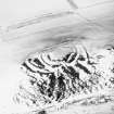 |
On-line Digital Images |
SC 1730397 |
RCAHMS Aerial Photography |
Oblique aerial view. |
1991 |
Item Level |
|
 |
On-line Digital Images |
SC 1730469 |
RCAHMS Aerial Photography |
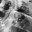
Cow Castle, oblique aerial view, taken from the N, centred on a settlement site, with a sheepfold to the left of the photograph. |
22/2/1996 |
Item Level |
|
 |
On-line Digital Images |
SC 1730470 |
RCAHMS Aerial Photography |
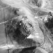
Cow Castle, oblique aerial view, taken from the WSW, centred on a fort and settlement site, with Nisbet settlement site and cultivation terraces to the top of the photograph. |
22/2/1996 |
Item Level |
|
 |
On-line Digital Images |
SC 1730473 |
RCAHMS Aerial Photography |
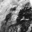
Langloch Knowe, oblique aerial view, taken from the W, centred on cultivation terraces and a fort, with another fort and settlement to the left of the photograph. |
22/2/1996 |
Item Level |
|
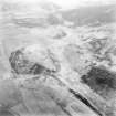 |
On-line Digital Images |
SC 1730508 |
RCAHMS Aerial Photography |
Oblique aerial view. |
1977 |
Item Level |
|
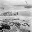 |
On-line Digital Images |
SC 1730509 |
RCAHMS Aerial Photography |
Oblique aerial view. |
1977 |
Item Level |
|
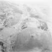 |
On-line Digital Images |
SC 1730510 |
RCAHMS Aerial Photography |
Oblique aerial view. |
1977 |
Item Level |
|
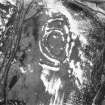 |
On-line Digital Images |
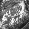
SC 1730519 |
RCAHMS Aerial Photography |
Oblique aerial view. |
1980 |
Item Level |
|
 |
On-line Digital Images |
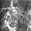
SC 1730520 |
RCAHMS Aerial Photography |
Oblique aerial view. |
1980 |
Item Level |
|
 |
On-line Digital Images |
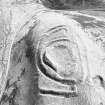
SC 1730521 |
RCAHMS Aerial Photography |
Oblique aerial view. |
1980 |
Item Level |
|
 |
On-line Digital Images |
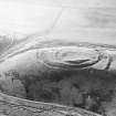
SC 1730525 |
RCAHMS Aerial Photography |
Oblique aerial view. |
1981 |
Item Level |
|
 |
On-line Digital Images |
SC 1730526 |
RCAHMS Aerial Photography |
Oblique aerial view. |
1981 |
Item Level |
|
 |
On-line Digital Images |
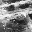
SC 1730608 |
RCAHMS Aerial Photography |
Cow Castle, oblique aerial view, taken from the NW, centred on a fort and settlement site, with Langloch Knowe fort and cultivation terraces to the top of the photograph. |
22/2/1996 |
Item Level |
|
 |
On-line Digital Images |
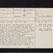
SC 2436320 |
Records of the Ordnance Survey, Southampton, Hampshire, England |
Cow Castle, NT03SW 14, Ordnance Survey index card, page number 1, Recto |
c. 1958 |
Item Level |
|
 |
On-line Digital Images |
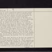
SC 2436321 |
Records of the Ordnance Survey, Southampton, Hampshire, England |
Cow Castle, NT03SW 14, Ordnance Survey index card, page number 2, Verso |
c. 1958 |
Item Level |
|
 |
On-line Digital Images |
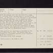
SC 2436322 |
Records of the Ordnance Survey, Southampton, Hampshire, England |
Cow Castle, NT03SW 14, Ordnance Survey index card, page number 3, Recto |
c. 1958 |
Item Level |
|