
Castle Hill


Fort (Iron Age)
Site Name Castle Hill
Classification Fort (Iron Age)
Canmore ID 45894
Site Number NS77NW 28
NGR NS 7091 7610
Datum OSGB36 - NGR
Permalink http://canmore.org.uk/site/45894


- Council East Dunbartonshire
- Parish Kirkintilloch (Strathkelvin)
- Former Region Strathclyde
- Former District Strathkelvin
- Former County Dunbartonshire
NS77NW 28 7091 7610
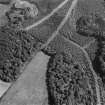
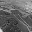
A short distance E of Bar Hill Roman fort (NS77NW 8) the Antonine Wall bends northwards to enclose a small rocky eminence, Castle Hill (155m high). The hill presents a long and fairly steep slope to the NE and shorter but steeper slopes, each about 30ft (9.1m) in height, to the NW and SW; on the SE, the original profile has been destroyed by a quarry, now disused. The evidence for fortifications here consists simply of two parallel terraces which presumably once enclosed the whole of the top of the hill but which are now only visible around the NW half of the circuit. The inner terrace follows the natural shoulder of the hill at a distance of from 10ft (3m) to 14ft (3.2m) below the OS triangulation station on the summit proper, while the lower terrace lies at a vertical distance of from 7 to 8ft (2.1-2.4m) below the first. These terraces are clearly not agricultural in origin, but must represent the quarried seatings for ramparts or walls which have subsequently been either eroded away or deliberately and systematically dismantled. There is no evidence to show whether the fort is earlier or later in date than the Antonine Wall, although the state of the remains suggests that the former alternative is perhaps the more likely of the two. One original entrance may have been situated on the E side, at the point where a well-worn track, running obliquely up the NE flank of the hill, breasts the slope; while there may have been another on the SW. The interior shows no trace of structures.
RCAHMS Marginal Lands Survey TS, visited (KS) 16 May 1955.
On the summit of Castle Hill, which is 145m above sea-level, is a small Iron Age hillfort, the multiple defences of which are traversed bythe 'Roman frontier line' in the shape of the Antonine Wall (NS77NW 49.00).
Anne S. Robertson/Lawrence Keppie 2001.
Field Visit (16 May 1955)
This site was included within the RCAHMS Marginal Land Survey (1950-1962), an unpublished rescue project. Site descriptions, organised by county, are available to view online - see the searchable PDF in 'Digital Items'. These vary from short notes, to lengthy and full descriptions. Contemporary plane-table surveys and inked drawings, where available, can be viewed online in most cases - see 'Digital Images'. The original typecripts, notebooks and drawings can also be viewed in the RCAHMS search room.
Information from RCAHMS (GFG) 19 July 2013.
Reference (1957)
This site is noted in the ‘List of monuments discovered during the survey of marginal land (1951-5)’ (RCAHMS 1957, xiv-xviii).
Information from RCAHMS (GFG), 24 October 2012.
Field Visit (May 1977)
Castle Hill NS 709 761 NS77NW
As described by Marginal Lands Survey. A semi-circular groove is just discernible on the S edge of the summit. The groove is 5m long, 0.8m wide and c.02m deep. The grass growth in it is more luxuriant than that in the area immediately surrounding it. On the NE, forestry has advanced to just below the outer and lower terrace.
RCAHMS 1982, visited (PC) 26 May 1977.
Note (14 August 2014 - 15 August 2016)
Traces of a small fortification can be seen on Castle Hill, a minor rocky summit immediately S of the Antonine Wall to the E of the Bar Hill Roman fort. Defended by two ramparts, both of which have been reduced to little more than terraces visible around the N and W flanks of the hillock, the rocky interior is essentially confined to the summit area and cannot have measured more than 49m from NW to SE by 40m transversely (0.15ha), despite the quarrying that has taken place around the S and SE. Little convincing evidence of an entrance is visible, though RCAHMS in 1955 suggested that there may have been one on the E where a trackway appeared to run obliquely up the NE flank of the hillock, and a second on the SW.
Information from An Atlas of Hillforts of Great Britain and Ireland – 15 August 2016. Atlas of Hillforts SC1487
Archaeological Evaluation (28 August 2015)
NH 7652 5666 An evaluation was carried out on 28 August 2015 after a small trench was excavated for emergency repairs to a buried water pipe in the southern portion of the fosse, between the covered way surrounding the ravelin and the SE bastion of the fort. There were no finds or features of
archaeological significance.
Archive: National Record of the Historic Environment (intended)
Funder: Historic Scotland
Paul Fox – Kirkdale Archaeology
(Source: DES, Volume 16)
OASIS id: kirkdale1-311309
Watching Brief (February 2021)
NS 710 762 A watching brief was conducted during works for the replacement of drainage at the Bar Hill Roman Fort (Canmore ID: 45894), part of the Antonine Wall between Kirkintilloch and Croy. The work included the re-excavation of the existing land drains in two locations, installation of new drainage, and the re-instatement of the ground surface. No archaeologically significant features or deposits were observed.
Archive: NRHE (intended)
Funder: Historic Environment Scotland
Oliver Rusk – CFA Archaeology Ltd
(Source: DES Vol 22)

