|
Photographs and Off-line Digital Images |
DC 47351/9 |
Records of the Ordnance Survey, Southampton, Hampshire, England |
Ordnance Survey 6-inch to the mile Provisional Edition, revision of 1913-14 with additions in 1946.
Additional annotations by Ordnance Survey for the Antonine Wall map covering the parishes of Falkirk and Kilsyth with Westerwood. |
c. 1946 |
Item Level |
|
 |
On-line Digital Images |
SC 2430327 |
Records of the Ordnance Survey, Southampton, Hampshire, England |
Arniebog, NS77NE 10, Ordnance Survey index card, page number 1, Recto |
c. 1958 |
Item Level |
|
 |
On-line Digital Images |
SC 2430328 |
Records of the Ordnance Survey, Southampton, Hampshire, England |
Arniebog, NS77NE 10, Ordnance Survey index card, Recto |
c. 1958 |
Item Level |
|
 |
On-line Digital Images |
SC 2430329 |
Records of the Ordnance Survey, Southampton, Hampshire, England |
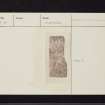
Arniebog, NS77NE 10, Ordnance Survey index card, Recto |
c. 1958 |
Item Level |
|
|
All Other |
551 166/1/1 |
Records of the Ordnance Survey, Southampton, Hampshire, England |
Archaeological site card index ('495' cards) |
1947 |
Sub-Group Level |
|