Strathblane, Parish Graveyard
Standing Stone (Prehistoric)
Site Name Strathblane, Parish Graveyard
Classification Standing Stone (Prehistoric)
Canmore ID 44452
Site Number NS57NE 6
NGR NS 56388 79373
NGR Description NS 56388 79373
Datum OSGB36 - NGR
Permalink http://canmore.org.uk/site/44452
- Council Stirling
- Parish Strathblane (Stirling)
- Former Region Central
- Former District Stirling
- Former County Stirlingshire
NS57NE 6 5638 7937.
A rough uninscribed stone block, as described by the Commission.
Visited by OS (J L D) 29 March 1957
As described above
Surveyed at 1/2500.
Visited by OS (W D J) 2 May 1966.
Field Visit (10 November 1955)
NS57NE (unnoted) 563 793
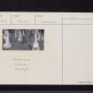
Standing Stone, Parish Graveyard, Strathblane. A few yards within the entrance to the graveyard of Strathblane Parish Church a standing stone appears among the monuments. It is a five-sided pillar, 3ft 9ins high, with an uneven but flattish top. At ground level the sides range from 1ft 9ins to 2ft 3ins in width. A standing stone occurs similarly in a graveyard at Struan, near Blair Atholl, Perthshire.
RCAHMS 1963, visited 10 November 1955
Field Visit (September 1978)
Strathblane NS 563 793 NS57NE 6
This five-sided pillar measures 1.1 m high and stands in the graveyard of the parish church.
RCAHMS 1979, visited September 1978
(RCAHMS 1963, p. 67, no. 56)


