Pricing Change
New pricing for orders of material from this site will come into place shortly. Charges for supply of digital images, digitisation on demand, prints and licensing will be altered.
Upcoming Maintenance
Please be advised that this website will undergo scheduled maintenance on the following dates:
Thursday, 9 January: 11:00 AM - 3:00 PM
Thursday, 23 January: 11:00 AM - 3:00 PM
Thursday, 30 January: 11:00 AM - 3:00 PM
During these times, some functionality such as image purchasing may be temporarily unavailable. We apologise for any inconvenience this may cause.
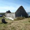
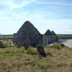
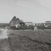
Lewis, Aignish, St Columba's Church
Burial Enclosure (Medieval), Church (Medieval), Cup Marked Stone (Period Unknown)(Possible), Grave Slab(S) (Medieval)
Site Name Lewis, Aignish, St Columba's Church
Classification Burial Enclosure (Medieval), Church (Medieval), Cup Marked Stone (Period Unknown)(Possible), Grave Slab(S) (Medieval)
Alternative Name(s) Chapel Of Ui Or Eye; St Columba's Church, Aiginish, Uidh; Old Kirk Of Eye; Eye Church; Aignish Church; Eaglais Na H-aoidhe
Canmore ID 4308
Site Number NB43SE 5
NGR NB 48469 32260
Datum OSGB36 - NGR
Permalink http://canmore.org.uk/site/4308
First 100 images shown. See the Collections panel (below) for a link to all digital images.
- Council Western Isles
- Parish Stornoway
- Former Region Western Isles Islands Area
- Former District Western Isles
- Former County Ross And Cromarty
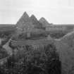
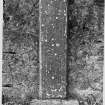
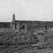
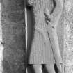
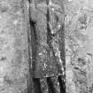
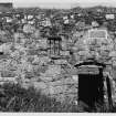
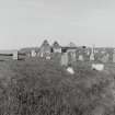
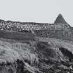
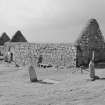
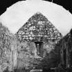
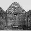
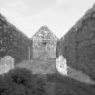
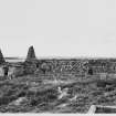
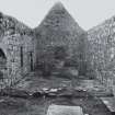
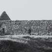
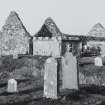
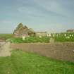
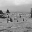
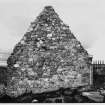
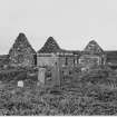
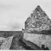
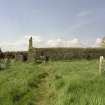
Church of St. Columba, Eye (Eaglais Chaluim Chille or Eaglais na h-Aoidhe/Uidh) 14 th century with 16th century enlargements Roughly coursed rubble ruin of what was once Lewis's foremost parish church, built on an earlier religious site said to have been founded by Columba's contemporary, St. Catan, and last used for worship in 1829. Under serious threat from coastal erosion, it has recently been consolidated. The original entrance in the middle of the south wall has at some time been blocked-up. Later enlargements included raising the unlit north wall and adding a chapel/burial aisle with tomb recess on the west gable. In the chancel - burial place of the Macleods of Lewis, formerly divided from the nave by a timber screen with loft above - two important graveslabs of c.1500 stand against the walls. Carved in hornblende schist, one depicts a knight with pointed helmet, said to be Roderick, 7th Chief (d. c.14 98), the other, with an inscription to his daughter Margaret Mackinnon (d.1503), an interlaced cross decorated with animals and foilage.
Taken from "Western Seaboard: An Illustrated Architectural Guide", by Mary Miers, 2008. Published by the Rutland Press http://www.rias.org.uk
NB43SE 5 48469 32260
(NB 4846 3225) Old Kirk of Eye (NR) (In Ruins)
OS 6" map, Ross-shire, 2nd ed., (1899)
Traditionally said to be on the site of a cell occupied by St Catan (6th or 7th century) and of a 'religious house'.
W C Mackenzie 1919.
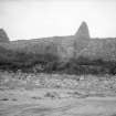
Roofless, but with walls complete, though in 1921 the W side was threatened by encroachment of the sea.
Originally a simple oblong, 61 3/4ft x 16 3/4ft within walls 2ft 8 ins to 3ft 5 ins thick, probably built in 14th century. In late 15th or early 16th century an addition 23ft x 16 1/4ft was made to the W end and the western gable partly reconstructed. Dedictated to St. Columba (M Martin 1934).
Two notable memorial slabs affixed to the walls: on the S Side, a high relief of a figure in the usual western style, evidently one of the Macleods of Lewis (17th century or earlier); on the N side a carved and inscribed slab to Margaret MacKinnon, daughter of Roderick Macleod and mother of John, the last Abbot of Iona. A third slab, with a single shallow cup 1 1/4 ins diameter cut in it, used to lie on the floor but could not be found in 1921.
RCAHMS 1928; M Martin 1934.
As described by RCAHMS
Visited by OS (A L F R) assistant archaeology officer 23 April 1964.
NB 485 322 A watching brief was undertaken as a condition of Scheduled Monument Consent on the construction of temporary arch supports in part of the church. No archaeological levels were disturbed; existing floor surfaces were recorded, including a fragment of sculptured stonework or graveslab.
A full report has been lodged with the NMRS.
Sponsor: Comhairle nan Eilean Siar.
C Knott 2000
NB 484 322 A general site assessment was undertaken, reviewing historical source material and evaluating the standing fabric of the ruined church (NMRS NB43SE 5) in advance of conservation works and coastal protection. A reassessment of the phasing of the church is presented whereby the chancel area is felt to represent the earliest surviving fabric, perhaps of the late 14th century. This was subsequently extended (nave walls) and the E gable rebuilt. The final phase represents the reconstruction of the W end and the addition of a substantial burial aisle, perhaps in the later 16th century.
Sponsor: Comhairle nan Eilean Siar.
T Addyman 2000.
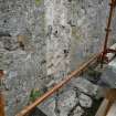
NB 484 322 Investigation of the wall heads of the ruin (NB43SE 5) was undertaken in October 2002 in order to identify any surviving evidence for the form of early roof structures in advance of possible reinstatement.
Turf was removed from the wall head at the NE corner of the main body of the church, revealing five sockets within the wall head masonry demonstrating the position of roof trusses at 0.75m intervals. Timber impressions survived to demonstrate that these had been roughly dressed and some 14-17cm in section. The lower ends of the rafters had been held in place by an ashlar-piece/sole-piece assembly. The easternmost rafter was embedded within the wall head of the E gable. The latter had apparently been detailed with flat skews and projecting skew-putts. This was considered to represent evidence for the last surviving roof structure over the main body of the church, which was itself not the original structure.
The junction with the existing W aisle roof was also examined. The internal cross wall dividing the two chambers relates to the construction of the W aisle, and some provision must have been made for the drop in level between the main roof to the E and the lower secondary roof structure to the W. In the 19th century, as the church became progressively derelict, the roof of the central part of the church was lost and its former junction with the W aisle roof structure (which was retained) was modified by a lowering of the wall head and the addition of new skews, the lowest skew still remaining in situ on either side. On the N side a few West Highland type slates also remain in place.
The W aisle roof structure differed in detail to that to the E, in that horizontal sockets at the upper internal wall heads showed that the roof had had wall plates on either side to which had presumably been affixed an ashlar-piece/sole-piece assembly. With a probable high collar it is possible that this chamber's roof structure had originally been lined with boards and painted.
Archive to be deposited in Western Isles SMR and the NMRS.
Sponsor: Urras Eaglais na h-Aoidhe (Uidh Church Trust).
T Addyman 2002
This chapel site was included in a research project to identify the chapel sites of Lewis and surrounding islands. The Lewis Coastal Chapel-sites survey recorded 37 such sites.
R Barrowman 2005
EXTERNAL REFERENCE:
Scottish Record Office
Building of new churches at Eye and Ness.
The one at Eye is to be built on the site of the delapidated chapel there.
Decision by the Commissioners for Highland Churches.
1825 GD 46/17/68
Field Visit (27 June 1921)
Eye Church.
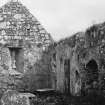
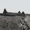
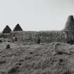
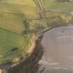
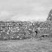
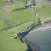
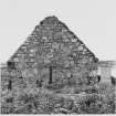
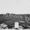
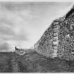
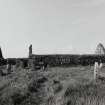
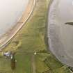
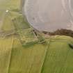
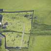
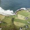
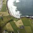
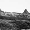
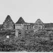
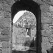
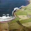
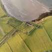
At the neck of the Eye Peninsula, 4 miles east of Stornoway, the ruinous church of Eye stands within a graveyard beside the shore; while the building is roofless the walls are complete. The church has been a single chamber oblong on plan, measuring 61 ¾ feet by 16 ¾ feet within walls 2 feet 8 inches to 3 feet 5 inches in thickness and 12 feet high, and was built probably in the 14th century. In the late 15th or early 16th century an addition measuring 23 feet by 16 ¼ feet was erected at the western end, the west gable then being partly reconstructed. The church is built of the local gneiss with a mingling of a coarse reddish sandstone also found close at hand; the latter material has been extensively used in repairs to the church walls. The original entrance to the church is near the middle of the south wall, and is 3 feet 7 inches wide with semicircular head, checks up. Four feet to the east of this door inside is another 2 feet 2 inches wide with pointed arched head chamfered, which has led into a projection (vestry?) now demolished. Over these doors are a small window splayed internally and, close together, two putlog holes with two corresponding on the north wall probably for the rood screen. There are also two small slit windows similarly splayed with pointed rear arches, while another 5 feet above floor to sill is situated in the centre of the east gable. A modern door with wooden lintel has been slapped through at the west end of the south wall and beside it, higher up, is a window 1 foot 7 ½ inches wide. In the centre of the west gable a door 3 feet 6. inches wide with semicircular head, chamfered arrises, checks and square sconsions, leads to the addition, which has been entered by a similar door, now a window, on the south. It has a semicircular-headed window 2 feet wide with chamfered arrises, checks and sconsions splayed internally in each outside wall. Below the window in the west wall is a semicircular arched recess 1 foot 9 inches wide by 1 foot 5 inches deep, with a bold edge roll and quirk moulding on jambs. A small recess, 1 foot 6 inches wide, has been built up in the north wall. The building generally is in a fair condition, but the northern side is threatened by an encroachment of the sea upon the sandy site. (Figs. 43, 44·)
CARVED SLABS.
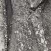
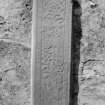
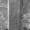
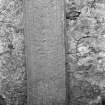
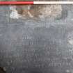
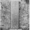
Now affixed to the walls of the church are two memorial slabs, which formerly lay on the floor. That on the south wall bears a figure in high relief of a usual western type, wearing a quilted coat reaching to the knees, a camail or tippet of mail on the neck and shoulders, and a pointed helm or bascinet. Elsewhere the bascinet and camail went out of fashion within the first quarter of the fifteenth century, after usage for about a century; but it is unsafe to base precise inferences for the Islands on this chronology. In the Highlands the quilted coat persists till the seventeenth century at least. The left hand of the figure rests upon the hilt of a sword with a pear-shaped pommel and quillons depressed towards the blade, while the right hand grasps a spear below the head. The slab undoubtedly commemorates one of the Macleods of Lewis, a line which failed earlv in the seventeenth century: any identification with a particular member can be only conjecture. (Fig. 42.) It is perhaps possible to collate it for an approximate date with the slab on the opposite wall. This shows an assemblage of carved devices, including both foliage and animals, with an elaborately designed panel at the top (Fig. 40). The whole surface is now much worn, as is also the inscription which was cut around its edges. Only a few detached words are fairly legible, but when in slightly better condition the whole was read as HIC JACET MARGARETA FILIA RODERICI MEI C LEOYD DE LEODHUIS VIDUA LACHLANNI MEIC FINGEONE OBIIT MoVoIII. Margaret Mackinnon was mother of John the last Abbot of Iona.
CUP- MARKED? STONE.
There used to lie on the floor of the church a stone of the shape of a graveslab, the underside of which bore about the centre of the surface a single shallow cup, 1 ¼ inch in diameter. The cup looked decidedly artificial in the close grained stone, but the slab cannot now be distinguished among the debris and vegetation.
HISTORICAL NOTE.
In 1506, John Polson ("Poylson"), precentor of Caithness, received a presentation to the rectory of Ey in Lewis in the event of its having to be vacated by John Macleod (1). In 1534 and 1536, Sir Magnus Vaus was rector, and in 1552, Sir Donald Monro, probably the Dean of that name, who wrote the Description of the Western Isles (1549) (2). The church was dedicated to Columba (3).
RCAHMS 1928, visited 27 June 1921
(1) Reg. Sec. Sig. i., No. 1332; (2) R.M.S., s.a.; (3) Martin.
OS map: Lewis xxviii.
Publication Account (1985)
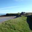
St Columba's church at Eye, the burying place of the MacLeods ofLewis, is believed to have been built on the site of the cell of St Catan, a contemporary of St Columba. The present buildings are probably medieval and clearly there are two periods of construction.
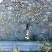
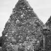
The eastern building is probably the older and is one of the largest pre-Reforrnation churches in the Western Isles. There are indications that the walls have been raised by over a metre and alterations made in the south wall; the original entrance near the middle of this wall is now blocked and the doorway is a later opening with a timber linel The only windows are on the south side and high in the east gable. The west end is pierced by a round-headed doorway leading to the smaller building. Local red sandstone is incorporated in its doors and windows. There is a blocked entrance on the south side of this building, and there have been windows in both side walls and the west wall; below the window, in the west gable, is an arched recess which may once have held a tomb.
Two carved stones are now clamped to the walls of the larger building. One depicts a warrior in a quilted coat, wearing a pointed helmet and grasping a spear and sword. The carving is probably 15th century and is popularly supposed to represent Roderick, 7th chief of the MacLeods of Lewis. The stone opposite, carved with a complex group of animals and foliage, has a Latin inscription which, in translation reads: 'Here lies Margareta, daughter of Rodericus MacLeod of Lewis, widow of Lachlan MacKinnon. She died in 1503'.
Information from ‘Exploring Scotland’s Heritage: Argyll and the Western Isles’, (1985).
Excavation (8 April 2008 - 9 April 2008)
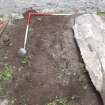
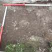
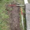
NB 4846 3225 In advance of the erection of a new gate at the entrance to the burial ground at Aoidhe church an excavation was undertaken on 8–9 April 2008 of the ground to be disturbed by the gate. The work located a possible occupation layer in the form of midden material including hand-made pottery at a depth of 0.75m below the present ground surface. The layers above this, which included iron slag of a possible medieval date, had been severely damaged by large concrete blocks inserted to support a previous gate.
Report: Comhairle nan Eilean Siar
Funder: HAIP, Archaeology Service, Achmore Old School, Achmore, Isle of Lewis
Catherine Dagg, 2008
Standing Building Recording (September 2010 - December 2010)
NB 4846 3226 A standing building survey was carried out September–December 2010 as part of an ongoing project to stabilise and conserve the now roofless remains of the medieval church of Eaglais na h-Aoidhe (St Columba’s), on behalf of Urras Eaglais na h-Aoidhe. Seven phases of building were identified, facilitated by classification of the mortars and plasters. Earliest was a 9.7m long fragment of a previously unrecognised earlier church identified within the N wall, built primarily of local coarse red sandstone and bonded in shell-lime mortar, presumably dating to the 13th or 14th centuries. This was extended at some time probably in the 14th century, creating a large parish church of simple rectangular plan divided between nave and chancel by a rood screen with loft over, lit by a rood loft light. Later, a lean-to sacristy or burial aisle was added to the S wall, and two adjacent pointed-arched doorways, both with dressings of fine sandstone, were inserted. After a series of further alterations, the aisle was removed, and a substantial chapel/burial aisle with round-headed arches was added to the W end. This work involved the first use of limestone mortar, as well as roof level detailing such as corbels, kneelers and at least one rainwater spout. After further remodelling and use of the nave, the main church roof was eventually removed with some care, the W annex converted to a stand-alone chapel, and a new area set aside for burial monuments in the former chancel in the 18th century. By the mid-19th century the building was effectively abandoned and the remaining roof lost, although the surrounding graveyard continued in use.
Archive: RCAHMS (intended). Report: CNES SMR
Funder: Historic Scotland, Comhairle Nan Eilean Siar and Stornoway Trust
Carol Knott and Mark Thacker, 2010
Watching Brief (November 2011 - June 2012)
NB 4846 3226 An intermittent watching brief was maintained November 2011 – June 2012 on ground disturbance associated with conservation work on the standing walls of the roofless church of Eaglais na h-Aoidhe (St Columba’s). Some minor additional details mostly relating to the interior E end of the church were added to a previous survey (DES 2011, 198). The dwarf cross wall abutting the chancel walls, apparently defining a post-medieval burial enclosure, was found to be of clay- and earth-bonded construction, as was the latest infill of the adjacent arched wall recess. A sequence of thin gravels immediately overlying grave-earth containing dispersed fragments of human bone was also recorded in this area.
Archive: RCAHMS (intended). Report: CNES SMR and RCAHMS
Funder: Historic Scotland, Comhairle nan Eilean Siar, Point Community Council and LEADER
Carol Knott,
2012
Watching Brief (August 2012)
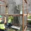
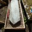
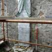
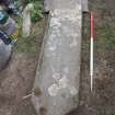
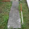
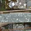
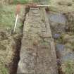
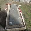
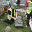
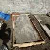
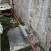
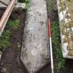
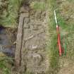
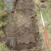
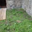
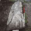
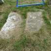
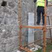
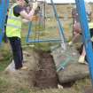
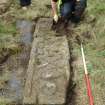
NB 48469 32260 A programme of archaeological work was carried out in August 2012 during conservation work which required the lifting of two upstanding stone slabs and five recumbent stone slabs. No features, deposits or artefacts of archaeological significance were found in association with any of the stones, but a small quantity of disarticulated human bone was recovered and reinterred at or close to its original location. A piece of cranium visible in the section left by Stone 4 was left in situ and reburied. A trial trench excavated in the NW corner of the main chapel identified numerous rounded to sub-angular stones immediately below the surface. The purpose of these stones is unclear, but there was no indication that they served any structural function.
Archive: CNES SMR and RCAHMS
Funder: Nicolas Boyes Stone Conservation on behalf of Urras Eaglais na h-Aoidhe
Magnus Kirby, CFA Archaeology Ltd
2012
Watching Brief (July 2012)
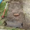
NB 48469 32260 A watching brief was carried out in July 2012 during the installation of four ground struts in the W chapel and the installation of new surfaces in the nave. A possible brick foundation for a burial enclosure and a stone slab grave kerb, both burials post-dating the abandonment of the church in 1829, were recorded in the first strut trench. The internal ground level in the chapel was raised to avoid any further disturbance of the deposits.
Archive: RCAHMS (intended)
Funder: The Uidh Church Trust
Cecily Spall, FAS Heritage, 2013
(Source: DES)
Project (22 August 2017 - 1 September 2017)
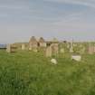
NB 48469 32260 A programme of geophysical survey was undertaken, 22 August – 1 September 2017, within Eaglais na h-Aoidhe and its graveyard as part of wider research into the graveyard and its burials. The Church of St Columba, Eye (Eaglais Chaluim Chille or Eaglais na h-Aoidhe/Uidh) is largely from the 14th century with 16th-century enlargements.
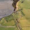
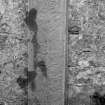
The survey aimed to identify possible buried grave slabs and potential earlier features in the church and graveyard, an area of c0.5ha. Survey was also extended beyond the existing graveyard walls, covering an additional 0.5ha, with the aim of identifying the potential earlier limits of the graveyard. The resistance and ground penetrating radar (GPR) surveys detected a wealth of anomalies which supported as well as complemented each other. The resistance survey and limited GPR survey beyond the current graveyard walls predominately identified agricultural trends, natural variations and rabbit activity. However, to the E of the extant graveyard wall a high resistance anomaly consistent with potential wall footings has been detected which may indicate an original eastern extent of the graveyard.
Within the graveyard the results can be broadly divided into responses from burials, possible earlier limits of the graveyard, potential structural features and natural variations. Generally, the resistance survey has not clearly identified burials. However, the GPR survey has identified a wealth of burials. The GPR shows a clear distinction between burials in the W and the E of the graveyard with the responses in the western half much more coherent and regular. There are indications of a boundary suggesting the western original limit of the graveyard prior to the western extension.
Of possible interest is an apparent lack of burials in the area of a group of family burial plots which lie on an area of high ground in the SE of the graveyard. It may simply be that the relatively steep slope in this area precluded burials, but a resistance anomaly suggestive of a possible structure has also been detected in this area. However, interpretation of a possible structure is extremely tentative. Furthermore, the remnants of two possible mausoleums and/or burial plots have been tentatively identified in the data, although one appears to have been removed. Unfortunately, no clearly defined structures were identified within or adjacent to the church. This is thought to be due to the extensive amount of ground disturbance and tumble within these areas.
Archive: Rose Geophysical Consultants
Funder: The Ui Church Trust funded by Heritage Lottery Fund
Susan Ovenden – Rose Geophysical Consultants
(Source: DES, Volume 18)
Resistivity (22 August 2017 - 1 September 2017)
NB 48469 32260 Resistivity survey.
Archive: Rose Geophysical Consultants
Funder: The Ui Church Trust funded by Heritage Lottery Fund
Susan Ovenden – Rose Geophysical Consultants
(Source: DES, Volume 18)
Ground Penetrating Radar (22 August 2017 - 1 September 2017)
NB 48469 32260 Ground penetrating radar survey.
Archive: Rose Geophysical Consultants
Funder: The Ui Church Trust funded by Heritage Lottery Fund
Susan Ovenden – Rose Geophysical Consultants
(Source: DES, Volume 18)
Note
Title: Chapel-sites on the Isle of Lewis: Results of the Lewis Coastal Chapel-sites Survey
Journal: SCOTTISH ARCHAEOLOGICAL INTERNET REPORTS (e-ISSN: 2056-7421)
Author: Barrowman, R C
Publisher: Society of Antiquaries of Scotland, Edinburgh
Date: 2020
MCE (2023): Reviewed as part of the GAPR. Publication was completed in 2020. Open Access publication with SAIR. Publication grant-aided by HES.


