|
Photographs and Off-line Digital Images |
AYD 10/1 P |
Records of the Royal Commission on the Ancient and Historical Monuments of Scotland (RCAHMS), Edinbu |
Inked drawing; Craigie Hill, Fort.
Photographic copy. |
c. 1953 |
Item Level |
|
|
Prints and Drawings |
AYD 10/2 |
Records of the Royal Commission on the Ancient and Historical Monuments of Scotland (RCAHMS), Edinbu |
Plane-table survey (redrawn): Craigie Hill, Fort. |
c. 1953 |
Item Level |
|
|
Prints and Drawings |
AYD 10/3 |
Records of the Royal Commission on the Ancient and Historical Monuments of Scotland (RCAHMS), Edinbu |
Plane-table survey: Craigie Hill, Fort. |
17/3/1953 |
Item Level |
|
|
Manuscripts |
MS 36/174 |
Records of the Royal Commission on the Ancient and Historical Monuments of Scotland (RCAHMS), Edinbu |
Field notebook of K A Steer (RCAHMS). 'S7 - Ayr, Wigtown'. |
24/5/1952 |
Item Level |
|
|
Prints and Drawings |
AYD 10/1 |
Records of the Royal Commission on the Ancient and Historical Monuments of Scotland (RCAHMS), Edinbu |
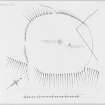
Inked drawing; Craigie Hill, Fort. |
c. 1953 |
Item Level |
|
 |
On-line Digital Images |
DP 148747 |
Records of the Royal Commission on the Ancient and Historical Monuments of Scotland (RCAHMS), Edinbu |
Inked plan; Craigie Hill Fort. |
c. 1953 |
Item Level |
|
 |
On-line Digital Images |
DP 148748 |
Records of the Royal Commission on the Ancient and Historical Monuments of Scotland (RCAHMS), Edinbu |
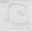
Plane-table survey (redrawn); Craigie Hill, fort. |
c. 1953 |
Item Level |
|
 |
On-line Digital Images |
DP 148749 |
Records of the Royal Commission on the Ancient and Historical Monuments of Scotland (RCAHMS), Edinbu |
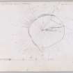
Plane-table survey; Craigie Hill Fort. |
17/3/1953 |
Item Level |
|
 |
Digital Files (Non-image) |
WP 000760 |
Records of the Royal Commission on the Ancient and Historical Monuments of Scotland (RCAHMS), Edinbu |
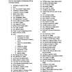
Scanned copy of RCAHMS Marginal Land Survey unpublished typescripts (Ayrshire), with index. |
1952 |
Item Level |
|
 |
On-line Digital Images |
SC 2425256 |
Records of the Ordnance Survey, Southampton, Hampshire, England |
Craigie Hill, NS43SW 4, Ordnance Survey index card, page number 1, Recto |
c. 1958 |
Item Level |
|
 |
On-line Digital Images |
SC 2425257 |
Records of the Ordnance Survey, Southampton, Hampshire, England |
Craigie Hill, NS43SW 4, Ordnance Survey index card, Recto |
c. 1958 |
Item Level |
|
 |
On-line Digital Images |
SC 2425258 |
Records of the Ordnance Survey, Southampton, Hampshire, England |
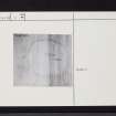
Craigie Hill, NS43SW 4, Ordnance Survey index card, Recto |
c. 1958 |
Item Level |
|
 |
On-line Digital Images |
SC 2425259 |
Records of the Ordnance Survey, Southampton, Hampshire, England |
Craigie Hill, NS43SW 4, Ordnance Survey index card, Recto |
c. 1958 |
Item Level |
|
 |
On-line Digital Images |
SC 2425260 |
Records of the Ordnance Survey, Southampton, Hampshire, England |
Craigie Hill, NS43SW 4, Ordnance Survey index card, Recto |
c. 1958 |
Item Level |
|
|
All Other |
551 166/1/1 |
Records of the Ordnance Survey, Southampton, Hampshire, England |
Archaeological site card index ('495' cards) |
1947 |
Sub-Group Level |
|