
Clachaig, Glenlean Blackpowder Works


Gunpowder Works (19th Century)
Site Name Clachaig, Glenlean Blackpowder Works
Classification Gunpowder Works (19th Century)
Alternative Name(s) Glan Lean; Clyde Gunpowder Mills; Clyde Mills; Clyde Powder Mills
Canmore ID 40783
Site Number NS18SW 5
NGR NS 12045 81475
Datum OSGB36 - NGR
Permalink http://canmore.org.uk/site/40783


- Council Argyll And Bute
- Parish Dunoon And Kilmun
- Former Region Strathclyde
- Former District Argyll And Bute
- Former County Argyll
NS18SW 5 centred 122 814
Works (dis) [at NS 1247 8147]
OS (GIS) MasterMap, May 2010.
Spans the boundary between the parishes of Dunoon and Kilmun, and Inverchaolain.
(undated) information in NMRS.
(Location cited as NS 11 81). Gunpowder Works, Clachaig, Glenlean: built c. 1840. An interesting group of roofless ruins.
J R Hume 1977.
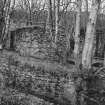
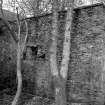
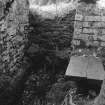
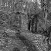
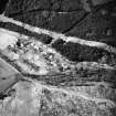
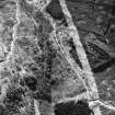
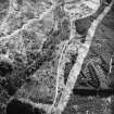
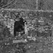
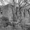
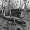
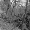
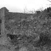
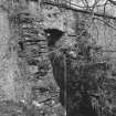
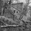
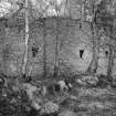
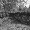
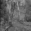
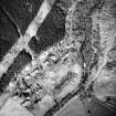
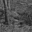
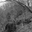
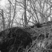
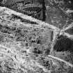
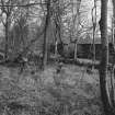
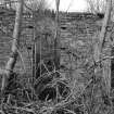
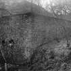
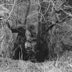
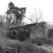
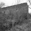
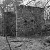
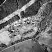
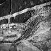
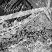
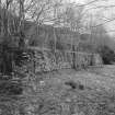
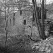
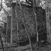
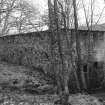
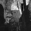
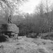
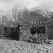
The remains of several large stone buildings, all contained within a high stone wall. This was one of four large black gunpowder works which operated in Argyll in the 19th century, attracted to the area by its lack of sizeable settlements, its accessibility by sea, and the availability of wood suitable for making charcoal.
Incorporating was the most dangerous operation in gunpowder manufacture, apart from drying. The works was operated by Curtis's and Harvey, which became part of Nobel's Explosives Co Ltd. Latterly it made sporting powder. It closed in 1892. (RCAHMS)
Field Visit (May 1989)
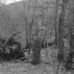
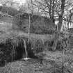
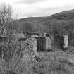
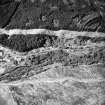
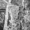
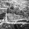
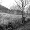
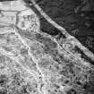
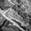
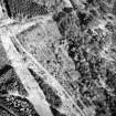
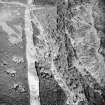
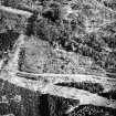
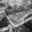
The extensive remains of the 'Clyde Powder Mills' are situated on the S side of the B836 road at the lower (E) end of Glen Lean, where the Little Eachaig River forms a narrow gorge 3km W of the head of the Holy Loch. The works were established shortly before 1838, when an explosion was reported, the proprietor being Robert Sheriff who subsequently established the Lochfyne Powder Works (No. 244) and sold those at Clachaig to Curtis and Harvey, the Faversham (Kent) manufacturers. The original work-force of about thirty was greatly expanded during the Crimean War, and in 1855 it was reported that 'a great many new first-class powder mills, driven by water power, have been erected .... A neat school-house, used on Sundays as a preaching station, has been built, while several cottages for the workmen have also been thrown up'. The works were closed down in 1876, when Curtis and Harvey acquired the Kames works (No. 242), but re-opened to manufacture sporting powder from 1891 to 1903, when the machinery was removed and the roofs were dismantled (1).
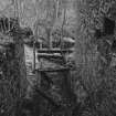
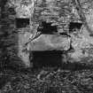
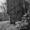
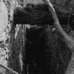
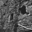
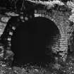
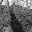
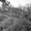
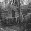
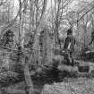
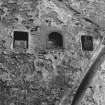
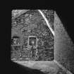
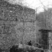
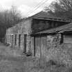
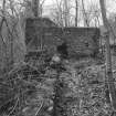
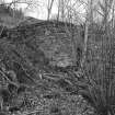
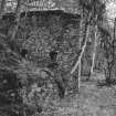
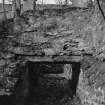
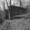
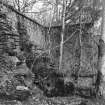
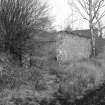
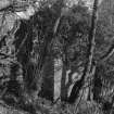
The site, which was surrounded by a high stone wall, extended for about 500m along the N bank of the river, and water-power was provided through upper and lower lades supplied from a rubble-built dam spanning the river immediately to the W (NS 119814). Remains of about twenty rubble-built structures survive, many of them in bank-side positions in the E part of the site. An early photograph (2) shows that some of those adjoining the road at the upper edge of the site were of two storeys and that many had hipped and slated roofs, although those housing more volatile processes are said to have had light peat-covered roofs. The buildings included mixing-, granulating-, pressing-, glazing-, dusting- and heading-houses, as well as offices, stables, refineries and a laboratory, but the site is heavily wooded and few of these can be identified. Comparison of maps surveyed in 1869 and 1900 (3) shows that few new buildings were added in that period, although some may have been rebuilt. Two brick chimneys, probably for boilers employed in the drying process, are visible in the early photograph, and surviving circular footings may represent a horse-engine house.
Five incorporating-mills are identifiable, each having a central waterwheel-pit, served by an open or underground lade, between open-fronted chambers which once contained pan-mills with edge-running millstones. Four are of the normal two-chambered type but the other has two pairs of chambers. These mills have all been enlarged from a lean-to form by extensions which increased the depth of the chambers and raised them to level coped wall-heads. One example had two chambers about 4.5m square and sloping from 5m to 2.6m in height at the front, but each was lengthened by 3.5m and raised to a uniform 5m. All five mills have cast-iron wall-boxes to house large timber cross-beams, which have not survived. A series of rubble-built magazines, extending for 900m from E to Wand linked by a horse-drawn tramway, were constructed along the boundary-wall S of the river, after 1869 and probably after the works re-opened in 1891. A typical example, built into the slope and measuring 7m by 4m over 0.5m walls, has windows in the end-walls and is enclosed by rubble-faced baffle-walls 2.5m thick.
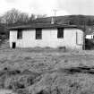
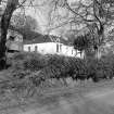
Workers' accommodation was provided in detached or terraced houses along the S side of the public road W of the works, and the single-storeyed five-bay manager's house, with a gabled porch bearing the datestone '1863', stands N of the road, adjoining a quarry which supplied the rubble used on the site. A cooperage was maintained until 1871 at Sandbank, where raw materials were imported and the finished product was shipped.
RCAHMS (1992)
Visited by RCAHMS, May 1989

