|
Photographs and Off-line Digital Images |
H 92222 PO |
Cambridge University Collection for Aerial Photography |
Oblique aerial view centred on the township of Sgal Mór with farmsteads, head-dykes and burial ground adjacent, taken from the NNW. The township of Crowlista lies in the foreground. |
2/8/1965 |
Item Level |
|
|
Photographs and Off-line Digital Images |
H 92223 PO |
Cambridge University Collection for Aerial Photography |
Oblique aerial view centred on the township of Sgal Mór with farmsteads, head-dykes and burial ground adjacent, taken from the NNW. The township of Crowlista lies in the foreground. |
2/8/1965 |
Item Level |
|
|
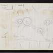
Photographs and Off-line Digital Images |
H 92334 PO |
Central Excavation Unit |
Oblique aerial view centred on the burial-ground and remains of the hut-circles and the possible location of the `Lewis Chessmen¿ gaming pieces, taken from the NNW. |
1980 |
Item Level |
|
 |
Digital Files (Non-image) |
WP 003958 |
Publications by the Royal Commission on the Ancient and Historical Monuments of Scotland |
Ninth report with inventory of monuments and constructions in the Outer Hebrides, Skye and the Small Isles |
1928 |
Item Level |
|
|
Photographs and Off-line Digital Images |
SC 1927210 |
Cambridge University Collection for Aerial Photography |
Oblique aerial view centred on the township of Sgal Mór with farmsteads, head-dykes and burial ground adjacent, taken from the NNW. The township of Crowlista lies in the foreground. |
2/8/1965 |
Item Level |
|
|
Photographs and Off-line Digital Images |
SC 1927211 |
Cambridge University Collection for Aerial Photography |
Oblique aerial view centred on the township of Sgal Mór with farmsteads, head-dykes and burial ground adjacent, taken from the NNW. The township of Crowlista lies in the foreground. |
2/8/1965 |
Item Level |
|
 |
On-line Digital Images |
SC 2345072 |
Records of the Ordnance Survey, Southampton, Hampshire, England |
Lewis, Ardoil, NB03SW 6, Ordnance Survey index card, Recto |
1958 |
Item Level |
|
 |
On-line Digital Images |
SC 2345073 |
Records of the Ordnance Survey, Southampton, Hampshire, England |
Lewis, Ardoil, NB03SW 6, Ordnance Survey index card, page number 1, Recto |
1958 |
Item Level |
|
 |
On-line Digital Images |
SC 2345074 |
Records of the Ordnance Survey, Southampton, Hampshire, England |
Lewis, Ardoil, NB03SW 6, Ordnance Survey index card, page number 2, Verso |
1958 |
Item Level |
|
 |
On-line Digital Images |
SC 2345075 |
Records of the Ordnance Survey, Southampton, Hampshire, England |
Lewis, Ardoil, NB03SW 6, Ordnance Survey index card, Recto |
1958 |
Item Level |
|
 |
On-line Digital Images |
SC 2345076 |
Records of the Ordnance Survey, Southampton, Hampshire, England |
Lewis, Ardoil, NB03SW 6, Ordnance Survey index card, Recto |
1958 |
Item Level |
|
|
All Other |
551 166/1/1 |
Records of the Ordnance Survey, Southampton, Hampshire, England |
Archaeological site card index ('495' cards) |
1947 |
Sub-Group Level |
|


