Pricing Change
New pricing for orders of material from this site will come into place shortly. Charges for supply of digital images, digitisation on demand, prints and licensing will be altered.
Bute, Rothesay, St Mary's Well
Well (Period Unassigned), Well Head (19th Century)
Site Name Bute, Rothesay, St Mary's Well
Classification Well (Period Unassigned), Well Head (19th Century)
Canmore ID 40384
Site Number NS06SE 2
NGR NS 08667 63750
Datum OSGB36 - NGR
Permalink http://canmore.org.uk/site/40384
- Council Argyll And Bute
- Parish Rothesay
- Former Region Strathclyde
- Former District Argyll And Bute
- Former County Buteshire
NS06SE 2 0866 6374
Well (NAT)
OS 6" map (1869)
(NS 0867 6372) St Mary's Well (NR)
OS 6" map (1924)
The well-housing is of sandstone blocks in the shape of a solid arch approx 4ft high. A metal insert contains a turn-knob and water-outlet. The feature is in sound condition but dry.
Information from OS Reviser (JR), 19 June 1954.
NS 0866 6374. This well is as described. The housing appears to be modern and the well is disused.
Visited by OS (WDJ) 14 January 1964
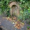
This well stands on the E side of the B881 public road 65m NE of St Mary’s Chapel (NS06SE 1). The top of the shaft is formed of dressed sandstone blocks into which a modern drain cover has been set and the wellhead comprises a tri-partite Romanesque arched recess set into a later rubble boundary wall. This arch is inscribed ‘St Mary’s Well’ and a metal tethering ring, probably for a cup or ladle, is attached. The turn-knob and water-outlet (tap) noted in 1954 have been removed.
A well is depicted at this location on the 1st edition of the 6-inch OS map (Buteshire 1869, Sheet CCIV).
Visited by RCAHMS (GFG, JRS) 13 September 2010.
Field Visit (19 June 1954)
The well-housing is of sandstone blocks in the shape of a solid arch approx 4ft high. A metal insert contains a turn-knob and water-outlet. The feature is in sound condition but dry.
Information from OS Reviser (JR), 19 June 1954.
Desk Based Assessment (24 September 1954)
Well (NAT)
OS 6" map (1869)
(NS 0867 6372) St Mary's Well (NR)
OS 6" map (1924)
The well-housing is of sandstone blocks in the shape of a solid arch approx 4ft high. A metal insert contains a turn-knob and water-outlet. The feature is in sound condition but dry.
Information from OS Reviser (JR), 19 June 1954.
Information from OS (CFW) 24 September 1954
Field Visit (14 January 1964)
NS 0866 6374. This well is as described. The housing appears to be modern and the well is disused.
Visited by OS (WDJ) 14 January 1964
Field Visit (13 September 2010)
This well stands on the E side of the B881 public road 65m NE of St Mary’s Chapel (NS06SE 1). The top of the shaft is formed of dressed sandstone blocks into which a modern drain cover has been set and the wellhead comprises a tri-partite Romanesque arched recess set into a later rubble boundary wall. This arch is inscribed ‘St Mary’s Well’ and a metal tethering ring, probably for a cup or ladle, is attached. The turn-knob and water-outlet (tap) noted in 1954 have been removed.
A well is depicted at this location on the 1st edition of the 6-inch OS map (Buteshire 1869, Sheet CCIV).
Visited by RCAHMS (GFG, JRS) 13 September 2010.


