
Bute, Little Dunagoil


Non Antiquity (Period Unassigned)
Site Name Bute, Little Dunagoil
Classification Non Antiquity (Period Unassigned)
Canmore ID 40290
Site Number NS05SE 3
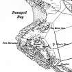
NGR NS 08712 53331
Datum OSGB36 - NGR
Permalink http://canmore.org.uk/site/40290


- Council Argyll And Bute
- Parish Kingarth
- Former Region Strathclyde
- Former District Argyll And Bute
- Former County Buteshire
NS05SE 3 08712 53331.
(NS 0871 5332) Cup Marked Stone (NR)
OS 6" map, (1957)
This flat-topped boulder, with 2 deep oval cups, has been moved by the farmer to the boggy area just NW of the SE wall of the field, 40 yds fro the E corner.
R W B Morris and D C Bailey 1967; Information contained in letter from R W B Morris to OS, 1 September 1966.
Built into the wall of a medieval longhouse associated with NS05SE 14 is a stone 1.0m high by 0.9m by 0.3m thick with two cup marks on its W side. Both of the cups are 0.02m deep, one being 0.08m in diameter and the other 0.06m. The farmer at Dunagoil has no recollection of having moved this stone and no knowledge of any other similar stone in the vicinity.
Surveyed at 1:10 000.
Visited by OS (B S) 23 November 1976.
The two cup marks on a boulder built into the SE wall of a medieval building (see NS05SE 30) are natural. The stone was first noted by Marshall (1915, 43) and was depicted on the 3rd edition of the OS 25-inch map revised in 1915 (Buteshire 1924, Sheet CCVII.2); the immediate area was not excavated during Marshall’s excavations of the building between 1958 and 1961 (1964, 30).
Visited by RCAHMS (GFG, AGCH, ARG) 20 March 2009.
Reference (1915)
Field Visit (1915)
Reference (1964)
Desk Based Assessment (4 February 1972)
This flat-topped boulder, with 2 deep oval cups, has been moved by the farmer to the boggy area just NW of the SE wall of the field, 40 yds from the E corner.
R W B Morris and D C Bailey 1967; Information contained in letter from R W B Morris to OS, 1 September 1966.
Field Visit (23 November 1976)
Built into the wall of a medieval longhouse associated with NS05SE 14 is a stone 1.0m high by 0.9m by 0.3m thick with two cup marks on its W side. Both of the cups are 0.02m deep, one being 0.08m in diameter and the other 0.06m. The farmer at Dunagoil has no recollection of having moved this stone and no knowledge of any other similar stone in the vicinity.
Surveyed at 1:10 000.
Visited by OS (B S) 23 November 1976.
Reference (2004)
Field Visit (20 March 2009)
The two cup marks on a boulder built into the SE wall of a medieval building (see NS05SE 30) are natural. The stone was first noted by Marshall (1915, 43) and was depicted on the 3rd edition of the OS 25-inch map (Buteshire 1915, Sheet CCVII.2); the immediate area was not excavated during Marshall’s excavations of the building between 1958 and 1961 (1964, 30).
Visited by RCAHMS (GFG, AGCH, ARG) 20 March 2009.

