Scheduled Maintenance
Please be advised that this website will undergo scheduled maintenance on the following dates: •
Every Thursday from 17th October until 7th November from 11:00 to 15:00 •
Tuesday, 22nd October from 11:00 to 15:00
During these times, some services may be temporarily unavailable. We apologise for any inconvenience this may cause.
Bute, Scalpsie
Burial Cairn (Bronze Age), Short Cist (Bronze Age), Bead (Jet)(Bronze Age), Food Vessel (Bronze Age)
Site Name Bute, Scalpsie
Classification Burial Cairn (Bronze Age), Short Cist (Bronze Age), Bead (Jet)(Bronze Age), Food Vessel (Bronze Age)
Canmore ID 40232
Site Number NS05NE 10
NGR NS 05954 58736
Datum OSGB36 - NGR
Permalink http://canmore.org.uk/site/40232
- Council Argyll And Bute
- Parish North Bute
- Former Region Strathclyde
- Former District Argyll And Bute
- Former County Buteshire
NS05NE 10 05954 58736.
(NS 0597 5873) Tumulus (NR)
OS 6" map, (1957)
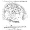
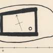
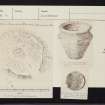
This nearly circular tumulus is about 45ft in diameter and 4ft-5ft high, covered with whin bushes. It was excavated by Bryce. The outer part was of earth, with a few large stones, while the core was of large boulders. Underneath was a short cist containing an inverted food vessel (Childe's type Blb), jet bead, bronze pin, flint scraper, a few fragments of flint and many fragments of burnt human bones. The finds are in the National Museum of Antiquities of Scotland (NMAS).
T H Bryce 1904; V G Childe 1946.
Reference (1893)
Excavation (1903)
Reference (1946)
Desk Based Assessment (25 June 1976)
This nearly circular tumulus is about 45ft in diameter and 4ft-5ft high, covered with whin bushes. It was excavated by Bryce. The outer part was of earth, with a few large stones, while the core was of large boulders. Underneath was a short cist containing an inverted food vessel (Childe's type Blb), jet bead, bronze pin, flint scraper, a few fragments of flint and many fragments of burnt human bones. The finds are in the National Museum of Antiquities of Scotland (NMAS).
T H Bryce 1904; V G Childe 1946.
Field Visit (27 October 1976)
A cairn measuring 15.0m EW by 12.0m transversely and 1.2m high.
Surveyed at 1:10 000.
Visited by OS (B S) 27 October 1976.
Field Visit (6 May 2009)
NS05NE 10 05954 58736
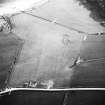
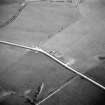
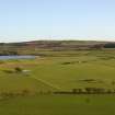
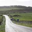
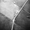
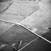
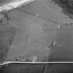
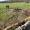
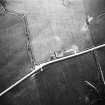
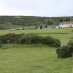
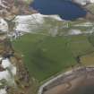
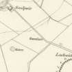
This barrow is situated at the edge of a field of improved pasture 290m SE of Scalpsie farmsteading (NS05NE 110). Measuring a maximum of 15m in diameter by about 1.5m in height, erosion to the N side of the grass-and gorse-grown mound shows that it is composed largely of small boulders and beach cobbles. Loose stones that are visible on the surface of the cairn may be the result of Bryce’s excavation (1904).The site is depicted on the 1st edition of the Ordnance Survey 6-inch map (Buteshire 1869, sheet CCXV) and is annotated 'Tumulus'.
Visited by RCAHMS (AGCH) 6 May 2009.
Reference (2009)
Field Visit (2009 - 2010)
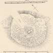
This subcircular cairn lies on the edge of the same field as Feature 45, immediately adjacent to the road. It measures 15m E-W by 12m N-S and stands around 1m high. It was excavated by Bryce in 1903 (Bryce 1903) and found to contain a short cist covered by a massive capstone. Within the cist were fragments of human bone, a jet bead, a bronze pin, a flint scraper, some pieces of flint and a complete inverted Bronze Age food vessel. These finds are now in the National Museum in Edinburgh. The cairn has long been overgrown with gorse, but in March 2010 the gorse bushes were removed, exposing the earthen mound of the cairn. The mound has been disturbed by burrowing animals and is now exposed to further damage by sheep, so we took the opportunity to record it as it appeared in March 2010. The cairn was partly re-excavated under the supervision of Paul Duffy in July 2010 (Duffy, forthcoming).
Measured Survey (2009 - 2010)
A series of measured drawings undertaken as part of ACFA's CARES project.
Excavation (August 2010 - September 2010)
NS 05954 58736 A three week community archaeology programme was undertaken at Scalpsie Barrow in August and September 2010, as part of the wider audit and enhancement of archaeological resources programme facilitated by the DBLPS.
The site comprises a sub-circular earth and stone mound, c15m in diameter and c1m high. A previous excavation by TH Bryce in 1903 had identified the presence of a central cist containing a cremation deposit, food vessel, flint knife and a jet bead. The current project aimed to identify the extent of subsequent rabbit and root damage to the monument and to locate and excavate the original trench dug by Bryce.
Excavation of the NE quadrant of the barrow revealed a complex stratigraphic sequence. Phase 1 is represented by the construction of a presumed surrounding ditch, an internal kerb of sub-rounded and sub-angular cobbles, and the slight enhancement of a natural sandy knoll. A burning episode at the northern end of the site (phase 2) produced a deposit of charcoal and partially vitrified sand and stone which abutted the kerb and filled the ditch. These deposits were then covered with a larger earthen mound (phase 3), which was revetted with a kerb of sub-rounded and sub-angular large cobbles, internal to the phase 1 kerb. The site was then covered with a layer of turf (phase 4), although it is unclear at present whether this was natural or anthropogenic in origin. No trace of an earlier excavation trench was observed outside of a central ‘hole’, presumably dug by Bryce to recover the cist and contents.
The key relationships between the construction phases of the barrow, the cist and the deposition of a partially intact beaker style pottery vessel found in the centre of the barrow were, unfortunately, largely obscured by rabbit damage and Bryce’s excavation trench. However, it is provisionally suggested on the basis of the available evidence that phases 1 and 2 are related to the deposition of the beaker style pottery, and that phase 3 is related to the construction of the cist excavated by Bryce. More detailed post-excavation analysis is required to clarify these provisional findings.
Archive: Bute Museum and RCAHMS (intended)
Funder: Heritage Lottery Fund, Argyll and Bute Council and Historic Scotland
Paul Duffy – Discover Bute Landscape Partnership Scheme
Project (5 June 2010 - 12 June 2010)
An integrated geophysical survey was conducted in an area with a burial cairn (NS05NE 9) and a barrow (NS05NE 10) at Scalpsie Bay 5–12 June 2010. The general aim was to gain a better understanding of these structures, to collate data for a PhD research project and to help in the planning of an excavation at the barrow by the DBLPS (DES 2010, 49).
An extensive magnetic gradiometer survey was undertaken to determine the extent of the cairns and any other features. The survey was carried out at 0.5 x 0.13m intervals covering 3.56ha. Targeted magnetic susceptibility, earth resistance and ground penetrating radar surveys were carried out over the burial cairn to clarify its current shape and depth.
The gradiometer survey mapped the two cairns and their immediate environs. The detected remains of the burial cairn measured c 37m E–W, 33m N–S and 48m NE–SW. The dimensions of the barrow were c15m N–S by 16m NE–SW. The presence of a metal fence to the E of the barrow prevented a full survey in that direction.
The multi-technique geophysical survey revealed anomalies associated with the cairns. Distinctive dipolar anomalies were detected in front of a possible entrance and surrounding the burial cairn. Low resistance anomalies around the burial cairn suggest a possible truncated ditch. Other trends and circular anomalies were detected inside the burial cairn. The GPR data recorded reflections of interest underlying the structure to a depth of 1m. The survey also detected features related to historical periods (eg old field boundaries and evidence of cultivation marks) as well as areas of disturbance in the burial cairn and geological features within the surveyed area. No remains suggesting the presence of the building which is mentioned in the RCAHMS database were identified.
Archive: DBLPS project (deposited) and RCAHMS (intended)
Funder: NERC and Discover Bute Landscape Partnership Scheme
University of Glasgow 2010
Magnetic Susceptibility (5 June 2010 - 12 June 2010)
Targeted magnetic susceptibility survey carried out over the burial cairn to clarify its current shape and depth.
Archive: DBLPS project (deposited) and RCAHMS (intended)
Funder: NERC and Discover Bute Landscape Partnership Scheme
University of Glasgow 2010
Ground Penetrating Radar (5 June 2010 - 12 June 2010)
Ground Penetrating Radar was conducted in an area with a burial cairn (NS05NE 9) and a barrow (NS05NE 10) at Scalpsie Bay 5–12 June 2010.
Archive: DBLPS project (deposited) and RCAHMS (intended)
Funder: NERC and Discover Bute Landscape Partnership Scheme
University of Glasgow 2010
Resistivity (5 June 2010 - 12 June 2010)
A resistance survey was conducted in an area with a burial cairn (NS05NE 9) and a barrow (NS05NE 10) at Scalpsie Bay 5–12 June 2010.
Archive: DBLPS project (deposited) and RCAHMS (intended)
Funder: NERC and Discover Bute Landscape Partnership Scheme
University of Glasgow 2010
Magnetometry (5 June 2010 - 12 June 2010)
A gradiometer survey was conducted in an area with a burial cairn (NS05NE 9) and a barrow (NS05NE 10) at Scalpsie Bay 5–12 June 2010.
Archive: DBLPS project (deposited) and RCAHMS (intended)
Funder: NERC and Discover Bute Landscape Partnership Scheme
University of Glasgow 2010


