Following the launch of trove.scot in February 2025 we are now planning the retiral of some of our webservices. Canmore will be switched off on 24th June 2025. Information about the closure can be found on the HES website: Retiral of HES web services | Historic Environment Scotland
Skipness Castle
Tower House (Medieval)
Site Name Skipness Castle
Classification Tower House (Medieval)
Canmore ID 39798
Site Number NR95NW 5
NGR NR 90819 57794
Datum OSGB36 - NGR
Permalink http://canmore.org.uk/site/39798
First 100 images shown. See the Collections panel (below) for a link to all digital images.
- Council Argyll And Bute
- Parish Saddell And Skipness
- Former Region Strathclyde
- Former District Argyll And Bute
- Former County Argyll
NR95NW 5 NR 90819 57794.
(NR 9078 5778) Skipness Castle (NR)
OS 6" map (1924)
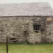
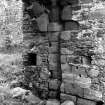
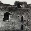
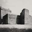
Skipness Castle, one of the major medieval fortresses of the western seaboard, has had a long and complex history of architectural development. On the evidence now available, the site was first occupied some time in the first half of the 13th century, when a hall-house and chapel were constructed. Other buildings of stone or timber may have been erected about the same period, and the site enclosed by an earth and timber rampart.
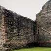
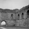
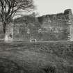
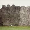
About the turn of the 13th and 14th centuries the castle was enlarged and strengthened by the erection of a high curtain wall, within which the hall-house and chapel were incorporated. The chapel was secularised, its place being taken by one at NR 9100 5752 (NR95NW 6). The enceinte wall enclosed an oblong courtyard, with projecting towers at the NE and SE angles, and in the N section of the W wall. Within the courtyard, ranges of buildings stood against the S wall, and the N section of the E wall.
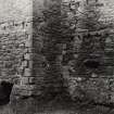
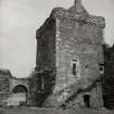
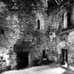
In the later Middle Ages, perhaps towards the beginning of the 16th century, the northernmost part of the E range of courtyard buildings was heightened by three upper storeys, and the upper portion of the adjacent section of the E curtain wall was rebuilt and provided with an embattled parapet walk. The transformation to a tower house was completed later in the 16th century by the reconstruction of the upper portion of the tower, and the removal of the remainder of the E courtyard range, to leave the tower free-standing on its S side.
The castle was abandoned about the end of the 17th century.
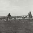
Late in the following century it was converted into a farmsteading by the removal of the early courtyard buildings, except the tower house, and the erection of lean-to sheds and offices against both sides of the curtain wall. These farm buildings were removed in 1898, and steps taken to preserve all that remained of the castle.
RCAHMS 1971
As described.
Earthwork resurveyed at 25".
Visited by OS (IA) 9 August 1973
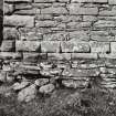
Prior to consolidating the foundations of the NE tower, a narrow trench was excavated at right angles to the wall on each of the E, N and W sides. All three disclosed an extensive platform of level gravel on which the foundations had been laid. Some sherds of pottery dating from the early 13th century to mid-16th century were found.
A M Kahane 1975
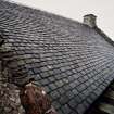
The roof of the tower and the cape house have been re-slated and work is proceeding on the consolidation of the rest of the monument.
CBA Annual Report 1975-6
NR 9080 5778. As described and planned by the RCAHMS.
Surveyed at 1:10,000.
Visited by OS (TRG) 22 February 1977
An extensive geophysical survey was completed on this site, intended to characterise the main structural sequence in advance of development.
A total of four areas were subsequently excavated in the light of the geophysical survey and demonstrated that:
1. The castle sits on an artifically extended natural gravel terrace - one of a series of raised beach deposits.
2. The present contours and limits of the castle mound have been extensively reworked as part of the policies of the neighbouring Skipness House.
3. There was evidence that the castle mound was extended and complemented by a shallow ditch, probably reflecting the general refurbishment of the site in the later 13th century.
4. 19th and 20th century occupation of the tower house saw the almost total clearance of redundant courtyard structures.
5. Robbed wall lines were traceable in the form of foundation pads rather than trenches, cut against the bedding for a cobbled surface in the courtyard.
6. The main cause of the present flooding on the site appeared to be the use of rolled turf as a courtyard surface, and a possibly ruptured water main located to the N of the castle.
Sponsor: Historic Scotland
G Ewart 1993
A watching brief was carried out by Kirkdale Archaeology at Skipness Castle in October 1995, in advance of the digging of drainage channels within the courtyard. Four narrow trenches were opened, revealing 18th-century metalled pathways and a possible 13th-century drainage ditch. Elements of the gravel platform upon which the castle was originally constructed were also encountered.
Sponsor: Historic Scotland
G Ewart and P Sharman 1996
NR 9080 5777 A watching brief recorded the cutting of a short service trench in the NE corner of the Guardianship area in August 1998. The trench indicated a depth above which the ground in the immediate area could be disturbed, if necessary, without damaging anything of archaeological importance.
The main deposit in the trench was obviously modern, indicative of levelling and destruction. It was likely to be the result of the demolition and clearance of post-medieval farm outbuildings.
Sponsor: Historic Scotland
P Sharman 1998
This site has only been partially upgraded for SCRAN. For further information, please consult the Architecture Catalogues for Argyll and Bute District..
February 1998
Publication Account (1985)
The magnificent castle of Skipness has a sequence of construction from the first half of the 13th century until it was abandoned at the end of the 17th century. It was first mentioned in 1261 when it was held by Dugald, son of Sween, presumably on behalf of the MacDonald chiefs; it remained in MacDonald hands until 1493 with the final forfeiture of John, Lord of the Isles, and subsequently was granted to the 2nd Earl of Argyll. The two earliest parts of the castle, a hall-house and separate chapel, were incorporated within the curtain wall of a castle of enceinte in the late 13th or early 14th century, the hall-house at the north-west corner and the chapel forming part of the inner wall on the south. The walls of the great courtyard castle survive almost to their original height with a complex gatehouse on the south wall which has a portcullis chamber above iti on the west wall there is a projecting latrine tower. The building of the three upper floors at the north-east corner of the castle are of rather later date probably at the beginning of the 16th century.
The chapel, dedicated to St Brendan, is situated 320m south-east of the castlei it dates from the same periodearly 14th century, at which time an earlier chapel was incorporated within the castle itself and its ecclesiastical use forgotten. The new chapel is a long building with the nave at the west end and the chancel to the easti the side-walls and gables survive almost intact The window- and door-mouldings are almost complete and, though plain or with simple decoration are described as of Anglo-Scottish First Pointed style.
Information from ‘Exploring Scotland’s Heritage: Argyll and the Western Isles’, (1985).
Excavation (12 September 1992 - 11 November 1992)
An extensive geophysical survey was completed on this site, intended to characterise the main structural sequence in advance of development.
A total of four areas were subsequently excavated in the light of the geophysical survey and demonstrated that:
1. The castle sits on an artifically extended natural gravel terrace - one of a series of raised beach deposits.
2. The present contours and limits of the castle mound have been extensively reworked as part of the policies of the neighbouring Skipness House.
3. There was evidence that the castle mound was extended and complemented by a shallow ditch, probably reflecting the general refurbishment of the site in the later 13th century.
4. 19th and 20th century occupation of the tower house saw the almost total clearance of redundant courtyard structures.
5. Robbed wall lines were traceable in the form of foundation pads rather than trenches, cut against the bedding for a cobbled surface in the courtyard.
6. The main cause of the present flooding on the site appeared to be the use of rolled turf as a courtyard surface, and a possibly ruptured water main located to the N of the castle.
G Ewart 1993
Sponsor: Historic Scotland
Kirkdale Archaeology
Excavation (17 October 1995 - 26 October 1995)
A watching brief was carried out by Kirkdale Archaeology at Skipness Castle in October 1995, in advance of the digging of drainage channels within the courtyard. Four narrow trenches were opened, revealing 18th-century metalled pathways and a possible 13th-century drainage ditch. Elements of the gravel platform upon which the castle was originally constructed were also encountered.
G Ewart and P Sharman 1996
Sponsor: Historic Scotland
Kirkdale Archaeology
Watching Brief (8 April 1997)
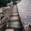
A watching brief was carried out at Skipness Castle on the 8th of April 1997, while a small hole was dug in the internal courtyard to emplace a banister support for the stair leading up to the NE tower.
The hole measured 20cm by 20cm in plan with a depth of 25cm, and was positioned along the base of the external stair on the S side of the NE tower, 27cm E from the lowest part of the stair.
8cm of thin turf and mortar waste overlay 9cm of dark brown topsoil over 8cm of stony dark brown soil. The lowermost layer was not bottomed. No features or finds were uncovered.
Sponsor: Historic Scotland
G Ewart and P Sharman 1997
Watching Brief (18 August 1998 - 19 August 1998)
Kirkdale Archaeology provided a watching brief at Skipness Castle, Kintyre, Argyll (NGR NR 908577) under the PIC call-off contract with Historic Scotland. The work to be recorded was the cutting of a short service trench in the NE corner of the Guardianship area.
The trench was 3.30 m long, 0.25 m wide and 0.30-0.35 m deep. It extended from the SW corner of the new custodian’s hut in the NE corner of the guardianship area to the telegraph pole beside the NE corner of the cart shed nearby.
Sponsor: Historic Scotland
P Sharman 1998
Kirkdale Archaeology
Excavation (October 2000)
In October 2000 Kirkdale Archaeology undertook an excavation at Skipness Castle. More information about this excavation can be found in the Kirkdale Archive.
G Ewart 2000
Sponsor: Historic Scotland
Kirkdale Archaeology
Watching Brief (August 2017)
NR 90809 57779 A watching brief was carried out, August 2017, within the scheduled monument of Skipness Castle. Three circular holes were excavated by hand for the insertion of fence strainer posts. The holes contained single topsoil contexts indicative of modern landscaping. No features or finds of archaeological significance were identified.
Archive: NRHE (intended). Report: WoSAS
Funder: Historic Environment Scotland
Graeme Carruthers – CFA Archaeology Ltd
(Source: DES, Volume 18)


