
Pricing Change
New pricing for orders of material from this site will come into place shortly. Charges for supply of digital images, digitisation on demand, prints and licensing will be altered.
Moss Farm, Arran


Hut Circle(S) (Prehistoric)
Site Name Moss Farm, Arran
Classification Hut Circle(S) (Prehistoric)
Alternative Name(s) Machrie Moor
Canmore ID 39738
Site Number NR93SW 40
NGR NR 90626 32476
NGR Description NR 90626 32476 and NR 90646 32469
Datum OSGB36 - NGR
Permalink http://canmore.org.uk/site/39738


- Council North Ayrshire
- Parish Kilmory
- Former Region Strathclyde
- Former District Cunninghame
- Former County Buteshire
Field Visit (22 September 1977)
NR93SW 40 9062 3247 and 9064 3246.
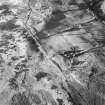
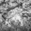
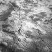
A: NR 9062 3247. B: NR 9064 3246. Two circular banked enclosures approximately 10.0m apart occupying the top of a prominent rise, under rough pasture at c 150ft OD, were found during field examination.
'A' consists of a stone and earth bank up to 6.0m wide and 0.6m high, enclosing a level featureless interior measuring 6.0m NE-SW by 8.0m transversely. There is a tapered 2.0m wide entrance in the SE side.
'B' consists of an earthen bank up to 4.0m wide and 0.6m high enclosing a featureless overgrown interior 8.0m in overall diameter. Much of the W & E sides of the bank cannot be traced but there is the suggestion of a 2.0m wide entrance in the SE side, and large facing stones are set around the perimeter of the N & SW sides.
'B' is difficult to classify because of its mutilations, but 'A' has the tailored neatness of a hut circle.
Surveyed at 1:10 000.
Visited by OS (J R L) 22 September 1977.
Watching Brief (26 October 2005 - 27 October 2005)
NR 906 324 Archaeological monitoring was undertaken at Machrie Moor, Arran on 26 and 27 October 2005, while contractors on behalf of the Arran Access Trust undertook the excavation of two gatepost holes and the clearance of open ditches. This work was part of a pathway improvement scheme on the main access track to the monuments. The works were spread along the track with the new gate allowing disabled access to the main body of stone circles and various ditches being cleared along the track to assist in the drainage of excess rainwater. No finds or deposits of archaeological significance were uncovered during these works.
Archive to be deposited in NMRS.
Sponsor: Historic Scotland.
C Shaw 2006
Note (23 July 2018 - 24 July 2018)
The location, classification and period of this site have been reviewed.
HES Survey and Recording 23-24 July 2018.

