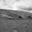
Arran, Moinechoill, Glean An T'suidhe
Chambered Cairn (Neolithic)
Site Name Arran, Moinechoill, Glean An T'suidhe
Classification Chambered Cairn (Neolithic)
Alternative Name(s) Monyquil
Canmore ID 39689
Site Number NR93NW 2
NGR NR 94068 35259
Datum OSGB36 - NGR
Permalink http://canmore.org.uk/site/39689
- Council North Ayrshire
- Parish Kilmory
- Former Region Strathclyde
- Former District Cunninghame
- Former County Buteshire
NR93NW 2 9407 3526.
(NR 9407 3526) Cairn (NR).
OS 6" map, (1924)
This Clyde group, chambered long cairn now stands 3-4ft high, slightly hollowed in the centre, and turf-covered. Oriented E-W it is 105ft long, the W end is now 50ft across and the E end 24ft across. However, the remains of the kerb some feet within the S edge indicate a trapezoidal plan 98ft long, about 50ft across the W end narrowing to 24ft across the E end. At each end of the S side an upright stone projects 1ft 6 ins above the cairn material, and two more stones were formerly visible at the SW end. The tops of boulders are visible along the S side; they seem to be fortuitously placed. Bryce (1903) dug into the S edge of the cairn, but did not find a continuous kerb.
There appears to have been a large chamber entered from the E end of the cairn. It probably consisted of four compartments, and was 24' long. It had been almost completely ruined before Bryce's excavation. Only four of its stones may now be seen, projecting 6ins - 1ft 10ins above the turf. The innermost compartment is formed of a pair of side-slabs and a back-slab; a septal slab at the E end is no longer visible. Only one other side stone of the chamber remains, in the centre of the N side. A transverse stone on its E side, formerly visible, was presumably a septal slab. No finds were made during Bryce's excavation.
The W end of the cairn was greatly ruined before 1901. Various large stones are to be seen near the medial line some apparently earthfast, but the plan is not evident. These stones strongly suggest that there has been a chamber, and probably also a concave facade, at this end of the cairn.
Information from OS (IF) 14 February 1973.
Sources: A S Henshall 1972; T Bryce 1903.
The cairn stands on slightly raised pastureland above the flood plain. Former ploughing has left a clearly defined edge and has accentuated its height. Generally as described, the likely existence of a concave facade at the W end cannot be substantiated from ground evidence. It is doubtful that 10 earthfast stones in line along the S edge could be a fortuitous arrangement, and a deliberate kerb is suggested by earthfast stones on the E and N sides.
Surveyed at 1:10 000.
Visited by OS (J R L) 20 October 1977.
Note (29 June 2018)
The location, classification and period of this site have been reviewed.
HES Survey and Recording 29 June 2018


