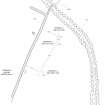
Torbhlaran 4
Cup Marked Stone (Neolithic) - (Bronze Age), Standing Stone (Neolithic) - (Bronze Age), Standing Stone (Prehistoric)
Site Name Torbhlaran 4
Classification Cup Marked Stone (Neolithic) - (Bronze Age), Standing Stone (Neolithic) - (Bronze Age), Standing Stone (Prehistoric)
Alternative Name(s) Torbhlaren
Canmore ID 39556
Site Number NR89SE 3
NGR NR 86402 94485
Datum OSGB36 - NGR
Permalink http://canmore.org.uk/site/39556
- Council Argyll And Bute
- Parish Kilmichael Glassary
- Former Region Strathclyde
- Former District Argyll And Bute
- Former County Argyll
NR89SE 3 8639 9449.
(NR 8640 9449) Standing Stone (NR)
OS 6" map (1924)
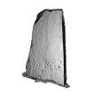
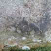
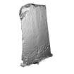
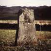
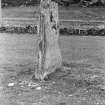
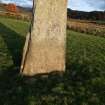
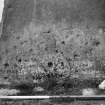
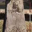
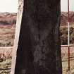
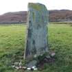
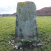
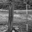
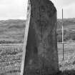
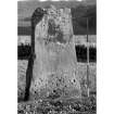
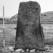
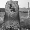
This standing stone measures 6'4" x 4' x 9", with slightly tapering sides. Its S face is marked with at least 30 cups, mostly very low down; there are 5 cups, one with a ring and radial gutter, and 2 longitudinal ridges on its N face.
M Campbell and M Sandeman 1964
Generally as described, the N face of the standing stone bears only ten cup marks.
Resurveyed at 1:2500.
Visited by OS (DWR) 7 May 1973
NR 8639 9449. This standing stone is 2.1m high, 1.2m broad and 0.15m thick. Its S face bears upwards of 30 cups and the N face upwards of 9 cups. The rings, radial gutter and longitudinal ridges (2) were not identified.
Surveyed at 1/2500.
Visited by OS (TRG) 17 March 1977
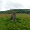
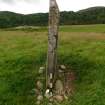
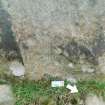
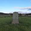
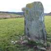
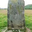
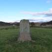
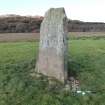
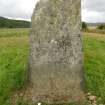
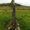
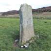
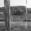
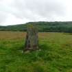
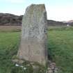
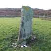
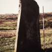
This standing stone is situated about 450m NNW of Torbhlaran farmhouse in an arable field immediately NW of the public road from Kilmichael Glassary to Ederline (Campbell and sandeman 1964). Aligned with its long axis NW-SE, it rises with slanting sides to a flat top, and measures l.2m by 0.l5m at the base and 21m in height. There are up to thirty cupmarks on the SW face and a further nine on the NE.
About 570m to the SW there is what may be a fallen standing stone which measures 3.4m by 0.8m by 0.2m; it lies in an arable field S of the public road on the W bank of the River Add, and has been reused as a bridge over a ditch.
Visited May 1985
RCAHMS 1988
Field Visit (May 1985)
This standing stone is situated about 450m NNW of Torbhlaran farmhouse in an arable field immediately NW of the public road from Kilmichael Glassary to Ederline (Campbell and sandeman 1964). Aligned with its long axis NW-SE, it rises with slanting sides to a flat top, and measures 1.2m by 0.15m at the base and 21m in height. There are up to thirty cupmarks on the SW face and a further nine on the NE.
About 570m to the SW there is what may be a fallen standing stone which measures 3.4m by 0.8m by 0.2m; it lies in an arable field S of the public road on the W bank of the River Add, and has been reused as a bridge over a ditch.
Visited May 1985
RCAHMS 1988
Note
Date Fieldwork Started 18/07/2019
Compiled by: ScRAP
Location Notes: The standing stone named Torbhlaran 4 lies in probably its original context in the landscape. It is situated in flat, arable land used for rough grazing. The rock is situated 10m W of the road and can be seen from the roadside. It is easily recognisable as the only standing stone remaining at Torbhlaran, although there are other fallen standing stones in the immediate area that have been been moved, including Canmore 39544, which is currently used as a footbridge over the burn on the W edge of the field. Torbhlaran 4 is 40m SE of the carved outcrop at Torbhlaran 3 (ScRAP 3275, Tiger Rock). At least two other carved rock ourcrops lie in the same field; Torbhlaran 1 (Cub Rock, Canmore 39543, ScRAP 3256) and Torbhlaran 2 (Lion Rock, Canmnore 39543, ScRAP 336), both at least 150m to the W of Torbhlaran 4. There are wide and panoramic views from Torbhalran 4 of the surrounding area, including mountains either side of it, and a small farm cottage around 60m to the S. There is also an audible stream around 600m to the SW.
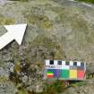
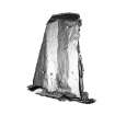
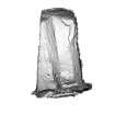
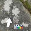
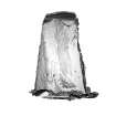
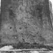
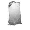
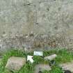
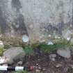
Panel Notes: Torbhlaran 4 is a (now) solitary standing stone measuring approximately 2.1m high, 1.1m wide, and 0.3m thick. It is orientated with one face to the NW and the other to the SE. The panel is fine grain schist with a hard compactness. The surface is relatively smooth with a few fissures and cracks, although the E face has a distinct triangular indentation running down its long axis. There are cupmarks on both surfaces, and these are located mainly on the lower part on both sides. Overall there are at least 58 small cup marks. The E face has fewer cupmarks - at least 20 of varying size, including one or two that may have very faint rings - and these are more scattered over the surface. It is possible that this surface was carved on natural bedrock before the stone was quarried and erected as a standing stone. The W face is flat ans smooth and is carved with at least 38 cupmarks, all clustered at the base of the stone below a horizontal fissure except for one cup with a faint possible partial ring. It is possible that more carvings lie beneath the current turf-line. There is also a possible cupmark on the S face of the stone.


