
Arran, Torr Righ Mor


Cairnfield (Prehistoric)
Site Name Arran, Torr Righ Mor
Classification Cairnfield (Prehistoric)
Canmore ID 39245
Site Number NR83SE 25
NGR NR 89212 30940
Datum OSGB36 - NGR
Permalink http://canmore.org.uk/site/39245


- Council North Ayrshire
- Parish Kilmory
- Former Region Strathclyde
- Former District Cunninghame
- Former County Buteshire
NR83SE 25 891 310.
NR 891310. Tormore, cairns 240.0m north east of Torr Righ Mor.
Source: DoE List of Scheduled Monuments 1977.
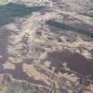
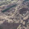
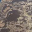
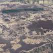
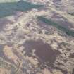
It is not clear to which area the DOE is referring. "240.0m north east of Torr Righ Mor" lies in an area of new afforestation and no cairns were evident. In the area of the map reference are a group of four peat and heather-covered stony mounds.
They average 3.0m diameter and 0.4m high, although one is 6.0m diameter and 1.0m high. They are similar to other probable clearance heaps in the area (see NR83SE 11), and it seems likely that they are associated with the nearby hut circles (NR83SE 11 & 22).
Visited by OS (TRG) 20 October 1977.
Plotted by SDD (HBM) at NR 8909 3110 and NR 8910 3115 on 1:10,000 map.
Note (27 November 2018)
The location, classification and period of this site have been reviewed.
HES Survey and Recording 27 November 2018

