|
Photographs and Off-line Digital Images |
D 5717 |
RCAHMS Aerial Photography |
Tormore, oblique aerial view, taken from the NW, centred on a hut-circle. Further hut-circles are visible in the top centre and bottom left-hand corner of the photograph. |
13/12/1996 |
Item Level |
|
|
Photographs and Off-line Digital Images |
D 5719 |
RCAHMS Aerial Photography |
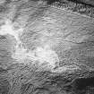
Tormore, oblique aerial view, taken from the W, centred on a hut-circle. A further hut-circle is visible in the centre right of the photograph. |
13/12/1996 |
Item Level |
|
|
Photographs and Off-line Digital Images |
D 5723 |
RCAHMS Aerial Photography |
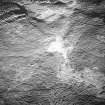
Tormore, oblique aerial view, taken from the SW, centred on a hut-circle. A further hut-circle is visible in the centre left of the photograph. |
13/12/1996 |
Item Level |
|
|
Photographs and Off-line Digital Images |
D 5726 |
RCAHMS Aerial Photography |
Tormore, oblique aerial view, taken from the SSW, centred on two hut-circles. Further hut-circles are visible in the bottom right-hand corner of the photograph. |
13/12/1996 |
Item Level |
|
|
Photographs and Off-line Digital Images |
D 5724 |
RCAHMS Aerial Photography |
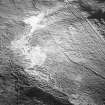
Tormore, oblique aerial view, taken from the WSW, centred on a hut-circle. A further hut-circle is visible in the centre right of the photograph. |
13/12/1996 |
Item Level |
|
 |
On-line Digital Images |
DP 233323 |
Historic Environment Scotland |
Oblique aerial view. |
12/5/2016 |
Item Level |
|
 |
On-line Digital Images |
DP 280397 |
Historic Environment Scotland |
Oblique aerial view. |
5/4/2018 |
Item Level |
|
 |
On-line Digital Images |
DP 280398 |
Historic Environment Scotland |
Oblique aerial view. |
5/4/2018 |
Item Level |
|
 |
On-line Digital Images |
DP 280399 |
Historic Environment Scotland |
Oblique aerial view. |
5/4/2018 |
Item Level |
|
 |
On-line Digital Images |
DP 280400 |
Historic Environment Scotland |
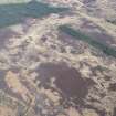
Oblique aerial view. |
5/4/2018 |
Item Level |
|
 |
On-line Digital Images |
DP 280402 |
Historic Environment Scotland |
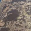
Oblique aerial view. |
5/4/2018 |
Item Level |
|
 |
On-line Digital Images |
SC 1783063 |
RCAHMS Aerial Photography |
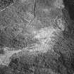
Tormore, oblique aerial view, taken from the NW, centred on a hut-circle. Further hut-circles are visible in the top centre and bottom left-hand corner of the photograph. |
13/12/1996 |
Item Level |
|
 |
On-line Digital Images |
SC 1783065 |
RCAHMS Aerial Photography |
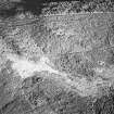
Tormore, oblique aerial view, taken from the W, centred on a hut-circle. A further hut-circle is visible in the centre right of the photograph. |
13/12/1996 |
Item Level |
|
 |
On-line Digital Images |
SC 1783069 |
RCAHMS Aerial Photography |
Tormore, oblique aerial view, taken from the SW, centred on a hut-circle. A further hut-circle is visible in the centre left of the photograph. |
13/12/1996 |
Item Level |
|
 |
On-line Digital Images |
SC 1783070 |
RCAHMS Aerial Photography |
Tormore, oblique aerial view, taken from the WSW, centred on a hut-circle. A further hut-circle is visible in the centre right of the photograph. |
13/12/1996 |
Item Level |
|
 |
On-line Digital Images |
SC 1783072 |
RCAHMS Aerial Photography |
Tormore, oblique aerial view, taken from the SSW, centred on two hut-circles. Further hut-circles are visible in the bottom right-hand corner of the photograph. |
13/12/1996 |
Item Level |
|
 |
On-line Digital Images |
SC 2417571 |
Records of the Ordnance Survey, Southampton, Hampshire, England |
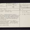
Arran, Tormore, NR83SE 11, Ordnance Survey index card, page number 1, Recto |
c. 1958 |
Item Level |
|
|
All Other |
551 166/1/1 |
Records of the Ordnance Survey, Southampton, Hampshire, England |
Archaeological site card index ('495' cards) |
1947 |
Sub-Group Level |
|


