Pricing Change
New pricing for orders of material from this site will come into place shortly. Charges for supply of digital images, digitisation on demand, prints and licensing will be altered.
Upcoming Maintenance
Please be advised that this website will undergo scheduled maintenance on the following dates:
Thursday, 9 January: 11:00 AM - 3:00 PM
Thursday, 23 January: 11:00 AM - 3:00 PM
Thursday, 30 January: 11:00 AM - 3:00 PM
During these times, some functionality such as image purchasing may be temporarily unavailable. We apologise for any inconvenience this may cause.
Castle Dounie
Dun (Prehistoric)
Site Name Castle Dounie
Classification Dun (Prehistoric)
Alternative Name(s) Creag Mhor
Canmore ID 39164
Site Number NR79SE 13
NGR NR 7674 9323
Datum OSGB36 - NGR
Permalink http://canmore.org.uk/site/39164
- Council Argyll And Bute
- Parish North Knapdale
- Former Region Strathclyde
- Former District Argyll And Bute
- Former County Argyll
NR79SE 13 7674 9323.
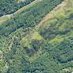
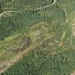
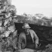
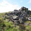
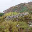
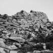
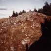
(NR 767 932) Castle Dounie occupies a high crag with another higher to SW. Oval, E side almost straight, W side ruinous, 75'6" x 58' overall. Gate at N, 8'5" wide x 6'10" long, reduced by inferior walling to 3'5" wide.
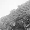
A similar wall runs for at least 6' inward from E side of gate. E wall stands to 5' high internally, with 3 deep niches or open-sided cells, the best preserved 5'6" wide x 3'6" deep x 5' high with over-sailing at inner corners. One cell may have stair (under rubble). At S end large cell with a partition wall dividing it from the main court: 4' wide x 14' long x 6' high at S. At W an apparent souterrain extending c.2' under wall from floor level. W of this the outer face of the fort wall stands to 8', with a slight batter, and shows a vertical joint suggesting alteration; beyond this the wall is weaker and has collapsed. Two long stones on slope below suggest lintels or gateposts.
M Campbell and M Sandeman 1964.
NR 7673 9324: A dun, generally as described, of at least two constructional phases. The alleged souterrain is part of the intra-mural structures. Stones on the slope below are all tumble. Name confirmed.
Visited by OS (DWR) 29 May 1973.
As described in the previous information.
Surveyed at 1/10,000.
Visited by OS (TRG) 26 January 1977.
Field Visit (June 1979)
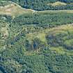
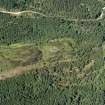
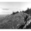
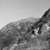
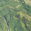
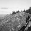
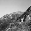
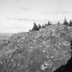
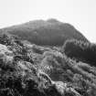
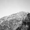
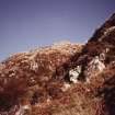
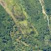
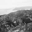
This unusual dun occupies the summit of a rocky knoll which lies at the NE end of a steep-sided ridge known as Creag Mhor, about l.5km SW of Ardnoe Point. The surrounding area has been afforested, but the dun may be approached from the NE along a Forest Trail Campbell and Sandeman 1964).
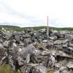
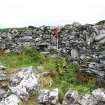
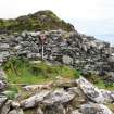
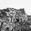
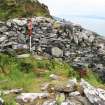
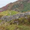
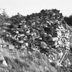
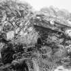
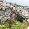
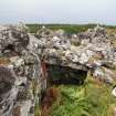
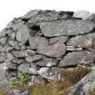
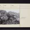
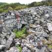
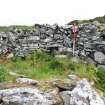
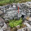
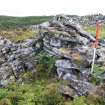
Irregular on plan, the dun measures 18m by 14m within a wall which can be traced with ease on all sides except the NW. The wall shows considerable variation in thickness, ranging from 3.8m on the SW to as little as 1.6m, and there is a marked thickening on the W side of the entrance-passage. Where best preserved, on the WSW, the outer face rises to a height of 2.6m in fourteen courses with a pronounced inward batter, but elsewhere it has been reduced to its basal course. In general, the inner face is not as well preserved as the outer face, and for much of its course its lower portion is obscured by debris. On the SW there is a straight-joint visible in the outer face, which rises vertically from the foundation course to the top of the surviving masonry, and appears to run through the body of the wall to join the inner face. The sizes of the stones used in the basal course of the outer face differ on each side of the joint, and the SE section is stepped in from the line of the wall on the NW side, which all points to the joint being the junction between two phases of wall-building, and suggests that the wall may have been constructed by different work-gangs.
Along the E side an extra skin was added to the inner face of the wall, and it is pierced at two points by open chambers, the back walls of which are formed by the inner face of the outer wall. A large slab at the NE end of the N chamber may be the lowest course of a corbelled roof; in the same chamber, on the S wall, there is a small aumbry. At the SE angle of the dun wall there is a further chamber; it has been built partly within the thickness of the dun wall, but its NE side is formed by the extra skin on the E wall. There is little doubt that the thickening of the E wall is an original feature and contemporary with the construction of the dun as a whole, and it may have served as the base for a stairway, which rose from a little to the E of the entrance to reach the wall-head above the SE chamber.
The well-preserved entrance lies on the NNE; originally it measured 2.1m across, unusually broad for an entrance-passage, but it was subsequently reduced to a width of 1m by a stretch of inferior walling attached to the W side of the passage. The narrowing of the entrance may have occurred in antiquity, but the possibility remains that it may be contemporary with a stretch of more recent walling which lies adjacent to the inner face of the dun wall on the NE. Apart from an outcrop of rock on the N, the interior of the dun is featureless.
RCAHMS 1988, visited June 1979.
Measured Survey (25 June 1979)
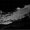
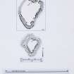
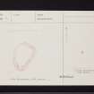
RCAHMS surveyed Castle Dounie dun on 25 June 1979 with plane-table and alidade producing a plan at a scale of 1:100. The plan of the dun was redrawn in ink and published at a scale of 1:250 (RCAHMS 1988a, 179).
Measured Survey (24 June 1982)
RCAHMS surveyed Cnoc a' Chaisteil, Lergychoniebeag dun on 24 June 1982 with plane-table and alidade producing a plan at a scale of 1:100. The plan of the dun was redrawn in ink and published at a scale of 1:250 (RCAHMS 1988a, 178).
Ground Survey (20 June 2011 - 21 June 2011)
A detailed topographic survey of the dun at Castle Dounie in Knapdale was undertaken 20–21 June 2011. The survey suggested that the 'straight joint' noted by previous surveyors in the S elevation in fact represents a second entrance, blocked and coursed over by later reconstruction.
Archive: RCAHMS (intended)
Funder: Forestry Commission Scotland
AOC Archaeology Group 2011
Measured Survey (20 June 2011 - 21 June 2011)
A detailed topographic survey of the dun at Castle Dounie in Knapdale was undertaken on behalf of the Forestry Commission in June 2011. The survey suggested that the 'straight joint' noted by previous surveyors in the south elevation in fact represnts a second entrance, blocked and coursed over by later reconstruction.
Information from Graeme Cavers (AOC Archaeology) July 2011
OASIS ID: aocarcha1-111905
Archaeological Evaluation (June 2011)
NR 7674 9323 An evaluation was undertaken during June 2011 within the entrance passage of Castle Dounie dun prior to the realignment of the access path to the site. The evaluation confirmed that the original, unusually large entranceway had been narrowed by a modification on the W side of the passage. The modification would appear to have been undertaken whilst the dun was under occupation as the lower passage wall of the later modification was sealed by a distinct accumulation of midden-like material. The samples collected from this material and a recovered metal pin/nail may provide dating evidence for the latest occupation of the dun.
Archive: Kilmartin House Museum (intended). Report: Forestry Commission, OASIS and RCAHMS
Funder: Forestry Commission Scotland
Kilmartin House Museum 2011


