Pricing Change
New pricing for orders of material from this site will come into place shortly. Charges for supply of digital images, digitisation on demand, prints and licensing will be altered.
Upcoming Maintenance
Please be advised that this website will undergo scheduled maintenance on the following dates:
Thursday, 9 January: 11:00 AM - 3:00 PM
Thursday, 23 January: 11:00 AM - 3:00 PM
Thursday, 30 January: 11:00 AM - 3:00 PM
During these times, some functionality such as image purchasing may be temporarily unavailable. We apologise for any inconvenience this may cause.
Islay, Bridgend, Borraichill Mor
Field System (Prehistoric)(Possible), Hut Circle (Prehistoric)
Site Name Islay, Bridgend, Borraichill Mor
Classification Field System (Prehistoric)(Possible), Hut Circle (Prehistoric)
Canmore ID 37754
Site Number NR36SW 17
NGR NR 31372 64710
Datum OSGB36 - NGR
Permalink http://canmore.org.uk/site/37754
- Council Argyll And Bute
- Parish Killarow And Kilmeny
- Former Region Strathclyde
- Former District Argyll And Bute
- Former County Argyll
Field Visit (24 August 1979)
NR36SW 17 3136 6470.
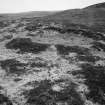
At NR 3136 6470, adjacent to early modern cultivation is a hut circle, measuring 6.5m diameter within a turf and heather-covered wall spread to 2.0m wide and 0.7m maximum height. The entrance is in the south-east arc. Some 50.0 to 60.0m distant, from the hut are the remains of a probable contemporary orthostatic wall.
Surveyed at 1:10 000.
Visited by OS (J M) 24 August 1979.
Field Visit (May 1980)
NR 313 647. In an area of heather-covered, peaty moorland to the SE of Borraichill Mor, there are two hut-circles (see also NR36SW 18), one of them apparently set to one side of a roughly rectangular enclosure measuring 150m by 70m and built of upright stones. This hut is about 6.5m in internal diameter within a wall now represented by a stony bank 2m thick and 0.7m high, with an entrance on the SE side. Several outer facing-stones are visible.
Visited May 1980
RCAHMS 1984
Measured Survey (1980)
RCAHMS surveyed the hut-circles and field system at Borraichill Mor at a scale of 1:1000. The site plan was redrawn in ink and published at a reduced scale (RCAHMS 1984, fig. 247.2). The hut circles were surveyed at 1:200 but unpublished.


