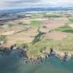
Castle Of Cadden
Castle (Medieval)
Site Name Castle Of Cadden
Classification Castle (Medieval)
Canmore ID 36829
Site Number NO87SE 3
NGR NO 85863 74834
Datum OSGB36 - NGR
Permalink http://canmore.org.uk/site/36829
- Council Aberdeenshire
- Parish Kinneff
- Former Region Grampian
- Former District Kincardine And Deeside
- Former County Kincardineshire
NO87SE 3 8586 7483.
(NO 8586 7483) Castle of Cadden (NR) (site of)
OS 1:10000 map (1973)
The remains of an old work, called the Castle of Cadden, occupy the top of a peninsular rock about 100 yds NE of Kinneff Castle (NO87SE 2). It seems to have had a ditch and drawbridge to protect it from an attack by land, where there remain some vestiges of masonry. The rest seems to have been an earthen mound thrown up about the top of the rock (Statistical Account [OSA] 1793). Nothing is known of its history.
New Statistical Account (NSA) 1845; A Jervise 1861
Little remains of the Castle of Cadden save the artificially scarped causeway, with a low bank, 0.6m high, on the landward side of the promontory, and a stretch of masonry 2.0m long, possibly the remains of a curtain wall, on the S side of the promontory.
Resurveyed at 1:2500.
Visited by OS (NKB) 19 December 1967
Listed.
Scottish Castle Survey 1988; N Bogdan and I B D Bryce 1991.
Field Visit (March 1982)
Castle of Cadden NO 858 748 NO87SE 3
What is probably a medieval fortification, known as Castle of Cadden, occupies a precipitous promontory which juts out from the coastal cliffs 300m ESE of Kinnett parish church. The promontory is enclosed by a low bank, and the only possible line of approach, from the WNW, is cut off by a ditch broken only by an entrance-causeway. Along the cliff edge on the SW, a short stretch of lime-mortar masonry is visible, and on the NNE side of the interior there are possible traces of a range of buildings.
RCAHMS 1982, visited March 1982
(Stat. Acct., vi, 1793, 208, footnote)


