
St Kilda, Hirta, An Lag Bho'n Tuath


Cleit (Post Medieval), Enclosure (Period Unknown)(Possible)
Site Name St Kilda, Hirta, An Lag Bho'n Tuath
Classification Cleit (Post Medieval), Enclosure (Period Unknown)(Possible)
Alternative Name(s) Hirta 2034
Canmore ID 359400
Site Number NF19NW 18.01
NGR NF 10302 99676
Datum OSGB36 - NGR
Permalink http://canmore.org.uk/site/359400


- Council Western Isles
- Parish Harris
- Former Region Western Isles Islands Area
- Former District Western Isles
- Former County Inverness-shire
Field Visit (8 September 2007)
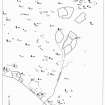
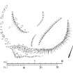
A cleit robbed to little more than a grass- and heather-grown spread of rubble, some of which has been dragged downslope to construct the 'enclosure' mapped on RCAHMS' earlier plan (Stell and Harman 1988, 24-5).
Visited by RCAHMS (JRS) 8 September 2007.

