|
Prints and Drawings |
DC 14851 PO |
Records of the Royal Commission on the Ancient and Historical Monuments of Scotland (RCAHMS), Edinbu |
(PMT Copy) Plan of both forts and a field-system with cairns and hut-circles adjacent to the White Caterthun. |
1989 |
Item Level |
|
|
Manuscripts |
MS 835/2 |
Records of the Royal Commission on the Ancient and Historical Monuments of Scotland (RCAHMS), Edinbu |
Site descriptions, RCAHMS Caterthuns Survey |
1989 |
Item Level |
|
|
Prints and Drawings |
DC 14848 PO |
Records of the Royal Commission on the Ancient and Historical Monuments of Scotland (RCAHMS), Edinbu |
(PMT Copy) Plan |
1989 |
Item Level |
|
|
Prints and Drawings |
DC 14874 |
Records of the Royal Commission on the Ancient and Historical Monuments of Scotland (RCAHMS), Edinbu |
Plan of ring-ditch house |
14/9/1989 |
Item Level |
|
|
Prints and Drawings |
DC 14875 |
Records of the Royal Commission on the Ancient and Historical Monuments of Scotland (RCAHMS), Edinbu |
Survey drawing, plan of ring ditch houses, field system and cairnfield |
13/9/1989 |
Item Level |
|
|
Prints and Drawings |
DC 27423/06 PO |
Records of the Royal Commission on the Ancient and Historical Monuments of Scotland (RCAHMS), Edinbu |
Annotated EDM survey plot, White Caterthun |
1989 |
Item Level |
|
|
Prints and Drawings |
E 42609 |
Records of the Royal Commission on the Ancient and Historical Monuments of Scotland (RCAHMS), Edinbu |
Plan of both forts and a field-system with cairns and hut-circles adjacent to the White Caterthun (photographic copy). |
1989 |
Item Level |
|
 |
On-line Digital Images |
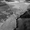
SC 991925 |
Records of Aberdeen Aerial Surveys, Aberdeen, Scotland |
Oblique aerial view centred on the remains of ring ditches, enclosures, cairns and a field system and former farmstead at White Catherthun, looking to the SSW. |
15/6/1983 |
Item Level |
|
 |
On-line Digital Images |
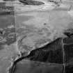
SC 991926 |
Records of Aberdeen Aerial Surveys, Aberdeen, Scotland |
Oblique aerial view centred on the remains of ring ditches, enclosures, cairns and a field system and former farmstead at White Catherthun, looking to the S. |
15/6/1983 |
Item Level |
|
 |
On-line Digital Images |
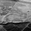
SC 991927 |
Records of Aberdeen Aerial Surveys, Aberdeen, Scotland |
Oblique aerial view centred on the remains of ring ditches, enclosures, cairns and a field system and former farmstead at White Catherthun, looking to the ESE. |
15/6/1983 |
Item Level |
|
 |
On-line Digital Images |
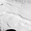
SC 1009497 |
Records of Aberdeen Aerial Surveys, Aberdeen, Scotland |
Oblique aerial view centred on the remains of ring ditches, cairnfield and field system at White Caterthun, looking to the NE. |
25/1/1985 |
Item Level |
|
 |
On-line Digital Images |
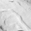
SC 1009498 |
Records of Aberdeen Aerial Surveys, Aberdeen, Scotland |
Oblique aerial view centred on the remains of ring ditches, cairnfield and field system at White Caterthun, looking to the NE. |
25/1/1985 |
Item Level |
|
 |
On-line Digital Images |
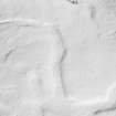
SC 1009499 |
Records of Aberdeen Aerial Surveys, Aberdeen, Scotland |
Oblique aerial view centred on the remains of ring ditches, cairnfield and field system at White Caterthun, looking to the NE. |
25/1/1985 |
Item Level |
|
 |
On-line Digital Images |
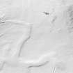
SC 1009500 |
Records of Aberdeen Aerial Surveys, Aberdeen, Scotland |
Oblique aerial view centred on the remains of ring ditches, cairnfield and field system at White Caterthun, looking to the NE. |
25/1/1985 |
Item Level |
|
 |
On-line Digital Images |
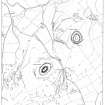
SC 1009501 |
Records of Aberdeen Aerial Surveys, Aberdeen, Scotland |
Oblique aerial view centred on the remains of ring ditches, cairnfield and field system at White Caterthun, looking to the N. |
25/1/1985 |
Item Level |
|
 |
On-line Digital Images |
SC 1368426 |
Records of the Royal Commission on the Ancient and Historical Monuments of Scotland (RCAHMS), Edinbu |
Plan of both forts and a field-system with cairns and hut-circles adjacent to the White Caterthun (photographic copy). |
1989 |
Item Level |
|
 |
On-line Digital Images |
SC 1970219 |
Papers of James Sloan Bone, landscape historian, Inverness, Highland, Scotland |
Aerial view of White Caterthun ring ditch houses and field system, near Brechin, Angus, looking SE. |
11/1979 |
Item Level |
|
 |
On-line Digital Images |
SC 1970259 |
Papers of James Sloan Bone, landscape historian, Inverness, Highland, Scotland |
Aerial view of White Caterthun Hillfort, near Brechin, Angus, looking E. |
2/1982 |
Item Level |
|
 |
On-line Digital Images |
SC 2409179 |
Records of the Ordnance Survey, Southampton, Hampshire, England |
White Caterthun, NO56NW 18, Ordnance Survey index card, Recto |
c. 1958 |
Item Level |
|
 |
On-line Digital Images |
SC 2409180 |
Records of the Ordnance Survey, Southampton, Hampshire, England |
White Caterthun, NO56NW 18, Ordnance Survey index card, Recto |
c. 1958 |
Item Level |
|
|
All Other |
551 166/1/1 |
Records of the Ordnance Survey, Southampton, Hampshire, England |
Archaeological site card index ('495' cards) |
1947 |
Sub-Group Level |
|