Scheduled Maintenance
Please be advised that this website will undergo scheduled maintenance on the following dates: •
Tuesday 3rd December 11:00-15:00
During these times, some services may be temporarily unavailable. We apologise for any inconvenience this may cause.
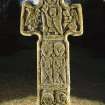
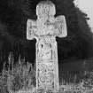
Camus's Cross
Cairn (Early Bronze Age), Cross (Early Medieval), Dagger (Bronze)(Early Bronze Age), Food Vessel (Early Bronze Age), Mount (Gold)(Early Bronze Age)
Site Name Camus's Cross
Classification Cairn (Early Bronze Age), Cross (Early Medieval), Dagger (Bronze)(Early Bronze Age), Food Vessel (Early Bronze Age), Mount (Gold)(Early Bronze Age)
Alternative Name(s) Camuston; Camus Cross; Camustane; Panmure Estates; Camus's Cross; Camustane Hill
Canmore ID 34552
Site Number NO53NW 3
NGR NO 51962 37907
Datum OSGB36 - NGR
Permalink http://canmore.org.uk/site/34552
- Council Angus
- Parish Monikie
- Former Region Tayside
- Former District Angus
- Former County Angus
NO53NW 3 5196 3791.
(NO 5196 3791) Tumulus (NR) (Site of)
Camus's Cross (NR)
OS 6" map (1923)
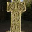
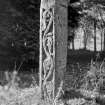
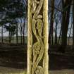
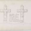
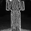
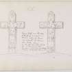
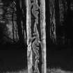
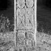
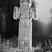
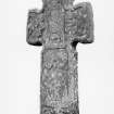
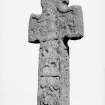
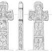
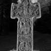
The Camus Cross (Class III), 6' high and sculptured, stood on a small tumulus which was opened by Sir Patrick Maule about 1620, and found to contain a skeleton, bowl-shaped food vessel, and a broad, oval gold ring which Anderson suggests was a pommel mount for a bronze dagger, comparable with that found at Gask Hill, Collessie (NO21SE 14); the urn and ring are in Brechin Castle.
A J Warden 1881; J Anderson 1886; J R Allen and J Anderson 1903.
Field Visit (3 June 1958)
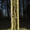
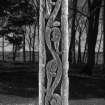
This cross stands on a small (? modern) mound measuring 7.5m E-W x 4.4m x 1.0m high. Facing E-W, it measures 2.0m high with arms 0.8m across; it is 0.2m thick. The sculptures are best preserved on the E face and N and S sides; it is weathered on the W face, but the symbols are still discernible.
The tumulus was probably cleared away when making the avenue.
Visited by OS (JLD) 3 June 1958.


