
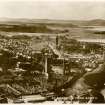
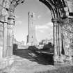
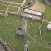
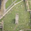
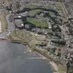
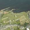
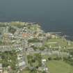
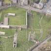
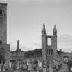
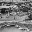
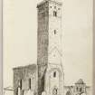
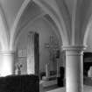
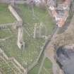
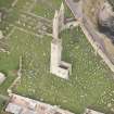
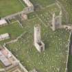
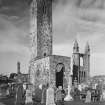
St Andrews Cathedral, St Rule's Church And St Rule's Tower


Church (12th Century), Tower (12th Century)
Site Name St Andrews Cathedral, St Rule's Church And St Rule's Tower
Classification Church (12th Century), Tower (12th Century)
Alternative Name(s) St Regulus Church
Canmore ID 34371
Site Number NO51NW 2.05
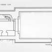
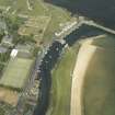
NGR NO 51475 16648
Datum OSGB36 - NGR
Permalink http://canmore.org.uk/site/34371


- Council Fife
- Parish St Andrews And St Leonards
- Former Region Fife
- Former District North East Fife
- Former County Fife
NO51NW 2.05 51475 16648
FROM ARCHITECTURE CATALOGUE:
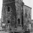
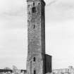
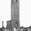
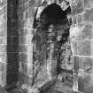
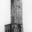
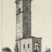
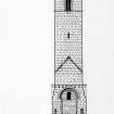
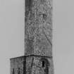
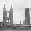
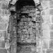
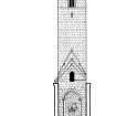
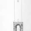
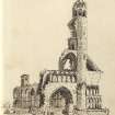
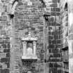
Very small with fine high tower, probably 12th century, Chancel and tower intact, but Chancel roofless.
REFERENCE
ST ANDREWS PUBLIC LIBRARY
Hay Flemming Collection
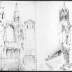
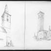
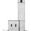
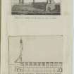
Plans, elevations & sections 3/8" scale by Robert H Craig
"Wharram-le-Street Church, Yorkshire and St Rule's church, St Andrews" by John Bilson 1924, text, drawings & photographs, D5/F(P)
(publication missing from library at time of upgrade 12.6.1996)
Publication Account (1981)
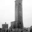
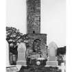
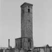
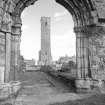
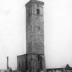
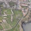
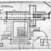
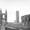
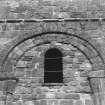
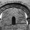
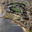
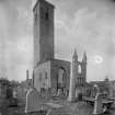
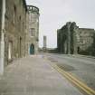
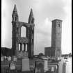
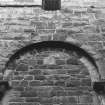
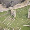
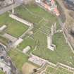
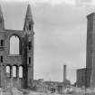
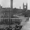
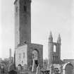
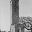
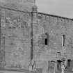
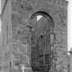
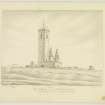
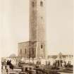
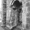
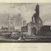
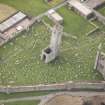
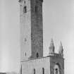
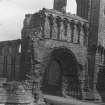
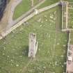
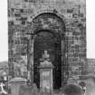
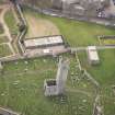
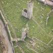
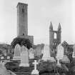
Standing to the south of the cathedral is the 108 feet high (32.92m) tower and ruined choir of St. Regulus Church. Neither the nave nor the sanctuary which was attached to the choir survives above ground. It is 'quite the most interesting of the earlier churches in Scotland' with features of both the Norman and the pre-Norman tradition (RCAM. 1933, 228).
Robert, the first prior of Scone, elected Bishop of St. Andrews, undertook the building of the church soon after his 1126 x 1127 consecration. Work is said to have proceeded slowly, for it was not until 1144 that the greater part of the church was said to have been completed. In 1159 Bishop Robert was buried in the church which was soon super-ceded by the present cathedral. Little is known of the structure of St. Regulus after that date. It appears to have escaped the 'fury' of the Reformers, and it was not until 1789 that we hear of repairs, including the removal of loose stones and the addition of a stairway in the tower's interior. Further work was carried out on the tower in 1841 (Roger, 1849, 83).
Information from ‘Historic St Andrews: The Archaeological Implications of Development’ (1981).
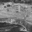
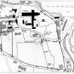
Watching Brief (26 September 2016)
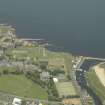
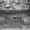
NO 5147 1665, NO 5152 1663 and NO 5145 1670 A watching brief was carried out, 26 September 2016, during the installation of three stone plinths to support new signage. All three trenches revealed similar sequences of a topsoil overlying a subsoil with mortar and stone inclusions. This lower deposit may represent the disturbed and redeposited soil of the cemetery. No bone was seen, and nothing of
archaeological significance was recorded.
Archive: NRHE (intended)
Funder: Historic Environment Scotland
David Murray – Kirkdale Archaeology
(Source: DES, Volume 17)

